Future Trends in Environmental Monitoring - Drones and Sensors
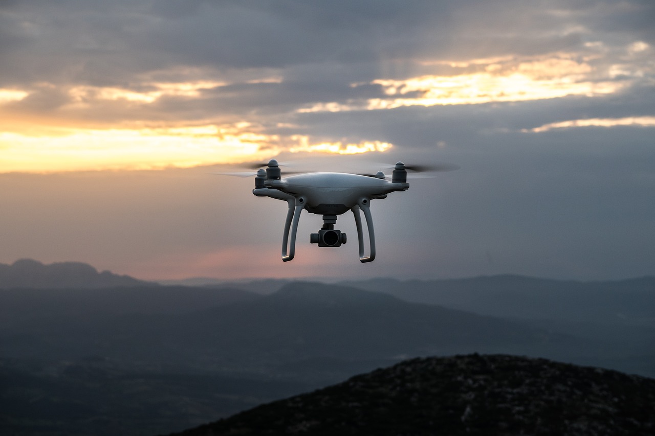
The world is changing, and so is our approach to understanding and protecting our environment. With the rise of drones and sensors, environmental monitoring has entered a new era of efficiency and accuracy. Imagine soaring above vast forests or gliding over polluted rivers, capturing data that was once painstakingly collected on foot. This is not just a dream; it’s the reality we are stepping into. Drones equipped with advanced sensors are revolutionizing how we monitor ecosystems, track wildlife, and assess the health of our planet. But what does the future hold for these technologies? Let’s dive deeper into the fascinating world of environmental monitoring and explore the trends that are shaping its future.
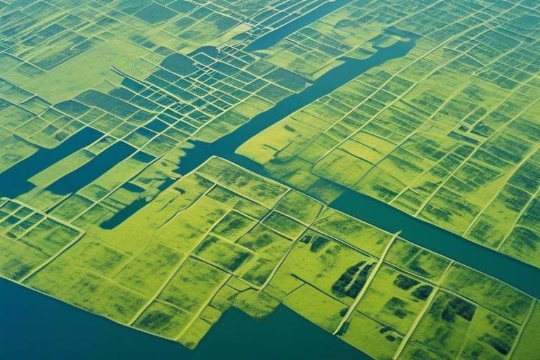
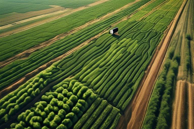
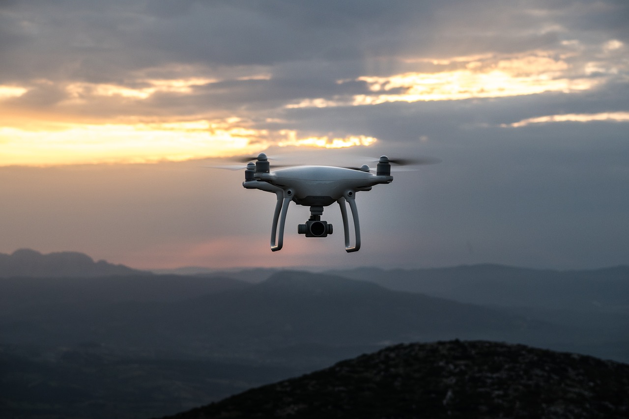
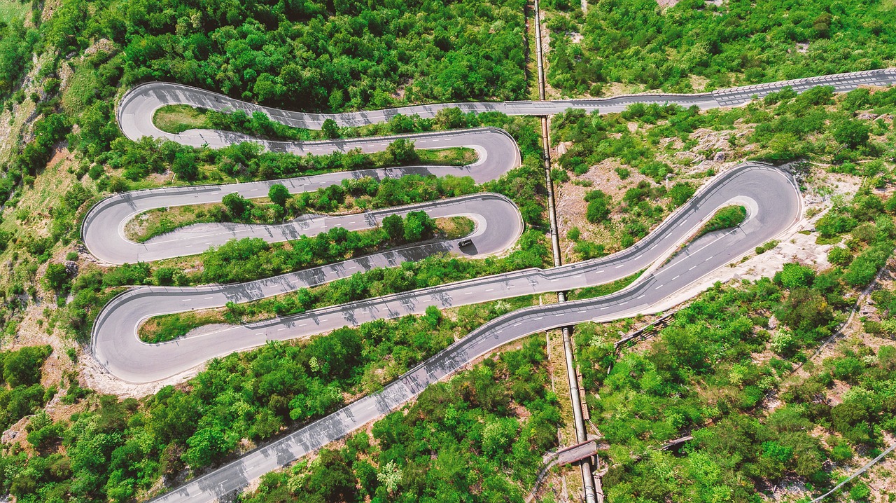
Drones have truly transformed the landscape of environmental monitoring. No longer confined to traditional methods, researchers can now utilize aerial perspectives to survey large areas quickly and efficiently. Picture a drone hovering over a dense forest, capturing high-resolution images and data that reveal the health of trees and underbrush. This ability to cover vast terrains with minimal human interference allows for more comprehensive analysis of ecosystems and natural resources. The versatility of drones means they can be deployed in various scenarios—from monitoring deforestation to assessing the impacts of climate change—making them an invaluable tool for environmental scientists.
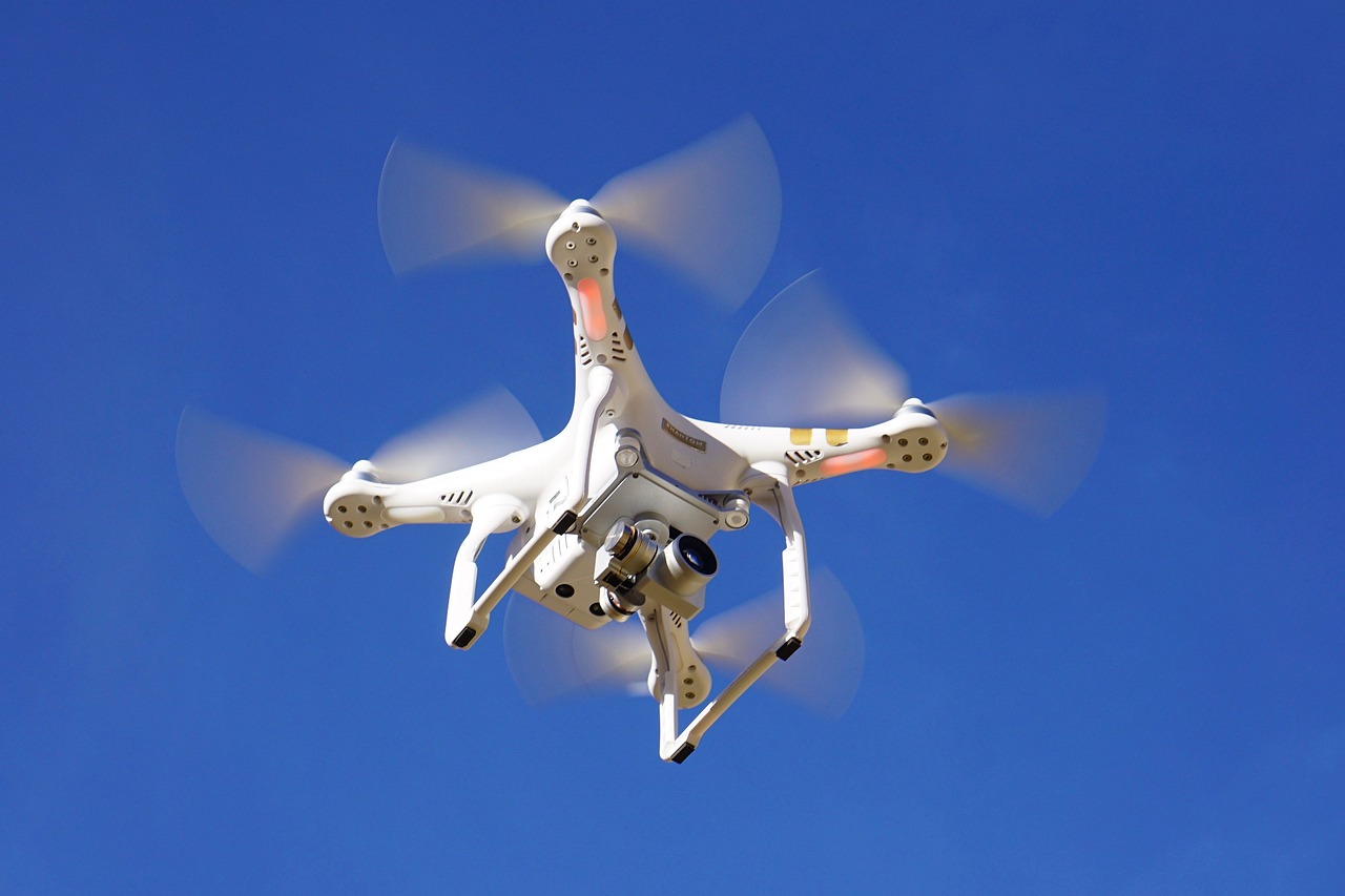
As drones take to the skies, the sensors they carry are becoming increasingly sophisticated. These advanced sensors enhance data accuracy and collection frequency, enabling researchers to gather real-time information on a variety of environmental parameters. Imagine sensors that can measure temperature, humidity, and even pollutant levels all at once! This capability provides crucial insights for researchers and policymakers alike, allowing them to make informed decisions based on reliable data. The integration of sensor technology with drones not only improves the precision of environmental monitoring but also paves the way for innovative applications in conservation and resource management.
When it comes to environmental monitoring, different types of sensors serve unique purposes. Here’s a brief overview of the most common types:
- Optical Sensors: These sensors utilize light to detect and measure environmental variables, playing a crucial role in monitoring vegetation health and water quality.
- Chemical Sensors: Designed to detect specific pollutants, these sensors are invaluable for tracking contamination levels and ensuring compliance with environmental regulations.
- Acoustic Sensors: These sensors use sound waves to monitor wildlife and assess ecosystem health, providing insights that are often missed by visual observation.
Optical sensors are fascinating devices that harness the power of light. They are essential for monitoring the health of vegetation and assessing water quality. By analyzing the light reflected off plants and water bodies, these sensors can provide real-time data that is critical for effective environmental management. Imagine being able to detect a decline in plant health before it becomes visible to the naked eye—this is the power of optical sensors!
On the other hand, chemical sensors are designed to detect specific pollutants in the air or water. Their sensitivity and specificity make them invaluable tools for tracking contamination levels and ensuring compliance with environmental regulations. These sensors can identify harmful substances at incredibly low concentrations, allowing for timely interventions to protect both human health and the environment. Think of them as the watchdogs of our ecosystems, tirelessly monitoring for threats and alerting us to potential dangers.
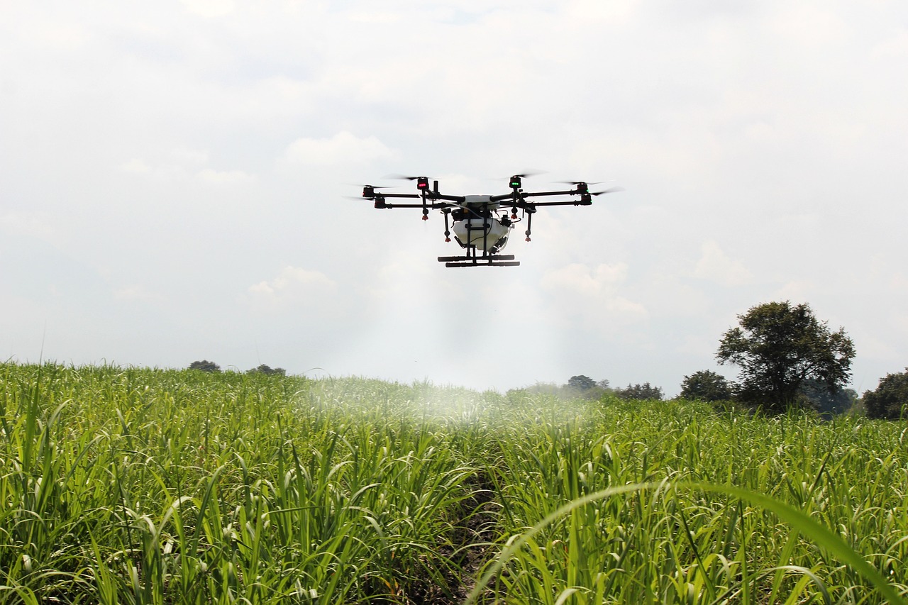
The true magic happens when drones and sensors come together. This integration creates a powerful tool for environmental monitoring, enabling real-time data collection and analysis. Imagine a drone equipped with a suite of sensors flying over a polluted river, gathering data on water quality and pollutant levels in real-time. This information can then be analyzed on the spot, allowing for immediate action to address environmental issues. The synergy between drones and sensors not only enhances decision-making processes but also improves environmental management strategies, making it easier to protect our planet.
As we look toward the future, the applications of drones and sensors in conservation efforts are expanding rapidly. From wildlife monitoring to habitat restoration, these technologies provide critical data that inform conservation strategies and enhance ecosystem protection. For instance, drones equipped with cameras and sensors are being used to track wildlife populations and movements. This non-invasive approach minimizes human disturbance while providing valuable insights into species behavior and habitat usage.
Imagine being able to monitor endangered species without ever stepping foot in their habitat. Drones equipped with advanced imaging technology allow researchers to observe wildlife populations from above, providing data on migration patterns, breeding habits, and population health. This non-invasive method is crucial for protecting vulnerable species and ensuring their survival in an ever-changing environment.
In addition to wildlife monitoring, drones can play a significant role in habitat restoration. By assessing damaged ecosystems from the sky, researchers can identify areas that require targeted restoration efforts. Sensors can gather data on soil health and vegetation cover, informing strategies to rehabilitate habitats effectively and sustainably. It’s like having a bird’s-eye view of the landscape, allowing for precise interventions that can make a world of difference.
Despite their incredible potential, the use of drones and sensors in environmental monitoring does not come without challenges. Regulatory hurdles can vary significantly, impacting deployment in certain areas. Understanding and navigating these regulations is essential for researchers and organizations seeking to utilize drone technology effectively. Additionally, the vast amounts of data collected by drones and sensors pose significant management challenges. Developing robust data processing and analysis frameworks is vital to derive meaningful insights from this information.
Regulations governing drone usage can be a maze to navigate. Different regions have different rules, and understanding these regulations is crucial for successful deployment. Researchers must stay informed about local laws to ensure compliance and avoid potential setbacks in their monitoring efforts.
As drones and sensors collect vast amounts of data, the challenge of managing this information becomes increasingly significant. Developing systems for data processing, storage, and analysis is essential to turn raw data into actionable insights. Without effective data management, the potential of these technologies could go unrealized, leaving critical environmental questions unanswered.
Q: How do drones improve environmental monitoring?
A: Drones provide aerial perspectives and allow for efficient surveying of large areas, enabling better analysis of ecosystems and natural resources.
Q: What types of sensors are commonly used in environmental monitoring?
A: Common sensors include optical sensors for vegetation health, chemical sensors for pollutant detection, and acoustic sensors for wildlife monitoring.
Q: What are the main challenges in using drones for environmental monitoring?
A: Key challenges include regulatory hurdles, data management issues, and the need for robust data processing frameworks.

Emergence of Drones in Environmental Monitoring
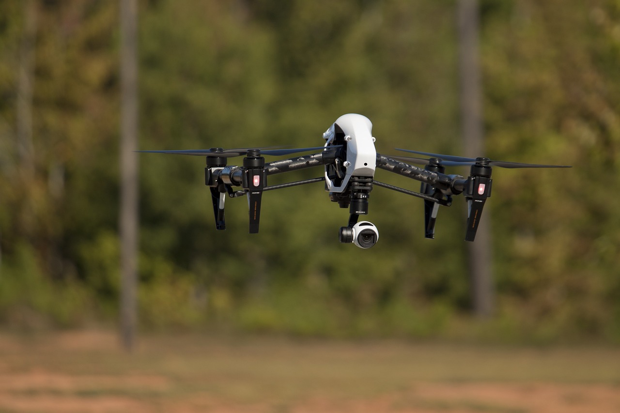
The introduction of drones into the realm of environmental monitoring has been nothing short of revolutionary. Imagine being able to survey vast landscapes, dense forests, and remote areas without the need for extensive ground teams—this is the magic that drones bring to the table. These flying marvels are equipped with high-resolution cameras and advanced sensors, enabling them to capture data and images from aerial perspectives that were previously challenging, if not impossible, to obtain. With their ability to cover large areas quickly and efficiently, drones have become invaluable tools for researchers and environmentalists alike.
One of the most exciting aspects of drone technology is its versatility. They can be deployed in a variety of settings, from urban environments to rugged terrains. This flexibility allows for comprehensive monitoring of ecosystems and natural resources. For instance, drones can be used to assess the health of forests, monitor wildlife populations, and even track changes in land use over time. The data collected can help identify trends, spot potential issues, and guide conservation efforts, making drones an essential component in the toolkit of environmental monitoring.
Furthermore, the integration of drones with real-time data processing capabilities enhances their effectiveness. Equipped with advanced sensors, drones can gather information on various environmental parameters such as temperature, humidity, and air quality. This data can be analyzed in real-time, providing immediate insights that can inform decision-making processes. For example, if a drone detects a spike in pollutant levels over a specific area, immediate action can be taken to address the issue before it escalates.
To truly appreciate the impact of drones on environmental monitoring, consider the following key benefits:
- Cost-Effectiveness: Drones reduce the need for expensive manned aircraft and extensive ground surveys, making monitoring more affordable.
- Safety: They can access hazardous or difficult-to-reach areas without putting human lives at risk.
- High-Resolution Data: Drones provide detailed imagery and data that can reveal changes in the environment with remarkable clarity.
However, the emergence of drones is not without its challenges. Regulatory hurdles often hinder their deployment, as different regions have varying laws regarding drone usage. Additionally, data management can become complex due to the sheer volume of information collected. Nevertheless, as technology continues to advance and regulations evolve, the potential for drones in environmental monitoring will only grow.
In summary, the emergence of drones in environmental monitoring represents a significant leap forward in our ability to understand and protect our planet. Their versatility, efficiency, and capability to gather real-time data make them indispensable tools for researchers, conservationists, and policymakers alike. As we look to the future, it’s clear that drones will play a pivotal role in shaping the way we monitor and manage our natural resources.
- What are the primary uses of drones in environmental monitoring?
Drones are primarily used for wildlife monitoring, habitat assessment, pollution tracking, and land-use analysis. - How do drones collect data?
Drones are equipped with various sensors and cameras that capture aerial images and environmental data, which can then be analyzed in real-time. - Are there any regulations regarding drone usage?
Yes, regulations vary by country and region, and it’s essential to comply with local laws when using drones for monitoring purposes.
Advancements in Sensor Technology
The world of environmental monitoring is undergoing a remarkable transformation, largely due to the . These innovations have not only increased the accuracy of data collected but have also enhanced the frequency at which this data can be gathered. Imagine a world where we can monitor air quality, soil health, and water conditions in real-time, all thanks to sophisticated sensors. This leap in technology is akin to upgrading from a flip phone to a smartphone; the capabilities and functionalities expand exponentially.
Modern sensors are designed to measure a wide array of environmental parameters. They can track everything from temperature and humidity to pollutant levels in the air and water. This data is crucial for researchers and policymakers alike, as it allows them to make informed decisions based on real-time information. For instance, a sudden spike in pollution levels can trigger immediate responses to mitigate environmental damage, much like how a smoke alarm prompts swift action in the case of fire.
Furthermore, the integration of Internet of Things (IoT) technology with sensors has revolutionized data collection. Sensors can now communicate with each other and with centralized databases, creating a network of information that is both comprehensive and easily accessible. This interconnectedness allows for a more holistic view of environmental conditions, empowering scientists to identify trends and patterns that were previously difficult to discern.
To illustrate the diversity of sensor technology, consider the following table that categorizes various types of sensors used in environmental monitoring:
| Type of Sensor | Functionality | Common Applications |
|---|---|---|
| Optical Sensors | Measure light reflection and absorption | Monitoring vegetation health, water quality |
| Chemical Sensors | Detect specific chemical compounds | Air quality monitoring, water contamination |
| Acoustic Sensors | Detect sound waves | Wildlife monitoring, noise pollution assessment |
Each type of sensor serves a unique purpose, contributing to a comprehensive understanding of environmental health. For example, optical sensors are invaluable for monitoring vegetation health, as they can detect changes in plant reflectance that indicate stress or disease. Meanwhile, chemical sensors play a critical role in tracking pollutants, ensuring compliance with environmental regulations, and protecting public health.
In conclusion, the advancements in sensor technology are paving the way for a new era of environmental monitoring. By providing accurate, real-time data, these sensors empower researchers and policymakers to take proactive measures in protecting our planet. As we continue to innovate and refine these technologies, the potential for improved environmental stewardship becomes increasingly attainable.
Types of Sensors Used
In the realm of environmental monitoring, the choice of sensors is pivotal. Different types of sensors serve unique purposes, each designed to measure specific environmental parameters. The most commonly used sensors include optical, acoustic, and chemical sensors. Understanding the functionality of these sensors is essential for effective data collection and analysis, which ultimately informs better environmental management strategies.
Optical sensors are among the most versatile tools in environmental monitoring. They utilize light to detect and measure a variety of environmental variables. For instance, these sensors can assess the health of vegetation by analyzing light absorption and reflectance patterns. This capability enables researchers to monitor changes in plant health over time, providing crucial insights into ecosystem dynamics. Furthermore, optical sensors are invaluable in water quality assessments, where they can measure parameters such as turbidity and chlorophyll levels, offering real-time data that is critical for effective management of aquatic environments.
Chemical sensors, on the other hand, are specifically designed to detect pollutants in air and water. These sensors boast high sensitivity and specificity, allowing them to track contamination levels with remarkable accuracy. For example, chemical sensors can identify harmful substances like heavy metals or toxic gases, making them essential tools for compliance with environmental regulations. Their deployment in industrial areas or near water bodies helps in early detection of pollution, enabling timely interventions to mitigate environmental damage.
Additionally, acoustic sensors are gaining traction in environmental monitoring, particularly for studying underwater ecosystems. These sensors use sound waves to detect changes in water conditions and can even monitor marine life behaviors. By analyzing the sounds produced by various aquatic species, researchers can gather data on biodiversity and ecosystem health, which is vital for conservation efforts.
To summarize, the integration of these diverse sensor types creates a comprehensive environmental monitoring system. Each sensor contributes unique data that, when combined, provides a holistic view of environmental conditions. This synergy not only enhances the accuracy of data collection but also supports informed decision-making processes. As technology continues to advance, we can expect even more sophisticated sensors to emerge, further revolutionizing the field of environmental monitoring.
- What are the main types of sensors used in environmental monitoring?
The primary types include optical, chemical, and acoustic sensors, each serving different purposes in data collection.
- How do optical sensors work?
Optical sensors utilize light to measure environmental variables, such as vegetation health and water quality, by analyzing light absorption and reflectance.
- What role do chemical sensors play?
Chemical sensors detect specific pollutants in air or water, providing crucial data for compliance with environmental regulations.
- Can drones be used with these sensors?
Yes, drones equipped with various sensors enhance data collection capabilities, allowing for efficient monitoring of large areas.
Optical Sensors
Optical sensors have emerged as a pivotal technology in the realm of environmental monitoring, offering a unique way to capture and analyze data through the lens of light. These sensors operate by detecting light waves and converting them into measurable signals, which can then provide insights into various environmental variables. For instance, they can be used to assess vegetation health by measuring the reflectance of light from plant surfaces. This capability is crucial for understanding ecosystem dynamics, as healthy vegetation plays a vital role in carbon sequestration and biodiversity.
One of the standout features of optical sensors is their ability to deliver real-time data. Imagine being able to monitor a forest's health or a lake's water quality as changes occur, rather than waiting days or weeks for results. This immediacy allows researchers and environmental managers to make timely decisions that can significantly impact conservation efforts. For example, if an optical sensor detects a sudden decline in plant health due to a pest outbreak, immediate action can be taken to mitigate the threat before it spreads.
Additionally, optical sensors can be categorized into different types based on their specific applications:
- Multispectral Sensors: These sensors capture data across multiple wavelengths, allowing for the analysis of various characteristics of vegetation and water bodies.
- Hyperspectral Sensors: Going a step further, hyperspectral sensors collect data across hundreds of wavelengths, providing detailed information about material composition and health.
- LiDAR (Light Detection and Ranging): This technology uses laser light to measure distances and can create high-resolution maps of terrain and vegetation structure.
Moreover, the integration of optical sensors with drones has amplified their effectiveness. Drones equipped with these sensors can cover vast areas quickly, capturing data that would be time-consuming and labor-intensive to collect on foot. This synergy not only enhances the quality of the data collected but also expands the scope of monitoring efforts. For instance, researchers can now assess remote or difficult-to-access areas, such as mountainous regions or dense forests, which were previously challenging to study.
However, despite their advantages, optical sensors do have limitations. Factors such as lighting conditions, atmospheric interference, and sensor calibration can affect data accuracy. For example, cloudy weather can obscure light signals, leading to less reliable readings. Therefore, it is essential for researchers to understand these constraints and employ strategies to mitigate their impact. This might include using advanced algorithms to correct data for atmospheric effects or conducting ground truthing to validate sensor readings.
In summary, optical sensors represent a transformative technology in environmental monitoring, providing a wealth of information that can drive effective conservation strategies. As technology continues to advance, we can expect these sensors to become even more sophisticated, offering deeper insights into the health of our planet.
Q1: What are optical sensors used for in environmental monitoring?
A1: Optical sensors are primarily used to measure variables such as vegetation health, water quality, and atmospheric conditions by detecting light waves and converting them into data.
Q2: How do drones enhance the capabilities of optical sensors?
A2: Drones allow for rapid and extensive data collection over large areas, making it easier to monitor hard-to-reach environments and gather real-time information.
Q3: What are the challenges associated with using optical sensors?
A3: Challenges include issues with data accuracy due to environmental factors like lighting conditions and atmospheric interference, as well as the need for proper calibration and validation of the data collected.
Q4: Can optical sensors be used in all weather conditions?
A4: No, optical sensors can be affected by weather conditions, particularly cloudy or rainy days that may obscure light signals and reduce data reliability.
Chemical Sensors
Chemical sensors are remarkable devices designed to detect and quantify specific pollutants in various environments, be it air, water, or soil. Their sensitivity and specificity make them invaluable tools in the quest for environmental safety and compliance with regulations. Imagine walking into a room filled with different scents; a chemical sensor acts like a highly trained nose, identifying and measuring the concentration of specific compounds in the air. This technology is essential for monitoring air quality, assessing water contamination, and ensuring that ecosystems remain healthy.
One of the key advantages of chemical sensors is their ability to provide real-time data. This instantaneous feedback allows researchers and policymakers to respond swiftly to environmental changes. For instance, if a chemical spill occurs in a water body, chemical sensors can detect the pollutants almost immediately, enabling rapid response measures to mitigate the impact on aquatic life. Furthermore, these sensors can be deployed in remote or hard-to-reach areas, making them ideal for continuous monitoring without the need for constant human presence.
Different types of chemical sensors utilize various technologies to detect pollutants. Here are a few common types:
- Electrochemical Sensors: These sensors measure the electrical changes that occur when a chemical reaction takes place, providing precise data on pollutant levels.
- Optical Sensors: Using light to detect chemical properties, these sensors can identify specific compounds based on how they absorb or emit light.
- Mass Spectrometry Sensors: These advanced sensors analyze the mass of molecules, allowing for the detection of even trace amounts of substances.
Additionally, chemical sensors are pivotal for regulatory compliance. Environmental agencies often set strict limits on pollutant levels, and these sensors provide the necessary data to ensure that industries adhere to these standards. For instance, a factory might use chemical sensors to monitor emissions in real-time, ensuring they do not exceed legal limits. The data collected can also be used to generate reports required by regulatory bodies, thus facilitating transparency and accountability.
In conclusion, chemical sensors are not just technical devices; they are essential components of modern environmental monitoring strategies. By offering precise, real-time data on pollutant levels, they empower researchers, policymakers, and conservationists to make informed decisions that protect our planet. As technology continues to evolve, we can expect even greater advancements in chemical sensor capabilities, paving the way for a cleaner and healthier environment.
- What are chemical sensors?
Chemical sensors are devices that detect and measure specific chemical substances in various environments, providing crucial data for environmental monitoring. - How do chemical sensors work?
They operate by detecting changes in chemical properties, often using methods such as electrochemical reactions or optical measurements to quantify pollutants. - Where are chemical sensors used?
These sensors are widely used in air quality monitoring, water quality assessments, and soil contamination checks, among other applications. - Can chemical sensors detect multiple pollutants?
Yes, many modern chemical sensors are designed to detect multiple pollutants simultaneously, enhancing their utility in environmental monitoring.
Integration of Drones and Sensors
This article explores emerging technologies in environmental monitoring, focusing on the roles of drones and sensors. It highlights advancements, applications, challenges, and future prospects in this vital field.
Drones have revolutionized environmental monitoring by providing aerial perspectives and data collection capabilities. Their versatility allows for efficient surveying of large areas, enabling better analysis of ecosystems and natural resources.
The development of advanced sensors has significantly enhanced data accuracy and collection frequency. These sensors can measure various environmental parameters, such as temperature, humidity, and pollutant levels, providing crucial insights for researchers and policymakers.
Different types of sensors are deployed in environmental monitoring, including optical, acoustic, and chemical sensors. Each type serves specific purposes, from detecting air quality to monitoring water bodies, contributing to comprehensive environmental assessments.
Optical sensors utilize light to detect and measure environmental variables. They play a crucial role in monitoring vegetation health and water quality, offering real-time data for effective environmental management.
Chemical sensors are designed to detect specific pollutants in the air or water. Their sensitivity and specificity make them invaluable for tracking contamination levels and ensuring compliance with environmental regulations.
The integration of drones and sensors represents a groundbreaking advancement in the field of environmental monitoring. By combining the aerial capabilities of drones with the precision of advanced sensors, researchers can collect data in ways that were previously unimaginable. Imagine flying over a dense forest, capturing real-time data on air quality, temperature, and even wildlife movements—all from a bird's-eye view. This synergy not only enhances the scope of data collection but also allows for rapid analysis and decision-making.
One of the most exciting aspects of this integration is the potential for real-time monitoring. For instance, drones equipped with chemical sensors can detect harmful pollutants in the atmosphere and provide immediate feedback to environmental agencies. This capability is crucial for timely interventions and can significantly mitigate the impact of environmental disasters. Moreover, the ability to cover large areas quickly means that researchers can gather extensive datasets that would be impossible to collect manually.
Furthermore, the fusion of drones and sensors opens up new avenues for data visualization. Imagine using sophisticated software to create detailed maps that highlight pollution hotspots or areas of ecological concern. These visual tools not only make the data more accessible but also facilitate better communication with stakeholders, policymakers, and the public. The integration of these technologies is a game-changer, making environmental monitoring more effective and efficient.
However, it's essential to recognize that this integration is not without its challenges. The reliance on technology raises questions about data accuracy, sensor calibration, and the need for skilled personnel to operate these systems. As we move forward, addressing these challenges will be crucial in maximizing the potential of drones and sensors in environmental monitoring.
Drones and sensors are increasingly used in conservation efforts, including wildlife monitoring, habitat restoration, and illegal poaching prevention. These technologies provide critical data that inform conservation strategies and enhance ecosystem protection.
Drones equipped with cameras and sensors are employed to track wildlife populations and movements. This non-invasive approach minimizes human disturbance while providing valuable insights into species behavior and habitat usage.
Using drones to assess damaged ecosystems enables targeted restoration efforts. Sensors can gather data on soil health and vegetation cover, informing strategies to rehabilitate habitats effectively and sustainably.
Despite their potential, the use of drones and sensors in environmental monitoring faces challenges, including regulatory hurdles, data management issues, and technological limitations. Addressing these challenges is crucial for maximizing their effectiveness.
Regulations governing drone usage can vary significantly, impacting deployment in certain areas. Understanding and navigating these regulations is essential for researchers and organizations seeking to utilize drone technology effectively.
The vast amounts of data collected by drones and sensors pose significant management challenges. Developing robust data processing and analysis frameworks is vital to derive meaningful insights from this information.
- What are the main benefits of using drones in environmental monitoring?
Drones provide aerial views, cover large areas quickly, and collect real-time data, enhancing the efficiency and effectiveness of environmental assessments.
- How do sensors improve data collection in environmental studies?
Advanced sensors can measure a variety of environmental parameters with high accuracy, allowing for more detailed and reliable data collection.
- What challenges do drones face in environmental monitoring?
Challenges include regulatory restrictions, data management complexities, and the need for skilled personnel to operate the technology.
Applications in Conservation Efforts
In recent years, the integration of drones and sensors in conservation efforts has emerged as a game-changer. These technologies are not just a passing trend; they are reshaping how we approach environmental protection and wildlife management. Imagine being able to monitor vast stretches of land without ever stepping foot on them. That’s the magic of drones! They soar above the treetops, capturing data and images that were once hard to obtain. This aerial perspective allows conservationists to gain insights into ecosystems that are often difficult to access.
Drones equipped with high-resolution cameras and advanced sensors are increasingly used for wildlife monitoring. This non-invasive method minimizes human disturbance, which is crucial when studying sensitive species. For example, researchers can track the movements of endangered animals without the stress of human presence. This approach not only helps in understanding species behavior but also aids in identifying critical habitats that need protection. The ability to gather real-time data means that conservation strategies can be adjusted on-the-fly, making them more effective and responsive.
Moreover, drones play a vital role in habitat restoration efforts. By assessing damaged ecosystems from above, conservationists can pinpoint areas that require immediate attention. Sensors can gather essential data on soil health, vegetation cover, and even moisture levels. This information is invaluable for developing targeted restoration strategies. For instance, if a drone identifies an area suffering from soil erosion, conservationists can prioritize that location for rehabilitation efforts. The synergy between drones and sensors leads to more efficient use of resources, ensuring that restoration efforts are both effective and sustainable.
In addition to wildlife monitoring and habitat restoration, drones are proving indispensable in combating illegal poaching. With their ability to cover large areas quickly, drones can patrol protected regions, providing real-time surveillance. This capability allows rangers to respond to poaching threats more effectively. The data collected can also be analyzed to identify patterns in poaching activities, enabling authorities to implement preventive measures. By leveraging technology, we can enhance the protection of endangered species and their habitats.
However, while the potential applications of drones and sensors in conservation are vast, it’s essential to acknowledge the challenges that come with them. Regulatory hurdles can impede the deployment of drones in certain areas, and understanding these regulations is crucial for conservationists. Additionally, the sheer volume of data collected poses significant management challenges. Developing effective data processing and analysis frameworks is vital to ensure that the insights gained are meaningful and actionable.
In summary, the applications of drones and sensors in conservation efforts are diverse and impactful. They offer innovative solutions for wildlife monitoring, habitat restoration, and anti-poaching initiatives. As technology continues to advance, we can expect even more exciting developments in this field, paving the way for a more sustainable future.
- How do drones help in wildlife monitoring?
Drones provide a non-invasive way to track wildlife populations and movements, minimizing human disturbance while collecting valuable data. - What types of data can sensors collect?
Sensors can measure various environmental parameters, including temperature, humidity, soil health, and pollutant levels. - Are there any regulations regarding drone usage in conservation?
Yes, regulations can vary by region, affecting how and where drones can be deployed for conservation purposes. - Can drones be used for habitat restoration?
Absolutely! Drones can assess damaged ecosystems and help develop targeted restoration strategies based on the data collected.

Wildlife Monitoring
Wildlife monitoring has undergone a transformative shift thanks to the integration of drones and advanced sensors. Imagine being able to observe elusive animals in their natural habitats without ever disturbing them. That's the magic of drone technology! These flying machines are equipped with high-resolution cameras and various sensors that allow researchers to collect data on wildlife populations, behaviors, and movements from an aerial perspective. This non-invasive approach not only minimizes human interference but also maximizes the quality of data collected.
One of the most exciting aspects of using drones for wildlife monitoring is their ability to cover vast areas in a fraction of the time it would take traditional methods. For instance, a team of researchers might spend weeks trekking through dense forests to gather data on a specific species. In contrast, a drone can fly over the same area in a matter of hours, capturing detailed images and data that can be analyzed later. This efficiency is crucial in conservation efforts, where time is often of the essence.
Moreover, drones can be equipped with various sensors that measure different environmental parameters. For example, thermal imaging cameras can detect heat signatures, making it easier to locate animals, especially at night or in thick foliage. This technology allows researchers to monitor not just the presence of wildlife but also their health and behavior, providing insights into how they interact with their environment. By analyzing the data collected, scientists can identify patterns that can inform conservation strategies and help protect endangered species.
However, the use of drones in wildlife monitoring is not without its challenges. For one, there are ethical considerations to take into account. While drones can minimize human disturbance, they can still cause stress to wildlife if not used responsibly. It's essential for researchers to follow best practices and guidelines to ensure that their monitoring efforts do not negatively impact the animals they study.
In addition, regulatory hurdles can pose significant challenges. Different countries and regions have varying laws regarding drone usage, which can complicate research efforts. Understanding these regulations is crucial for researchers and organizations aiming to utilize drone technology effectively. It's a bit like navigating a maze—one wrong turn, and you might find yourself stuck!
In conclusion, the integration of drones in wildlife monitoring represents a groundbreaking advancement in conservation efforts. By providing researchers with the tools to gather data efficiently and ethically, we can better understand and protect our planet's precious wildlife. As technology continues to evolve, the potential for drones to play an even greater role in conservation is limitless. The future is bright, and with it, the hope for a more sustainable coexistence with our natural world!
- How do drones help in wildlife monitoring? Drones provide a non-invasive way to observe wildlife, allowing researchers to collect data on animal populations and behaviors without disturbing their natural habitats.
- What types of sensors are used with drones for wildlife monitoring? Drones can be equipped with various sensors, including thermal imaging cameras, optical cameras, and environmental sensors, to gather comprehensive data.
- Are there any ethical concerns with using drones for wildlife monitoring? Yes, while drones minimize human disturbance, they can still stress wildlife if not used responsibly. It's essential to follow ethical guidelines during monitoring.
- What are some challenges faced when using drones for wildlife monitoring? Challenges include regulatory hurdles, ethical considerations, and the need for robust data management systems to process the large amounts of data collected.
Habitat Restoration
When it comes to , drones are not just flying gadgets; they are game-changers. Imagine being able to assess a damaged ecosystem from the sky, pinpointing areas that need urgent attention without disturbing the wildlife below. Drones equipped with advanced sensors can survey vast landscapes in a fraction of the time it would take traditional methods. This efficiency is crucial when time is of the essence in restoration efforts.
One of the most exciting aspects of using drones in habitat restoration is their ability to gather real-time data. For instance, sensors can measure soil health, moisture levels, and vegetation cover. This data is invaluable in determining the current state of an ecosystem and in planning effective restoration strategies. By analyzing this information, environmentalists can make informed decisions about where to focus their efforts, ensuring that resources are allocated where they are most needed.
Moreover, the integration of drones with geographic information systems (GIS) allows for comprehensive mapping of restoration sites. This mapping can reveal patterns that are not immediately visible to the naked eye, such as areas prone to erosion or those that are particularly resilient. By understanding these dynamics, restoration projects can be tailored to the specific needs of the ecosystem, improving the chances of success.
To illustrate the impact of drone technology in habitat restoration, consider the following table that highlights various applications:
| Application | Description | Benefits |
|---|---|---|
| Soil Analysis | Using sensors to measure soil composition and health. | Identifies nutrient deficiencies and contamination. |
| Vegetation Monitoring | Tracking plant growth and health over time. | Helps in assessing the success of restoration efforts. |
| Wildlife Habitat Assessment | Mapping and analyzing habitats critical for wildlife. | Informs conservation strategies and habitat protection. |
Furthermore, drones can assist in post-restoration monitoring. After an ecosystem has been restored, continuous monitoring is essential to ensure that the restoration efforts are successful and that the ecosystem is recovering as planned. Drones can provide ongoing surveillance, allowing for quick adjustments to management strategies if necessary.
In summary, the role of drones in habitat restoration is multifaceted and impactful. Their ability to collect data efficiently and accurately transforms how we approach the restoration of our precious ecosystems. As technology continues to evolve, the potential for drones to further enhance these efforts is immense, paving the way for a more sustainable future.
- How do drones help in habitat restoration? Drones provide aerial views and real-time data collection, allowing for efficient assessment and monitoring of ecosystems.
- What types of sensors are used with drones for restoration? Common sensors include those for soil moisture, temperature, and vegetation health, which provide critical data for restoration efforts.
- Are there any limitations to using drones in habitat restoration? Yes, challenges include regulatory restrictions, data management issues, and the need for skilled personnel to interpret the data.

Challenges and Limitations
While the integration of drones and sensors in environmental monitoring presents exciting opportunities, it is not without its challenges and limitations. One of the most significant hurdles is the regulatory landscape. Drones are subject to various laws and regulations that can differ widely from one region to another. For instance, in some areas, drone flights may be restricted due to privacy concerns or airspace regulations, making it difficult for researchers and conservationists to deploy these technologies effectively. Understanding and navigating this complex regulatory framework is crucial for maximizing the potential of drones in environmental monitoring.
Another critical challenge lies in data management. Drones and sensors generate vast amounts of data, which can be overwhelming to process and analyze. Without a robust data management strategy, valuable insights can be lost in a sea of information. Researchers need to develop effective frameworks that allow for the efficient processing of this data, ensuring that it can be translated into actionable insights. This often requires advanced software solutions and skilled personnel, which can be resource-intensive.
Moreover, the technological limitations of drones and sensors themselves can pose challenges. For example, factors such as battery life, payload capacity, and environmental conditions can affect the performance of drones. Drones may struggle to operate in adverse weather conditions like heavy rain or strong winds, limiting their usability in certain environments. Additionally, the sensors must be sensitive enough to capture the required data accurately, and any malfunction can lead to compromised data integrity.
Furthermore, there is a need for continuous training and education for personnel involved in operating drones and interpreting sensor data. As technology evolves, staying updated with the latest advancements is essential to ensure effective monitoring practices. This ongoing education can be a logistical and financial burden for many organizations.
In summary, while drones and sensors hold immense potential for enhancing environmental monitoring, addressing these challenges is vital for their successful implementation. By navigating regulatory hurdles, developing efficient data management strategies, overcoming technological limitations, and investing in training, we can unlock the full capabilities of these innovative tools.
- What are the primary regulatory challenges associated with drone use in environmental monitoring?
Regulations can vary significantly depending on the region, impacting deployment and operational practices. Understanding local laws is essential for effective usage. - How can organizations manage the vast amounts of data collected by drones and sensors?
Developing robust data processing frameworks and utilizing advanced software solutions can help organizations analyze and derive meaningful insights from the data. - What technological limitations do drones face in environmental monitoring?
Factors such as battery life, payload capacity, and adverse weather conditions can affect the performance and reliability of drones in the field. - Why is training important for personnel using drones and sensors?
Continuous training ensures that personnel are up-to-date with the latest technologies and best practices, which is crucial for effective monitoring efforts.
Regulatory Hurdles
When it comes to the exciting world of drones and sensors in environmental monitoring, one cannot overlook the significant that often stand in the way. These regulations are not just mere bureaucratic red tape; they can profoundly impact how, when, and where these technologies can be deployed. For instance, the Federal Aviation Administration (FAA) in the United States has stringent rules regarding drone flights, which can vary widely depending on the location and purpose of the flight. This means that researchers and organizations must navigate a complex web of regulations that can sometimes feel like an obstacle course.
Moreover, these regulations can differ not only by country but also by state or region. For example, some areas may have specific restrictions on flying drones over protected wildlife habitats or urban environments. This variability can lead to confusion and may even deter organizations from utilizing drone technology altogether. Understanding these regulations is crucial for maximizing the potential of drones in environmental monitoring. It’s like trying to play a game without knowing the rules; you might end up making mistakes that could cost you dearly.
In addition to varying regulations, there are also issues related to data privacy and airspace management. Drones equipped with cameras and sensors can inadvertently collect sensitive information, raising concerns about privacy and data protection. This is particularly important in urban settings where the potential for capturing personal data is heightened. Therefore, organizations must take proactive measures to ensure compliance with data protection laws, which can add another layer of complexity to their operations.
To illustrate the regulatory landscape, consider the following table that outlines some common regulatory issues faced by organizations using drones in environmental monitoring:
| Regulatory Issue | Description |
|---|---|
| Flight Restrictions | Limitations on where drones can be flown, especially near airports and populated areas. |
| Privacy Concerns | Regulations regarding the collection of personal data and ensuring the privacy of individuals. |
| Licensing Requirements | Necessity for drone operators to obtain specific licenses or certifications to operate legally. |
| Environmental Regulations | Compliance with laws that protect wildlife and natural habitats, which can restrict drone usage. |
In conclusion, while the integration of drones and sensors in environmental monitoring holds immense promise, overcoming regulatory hurdles is essential for unlocking their full potential. Organizations must invest time and resources into understanding the regulatory landscape to ensure compliance and effective deployment. After all, navigating these challenges is not just about following the rules; it's about paving the way for innovative solutions that can enhance environmental conservation efforts.
- What are the main regulations for using drones in environmental monitoring? Regulations vary by region but often include flight restrictions, data privacy laws, and licensing requirements.
- How can organizations ensure compliance with drone regulations? Organizations should stay informed about local laws, obtain necessary licenses, and implement data protection measures.
- What are the consequences of not following drone regulations? Non-compliance can lead to fines, legal issues, and potential damage to reputation.
Data Management Issues
In the rapidly evolving field of environmental monitoring, the integration of drones and sensors generates an avalanche of data. This data, while invaluable, brings forth a multitude of management challenges that need addressing. Imagine trying to fill a swimming pool with a fire hose; the sheer volume can be overwhelming, making it difficult to maintain control and ensure quality. Similarly, the vast amounts of data collected can lead to issues related to storage, processing, and analysis.
One of the foremost challenges is the storage capacity. With drones capturing high-resolution images and sensors continuously measuring environmental variables, the data generated can quickly exceed the capabilities of traditional storage solutions. Organizations must invest in robust data storage systems that can handle large datasets efficiently. This often means transitioning to cloud-based solutions or utilizing high-capacity physical servers that can manage the influx of information.
Another critical issue is data processing. The raw data collected by drones and sensors is often unstructured and requires significant processing to be useful. This is akin to receiving a jigsaw puzzle without the picture on the box; you have all the pieces, but without a clear strategy, putting them together becomes a daunting task. Advanced algorithms and machine learning techniques are becoming essential to transform this raw data into actionable insights. However, the need for skilled data scientists and analysts can strain resources, particularly for smaller organizations.
Furthermore, the analysis of this data can be overwhelming. With numerous variables at play, determining what data is relevant and how it should be interpreted can lead to confusion. For instance, when monitoring air quality, one must consider various pollutants, weather conditions, and geographical factors. This complexity necessitates a well-defined framework for analysis, ensuring that the data is not only accurate but also relevant to the questions being posed. Organizations must establish protocols to guide data analysis, making it easier to extract meaningful conclusions.
Finally, there are data integration issues. Often, data collected from different sensors or drones may not be compatible, leading to fragmented insights. Imagine trying to piece together a story from different books that don’t share a common theme; the result can be disjointed and confusing. To overcome this, establishing standardized data formats and protocols is crucial. By ensuring that all data collected can be easily integrated and compared, organizations can create a more cohesive understanding of environmental conditions.
In summary, while the potential of drones and sensors in environmental monitoring is immense, the challenges of data management are equally significant. Addressing storage, processing, analysis, and integration issues is vital for organizations aiming to harness the full power of this technology. By investing in the right tools and strategies, the environmental monitoring community can turn these challenges into opportunities for innovation and improved decision-making.
- What types of data are collected by drones and sensors in environmental monitoring? Drones and sensors collect a variety of data including air quality measurements, temperature, humidity, soil health, and high-resolution images of ecosystems.
- How can organizations manage the large volumes of data generated? Organizations can manage data by investing in cloud storage solutions, employing advanced data processing techniques, and establishing clear data analysis protocols.
- What are the benefits of using drones for environmental monitoring? Drones provide aerial perspectives, allowing for the efficient surveying of large areas, which enhances the analysis of ecosystems and natural resources.
- Are there specific regulations for using drones in environmental monitoring? Yes, regulations can vary by region and must be adhered to, ensuring safe and responsible use of drone technology.
Frequently Asked Questions
- What are the primary benefits of using drones in environmental monitoring?
Drones offer a bird's-eye view of ecosystems, allowing for efficient surveying of vast areas. They can collect high-resolution data quickly and accurately, making them invaluable for analyzing changes in the environment, such as deforestation or water quality issues.
- How do sensors enhance environmental monitoring efforts?
Sensors provide precise measurements of various environmental parameters like temperature, humidity, and pollutant levels. This data is crucial for researchers and policymakers as it helps in making informed decisions regarding environmental protection and resource management.
- What types of sensors are commonly used in environmental monitoring?
There are several types of sensors, including optical sensors for monitoring vegetation health, chemical sensors for detecting pollutants, and acoustic sensors for studying wildlife. Each type plays a specific role in gathering vital data for comprehensive environmental assessments.
- Can drones and sensors work together effectively?
Absolutely! The integration of drones and sensors creates a powerful monitoring tool. Drones can carry sensors to collect real-time data over large areas, enhancing the speed and efficiency of environmental assessments.
- How are drones used in wildlife monitoring?
Drones equipped with cameras and sensors can track wildlife populations and their movements without causing disturbance. This non-invasive method allows researchers to gather valuable insights into species behavior and habitat usage.
- What challenges do drones and sensors face in environmental monitoring?
Some challenges include navigating regulatory hurdles that vary by location, managing the vast amounts of data collected, and addressing technological limitations. Overcoming these obstacles is essential for maximizing the effectiveness of these tools.
- Are there any regulations governing the use of drones for environmental monitoring?
Yes, regulations can differ significantly by region, affecting where and how drones can be deployed. It's crucial for researchers and organizations to understand these regulations to ensure compliance and effective use of drone technology.
- What is the future outlook for drones and sensors in environmental monitoring?
The future looks promising! As technology advances, we can expect more sophisticated drones and sensors that will enhance data collection and analysis. This will lead to better environmental management strategies and improved conservation efforts.