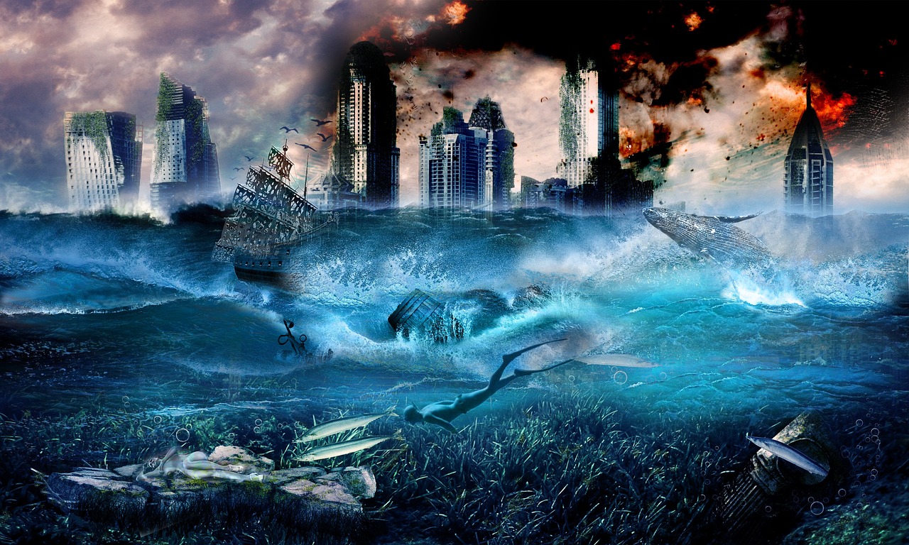
Innovations in Disaster Risk Reduction Research Methods
In a world where natural disasters are becoming increasingly frequent and severe, the need for effective disaster risk reduction (DRR) strategies has never been more critical. Innovations in research methodologies are paving the way for a deeper understanding of these challenges, enabling communities and governments to prepare better and respond effectively. This article delves into the latest advancements in research methods that are transforming how we approach disaster risk reduction. From cutting-edge technologies to community engagement, the landscape of DRR is evolving, and it’s essential to stay informed about these changes to enhance our resilience against natural calamities.
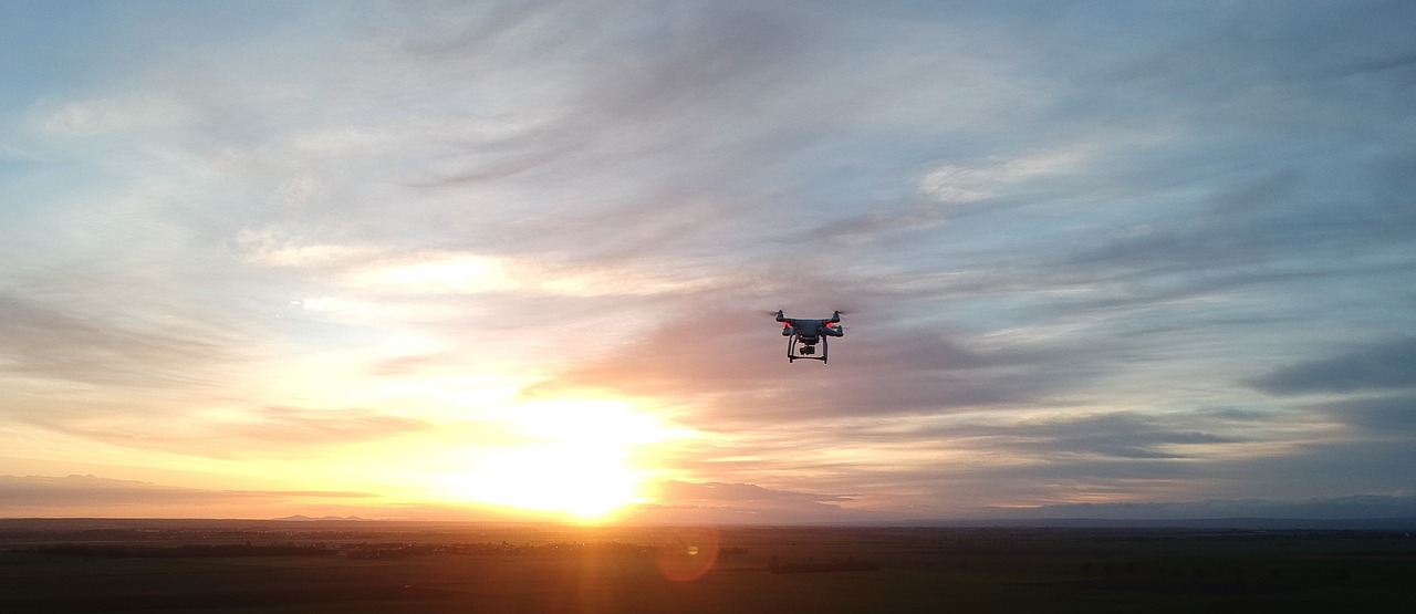
Imagine flying over disaster-prone areas, capturing real-time data from the sky. Drones and remote sensing technologies are revolutionizing the way we collect data in disaster risk reduction. These tools provide unprecedented access to hard-to-reach areas, allowing researchers to gather accurate information about vulnerabilities and potential impacts. For instance, drones can quickly survey damage after a disaster, offering insights that traditional methods might miss. This real-time data collection not only enhances accuracy but also enables quicker responses, ultimately saving lives and resources.
Engaging communities in the research process is like planting seeds of knowledge in fertile soil. Community-Based Participatory Research (CBPR) emphasizes the importance of local knowledge integration, empowering residents to actively contribute to disaster risk assessments. By involving community members, researchers can tap into invaluable insights that reflect the unique challenges and strengths of each area. This collaborative approach not only enhances the relevance of findings but also fosters a sense of ownership among residents, leading to more effective and sustainable risk management strategies.
Have you ever wondered how scientists can predict the path of a hurricane days in advance? Advanced predictive modeling techniques, including machine learning and simulation models, are at the heart of this capability. These sophisticated methods allow researchers to forecast disaster impacts and evaluate potential mitigation strategies. By analyzing vast amounts of data, predictive models can identify patterns and trends that inform decision-making. This proactive approach enables governments and organizations to allocate resources more effectively, ultimately reducing the risks associated with natural disasters.
Disasters don’t occur in isolation; they impact various aspects of life, including social, economic, and environmental factors. Integrated risk assessment frameworks are essential for understanding the multifaceted nature of disaster risks. By considering these diverse elements, stakeholders can prioritize interventions that address the root causes of vulnerability. For example, a comprehensive risk assessment might analyze how economic disparities exacerbate the impact of disasters, leading to targeted programs that enhance community resilience.
When it comes to visualizing disaster risks, remote sensing and Geographic Information Systems (GIS) are game-changers. These technologies enhance spatial analysis capabilities, allowing researchers to map vulnerable areas and assess potential impacts visually. For instance, GIS can help identify regions at risk of flooding, enabling targeted interventions and resource allocation. By leveraging these tools, researchers can present complex data in a more digestible format, facilitating informed decision-making among stakeholders.
In today’s digital age, social media isn’t just for sharing vacation photos; it’s a powerful tool for disaster response. Leveraging social media platforms and crowdsourcing data allows for real-time information gathering during disasters. This approach facilitates rapid response efforts and improves communication among stakeholders and affected communities. For example, during a hurricane, social media can be used to disseminate critical information, such as evacuation routes and shelter locations, ensuring that everyone stays informed and safe.
Innovations in policy and institutional frameworks play a vital role in supporting research efforts. Effective collaboration among stakeholders is essential for translating research findings into actionable disaster risk reduction practices. By fostering partnerships between governments, non-profits, and academic institutions, we can create a cohesive approach to disaster management that considers diverse perspectives and expertise. This collaborative environment ensures that research informs policy decisions, leading to more effective risk reduction strategies.
Investing in capacity building and training programs for researchers and practitioners is crucial for promoting the adoption of innovative research methods in disaster risk reduction. These programs enhance skills and knowledge, empowering individuals to implement cutting-edge techniques effectively. As the field of DRR continues to evolve, ongoing education and training will be vital for ensuring that professionals are equipped to tackle emerging challenges.
Finally, assessing the impact of research on disaster risk reduction policies is essential for understanding effectiveness. It’s not enough to develop innovative methodologies; we must ensure they translate into actionable insights that inform and shape policy decisions. By evaluating research outcomes, stakeholders can identify successful strategies and areas for improvement, ultimately enhancing the overall effectiveness of disaster risk reduction efforts.
- What are the key benefits of using drones in disaster risk reduction?
Drones provide real-time data collection, access to hard-to-reach areas, and improved accuracy in assessing vulnerabilities. - How does community engagement improve disaster risk assessments?
Community engagement integrates local knowledge, leading to more relevant findings and empowering residents to take ownership of risk management. - Why are predictive modeling techniques important?
They allow researchers to forecast disaster impacts and evaluate mitigation strategies, leading to informed decision-making. - What role do social media and crowdsourcing play in disaster response?
They facilitate real-time information gathering and improve communication among stakeholders and affected communities.
Emerging Technologies in Data Collection
The landscape of disaster risk reduction is undergoing a dramatic transformation, thanks in large part to emerging technologies that are reshaping how we collect and analyze data. Imagine a world where drones soar above disaster-stricken areas, providing real-time imagery and data that can save lives. This is not science fiction; it's happening now. Technologies like drones, remote sensing, and geographic information systems (GIS) are revolutionizing our ability to gather crucial information quickly and accurately. By harnessing these tools, researchers can assess vulnerabilities and impacts with unprecedented precision.
Drones, for instance, have become invaluable in disaster scenarios. They can access hard-to-reach areas, capturing high-resolution images that reveal the extent of damage and the needs of affected communities. This capability not only enhances the speed of data collection but also improves the accuracy of assessments. Remote sensing technologies complement this effort by providing satellite imagery and aerial data, which can be analyzed to track changes over time. This is particularly useful for monitoring natural phenomena such as floods, wildfires, and landslides, allowing for timely interventions.
Moreover, the integration of machine learning algorithms into data collection processes is paving the way for smarter analytics. These algorithms can sift through vast amounts of data, identifying patterns and correlations that may not be immediately apparent. For example, by analyzing social media posts, researchers can gauge public sentiment and responses during disasters, providing insights that traditional methods might miss. This ability to capture real-time data means that decision-makers can act swiftly, adapting their strategies to the evolving situation on the ground.
To illustrate the impact of these technologies, consider the following table that summarizes the key benefits of emerging technologies in data collection:
| Technology | Benefits |
|---|---|
| Drones | Real-time data collection, access to remote areas, high-resolution imagery |
| Remote Sensing | Satellite imagery, monitoring of natural phenomena, historical data analysis |
| Machine Learning | Pattern recognition, predictive analytics, real-time sentiment analysis |
| GIS | Spatial analysis, visualization of risks, resource allocation |
As we embrace these technologies, it’s essential to recognize the collaborative nature of disaster risk reduction. Researchers, local governments, and communities must work together to leverage these tools effectively. By integrating local knowledge with advanced data collection methods, we can create a more comprehensive understanding of risks and vulnerabilities. This collaborative approach not only enhances the relevance of the data collected but also empowers communities to take an active role in their own disaster preparedness and response efforts.
In conclusion, the integration of emerging technologies in data collection is not just a trend; it’s a vital evolution in the field of disaster risk reduction. By utilizing drones, remote sensing, and machine learning, we can gather more accurate data, respond more effectively to disasters, and ultimately save lives. As we continue to innovate and adapt, the future of disaster risk reduction looks brighter than ever.
- What role do drones play in disaster risk reduction? Drones provide real-time data collection, access to remote areas, and high-resolution imagery, which is crucial for assessing damage and planning responses.
- How does remote sensing enhance disaster preparedness? Remote sensing offers satellite imagery and aerial data that help monitor natural phenomena and track changes over time, facilitating timely interventions.
- Can machine learning improve disaster response? Yes, machine learning algorithms can analyze vast amounts of data to identify patterns, enabling quicker and more informed decision-making during disasters.

Community-Based Participatory Research
Community-Based Participatory Research (CBPR) is a transformative approach that shifts the paradigm of traditional research methodologies. Instead of researchers merely observing communities from a distance, CBPR invites community members to become active partners in the research process. This collaboration not only enhances the quality of the data collected but also ensures that the research is grounded in the real experiences and needs of the community. Imagine a scenario where local residents, equipped with their unique insights, help shape the research questions, design the studies, and interpret the findings. This approach fosters a sense of ownership and empowerment among participants, leading to more relevant and actionable outcomes.
One of the most significant advantages of CBPR is its potential to bridge the gap between scientific research and community action. By integrating local knowledge with academic expertise, CBPR creates a rich tapestry of information that can inform disaster risk assessments. For instance, when assessing vulnerabilities to natural disasters, local residents might provide invaluable context about historical events, cultural practices, and social dynamics that researchers might overlook. This collaboration can lead to more accurate assessments of risk and more effective strategies for disaster preparedness.
Furthermore, the participatory nature of CBPR enhances trust and communication between researchers and community members. When individuals feel that their voices are heard and valued, they are more likely to engage in the research process and share critical information. This two-way street not only improves data quality but also fosters long-term relationships that can be beneficial in times of crisis. For example, during a disaster, communities that have previously engaged in CBPR may respond more effectively, as they have established networks and trust with researchers and emergency responders.
To illustrate the impact of CBPR, consider the following table that showcases some successful case studies:
| Case Study | Location | Outcome |
|---|---|---|
| Flood Risk Assessment | New Orleans, USA | Enhanced community resilience through localized flood response strategies. |
| Earthquake Preparedness | Tokyo, Japan | Increased public awareness and participation in emergency drills. |
| Wildfire Management | California, USA | Improved resource allocation and evacuation plans based on community input. |
In conclusion, Community-Based Participatory Research is not just a methodology; it is a philosophy that recognizes the invaluable contributions of local knowledge in understanding and mitigating disaster risks. By empowering communities to take part in research, we can develop more effective, relevant, and sustainable disaster risk reduction strategies. This collaborative approach not only enriches the research process but also strengthens community ties, ensuring that everyone has a stake in building a safer future.
- What is Community-Based Participatory Research (CBPR)?
CBPR is a collaborative research approach that actively involves community members in the research process, ensuring that their insights and experiences shape the research outcomes. - How does CBPR enhance disaster risk reduction?
By integrating local knowledge with scientific expertise, CBPR leads to more accurate risk assessments and effective disaster preparedness strategies. - Can CBPR improve community resilience?
Yes! CBPR fosters trust and communication between researchers and community members, which can enhance community resilience during disasters. - What are some successful examples of CBPR?
Case studies in New Orleans, Tokyo, and California demonstrate how CBPR has led to improved disaster response strategies and community engagement.

Predictive Modeling Techniques
In the realm of disaster risk reduction, have emerged as a game changer. Imagine having the ability to foresee the consequences of a natural disaster before it strikes—this is precisely what these advanced methodologies offer. By leveraging the power of machine learning and sophisticated simulation models, researchers can analyze vast amounts of data to predict potential impacts and evaluate various mitigation strategies. This not only aids in preparedness but also enhances the decision-making process for policymakers and emergency responders.
At the heart of predictive modeling lies the ability to process and interpret complex datasets. These models utilize historical data, environmental variables, and even real-time information to generate forecasts. For instance, they can predict how a hurricane might affect different regions based on factors such as population density, infrastructure resilience, and past storm patterns. By doing so, they allow for targeted interventions that can save lives and reduce economic losses. The integration of geospatial data further enriches these models, providing a visual representation of risk areas.
One of the fascinating aspects of predictive modeling is its adaptability. As new data becomes available—whether from satellite imagery, social media, or community reports—models can be updated and refined. This iterative process ensures that predictions remain relevant and accurate. For example, during the COVID-19 pandemic, predictive models were crucial in forecasting infection rates and guiding public health responses. Similarly, in disaster management, these models can help anticipate the spread of wildfires or the flooding potential of rivers after heavy rainfall.
However, it's important to note that while predictive modeling can significantly enhance disaster preparedness, it is not infallible. The accuracy of predictions can vary based on data quality and model sophistication. Therefore, continuous evaluation and improvement of these models are essential. Researchers often engage in collaborative efforts to share insights and refine methodologies, thereby enhancing the overall effectiveness of predictive modeling in disaster risk reduction.
To illustrate the effectiveness of predictive modeling techniques, consider the following table, which summarizes key components and their impacts:
| Technique | Description | Impact on Disaster Management |
|---|---|---|
| Machine Learning | Algorithms that learn from data patterns to make predictions. | Improved accuracy in forecasting disaster impacts. |
| Simulation Models | Replicate real-world scenarios to assess potential outcomes. | Informed decision-making and resource allocation. |
| Geospatial Analysis | Utilizes geographic data to visualize risk areas. | Targeted interventions for vulnerable populations. |
In conclusion, the integration of predictive modeling techniques into disaster risk reduction strategies represents a significant advancement in our ability to prepare for and respond to natural disasters. By harnessing the power of data and technology, we can create more resilient communities and minimize the devastating impacts of disasters. As we continue to innovate and refine these methodologies, the potential for saving lives and reducing economic losses becomes increasingly tangible.
- What are predictive modeling techniques?
Predictive modeling techniques are advanced methodologies that use historical and real-time data to forecast the impacts of natural disasters and assess mitigation strategies.
- How do machine learning and simulation models work?
Machine learning algorithms analyze data patterns to make predictions, while simulation models replicate real-world scenarios to evaluate potential outcomes.
- Why is data quality important in predictive modeling?
Data quality directly affects the accuracy of predictions; poor quality data can lead to misleading forecasts and ineffective disaster management strategies.
- Can predictive models be updated?
Yes, predictive models can be continuously updated with new data to maintain their relevance and accuracy in forecasting disaster impacts.

Integrated Risk Assessment Frameworks
When it comes to understanding disaster risks, traditional methods often fall short. This is where come into play. These innovative frameworks are designed to provide a comprehensive analysis by weaving together various elements such as social, economic, and environmental factors. Imagine trying to solve a jigsaw puzzle; without all the pieces, you can’t see the full picture. Similarly, by integrating multiple dimensions of risk, stakeholders can gain a clearer understanding of the complexities involved in disaster scenarios.
One of the standout features of these frameworks is their ability to facilitate collaboration among different sectors. By bringing together experts from various fields—such as urban planning, environmental science, and public health—these frameworks ensure that all relevant perspectives are considered. This collaborative approach not only enriches the data collected but also enhances the relevance of the findings. For instance, an integrated framework might combine data on flood risk with socio-economic information about affected communities, enabling targeted interventions that address both physical and social vulnerabilities.
Moreover, the implementation of these frameworks often involves the use of advanced tools and technologies. Geographic Information Systems (GIS) and remote sensing technologies play a crucial role in visualizing disaster risks. They allow researchers to map out vulnerable areas and assess potential impacts in real-time. For example, a city could utilize GIS to identify neighborhoods that are at higher risk of flooding during heavy rains, thus prioritizing them for preventive measures.
To illustrate how integrated risk assessment frameworks operate, let’s consider a hypothetical scenario involving a coastal city prone to hurricanes. The framework might include:
- Environmental Factors: Analyzing historical hurricane patterns, sea-level rise, and coastal erosion.
- Social Factors: Assessing community preparedness, socioeconomic status, and access to resources.
- Economic Factors: Evaluating the potential economic impact on local businesses and infrastructure.
By analyzing these interconnected factors, the city can develop a more robust disaster management plan that not only prepares for the immediate impact of hurricanes but also addresses long-term recovery and resilience strategies. This holistic view is essential for effective risk management, as it allows policymakers to prioritize interventions that will have the greatest impact on community safety and sustainability.
In conclusion, Integrated Risk Assessment Frameworks represent a transformative approach to disaster risk reduction. They empower stakeholders to see the bigger picture by integrating diverse data sources and perspectives. As we continue to face the challenges posed by natural disasters, these frameworks will be vital in shaping effective, informed, and sustainable risk management strategies.
- What is an Integrated Risk Assessment Framework?
An Integrated Risk Assessment Framework is a systematic approach that combines various factors—social, economic, and environmental—to provide a comprehensive analysis of disaster risks. - How can these frameworks improve disaster preparedness?
By integrating multiple data sources and perspectives, these frameworks allow stakeholders to identify vulnerabilities and prioritize interventions effectively, leading to better preparedness. - What role do technologies play in these frameworks?
Technologies like GIS and remote sensing enhance data visualization and analysis, enabling real-time assessments of disaster risks and impacts.
Remote Sensing and Geographic Information Systems (GIS)
In the realm of disaster risk reduction, Remote Sensing and Geographic Information Systems (GIS) have emerged as transformative tools, fundamentally changing how researchers and practitioners analyze and respond to potential hazards. Imagine being able to observe the Earth from above, collecting critical data that can predict where disasters might strike and how they will impact communities. This is not just a fantasy; it's the reality offered by these technologies.
Remote sensing involves gathering information about the Earth's surface from satellites or aerial platforms. This method allows for the collection of vast amounts of data, which can be processed and analyzed to assess environmental conditions, track changes over time, and monitor disaster-prone areas. For instance, before a hurricane makes landfall, remote sensing can provide real-time data on wind patterns, precipitation levels, and even sea surface temperatures. This information is invaluable for making timely decisions that could save lives.
On the other hand, GIS is a powerful tool that enables the visualization, analysis, and interpretation of spatial data. By integrating various data sources, GIS allows researchers to create detailed maps that highlight vulnerable areas, infrastructure, and population density. This capability is crucial for prioritizing interventions and allocating resources effectively. For example, a GIS map that overlays flood zones with population data can identify which communities are at the highest risk, allowing for targeted evacuation plans and resource distribution.
When combined, remote sensing and GIS create a robust framework for disaster risk assessment and management. They enable stakeholders to:
- Visualize Risks: Create detailed maps that highlight areas at risk of disasters.
- Analyze Vulnerabilities: Assess the resilience of infrastructure and communities to various hazards.
- Support Decision-Making: Provide data-driven insights that inform policy and operational responses.
Moreover, these technologies are not static; they are continually evolving. Advances in drone technology are allowing for even more localized data collection, while improvements in satellite imagery resolution are enhancing the detail of the information gathered. As these tools become more sophisticated, the ability to predict and respond to disasters will only improve.
However, the implementation of remote sensing and GIS technologies does come with challenges. Data accessibility, the need for technical expertise, and the integration of diverse data sources can complicate their use. To address these challenges, ongoing training and capacity-building initiatives are essential. Researchers and practitioners must be equipped with the skills necessary to harness the full potential of these technologies.
In conclusion, remote sensing and GIS are not just buzzwords in the field of disaster risk reduction; they are essential components that enhance our understanding of risks and improve our preparedness strategies. By leveraging these technologies, we can create a safer world, one where communities are better equipped to face the challenges posed by natural disasters.
1. How does remote sensing differ from GIS?
Remote sensing involves collecting data from a distance (like satellites), while GIS is a system for analyzing and visualizing that data.
2. What are some common applications of GIS in disaster management?
GIS is used for mapping hazards, assessing vulnerabilities, planning evacuations, and managing resources during a disaster response.
3. Can remote sensing data be used in real-time during disasters?
Yes, remote sensing can provide real-time data that helps inform decisions during ongoing disasters, such as tracking storm paths or assessing damage.
4. What skills are required to work with remote sensing and GIS?
Skills in data analysis, spatial reasoning, and familiarity with GIS software are essential for effectively utilizing these technologies.
Social Media and Crowdsourcing Data
In today's hyper-connected world, the role of social media and crowdsourcing data in disaster risk reduction has become increasingly pivotal. Imagine a scenario where a natural disaster strikes—like an earthquake or a hurricane. Traditional methods of gathering information can be slow and cumbersome, but with the power of social media, real-time updates can flow in from affected areas almost instantaneously. This capability not only enhances our understanding of the situation on the ground but also significantly improves the response time of emergency services.
Social media platforms such as Twitter, Facebook, and Instagram have transformed into vital tools for communication during crises. Individuals and organizations can share live updates, images, and videos, providing a clearer picture of the disaster's impact. This immediacy is crucial; it allows responders to allocate resources more effectively and prioritize areas that need urgent attention. For instance, during events like Hurricane Harvey, social media was instrumental in coordinating rescue efforts and disseminating vital information to those in need.
Moreover, crowdsourcing data from these platforms enables communities to contribute their insights and observations. By harnessing the collective knowledge of individuals on the ground, researchers and policymakers can gain access to a wealth of information that might otherwise remain hidden. This process can be as simple as using hashtags to categorize posts or employing specialized apps that allow users to report conditions in real-time. The integration of geolocation data further enhances the value of this information, allowing for precise mapping of affected areas.
To illustrate the impact of social media and crowdsourcing, consider the following table that outlines the benefits:
| Benefits | Description |
|---|---|
| Real-Time Information | Immediate updates from affected individuals enhance situational awareness. |
| Community Engagement | Empowers locals to share their experiences and contribute to data collection. |
| Resource Allocation | Helps responders prioritize areas needing urgent assistance based on live data. |
| Enhanced Communication | Facilitates dialogue between stakeholders, responders, and affected communities. |
However, while the benefits are substantial, there are also challenges associated with using social media and crowdsourced data. Issues such as misinformation and data reliability can complicate the response efforts. Therefore, it is crucial to implement systems that verify the authenticity of the information being shared. Collaboration between tech companies, researchers, and emergency responders can lead to the development of tools that filter out unreliable data while amplifying credible sources.
In conclusion, the integration of social media and crowdsourcing into disaster risk reduction strategies is not just a trend; it's a necessity in our modern world. By embracing these innovative methods, we can enhance our preparedness and response capabilities, ultimately saving lives and reducing the impact of disasters on communities. As we move forward, it will be essential to refine these approaches, ensuring that they are both effective and sustainable.
- How can social media improve disaster response? Social media provides real-time updates and insights from affected individuals, helping responders make informed decisions quickly.
- What are the risks of using crowdsourced data? The main risks include misinformation and data reliability, which can hinder effective response efforts.
- How can we verify information from social media during disasters? Implementing verification systems and collaborating with tech companies can help filter out unreliable data.
Policy and Institutional Frameworks
The landscape of disaster risk reduction (DRR) is continually evolving, and at the heart of this evolution are . These frameworks serve as the backbone for effective disaster management, guiding how research is conducted, how data is shared, and how communities are prepared for potential disasters. Without robust policies, even the most innovative research methodologies can fall flat. It's like building a house without a solid foundation; no matter how beautiful the structure, it won't withstand the storms.
One of the most exciting trends in DRR is the increasing emphasis on collaboration among various stakeholders. Governments, non-governmental organizations (NGOs), academia, and community groups are finding ways to work together to create comprehensive strategies that address the multifaceted nature of disaster risks. For instance, local governments can leverage research findings to create policies that are not only scientifically sound but also tailored to the unique needs of their communities. This collaborative approach ensures that the voices of those most affected by disasters are heard and integrated into the planning process.
Moreover, the integration of innovative technologies into policy frameworks is transforming how disaster preparedness is approached. For example, many countries are now utilizing data analytics and geographic information systems (GIS) to inform their policies. This data-driven approach allows for a more precise understanding of vulnerabilities, enabling decision-makers to prioritize interventions effectively. Imagine trying to navigate a city without a map; that’s what it’s like making policy decisions without data. The clearer the picture, the better the decisions.
However, it’s not just about technology; the human element is crucial. Policies must be flexible enough to adapt to new findings and community feedback. This adaptability can be achieved through regular reviews and updates to existing frameworks. For instance, capacity building initiatives can be embedded within policy structures to ensure that all stakeholders are equipped with the necessary skills and knowledge to implement DRR strategies effectively. This ongoing education helps bridge the gap between research and practice, ensuring that innovative methodologies are not just theoretical concepts but are applied in real-world scenarios.
To illustrate the importance of well-structured policies in disaster risk reduction, consider the following table that outlines key elements of effective policy frameworks:
| Key Element | Description |
|---|---|
| Inclusivity | Engaging all stakeholders, including marginalized communities, in the policy-making process. |
| Data-Driven | Utilizing research and data analytics to inform policy decisions and strategies. |
| Flexibility | Allowing policies to adapt based on new information and community feedback. |
| Capacity Building | Investing in training programs to enhance the skills of stakeholders involved in DRR. |
In conclusion, the success of disaster risk reduction initiatives hinges on the strength of the policy and institutional frameworks that support them. By fostering collaboration, embracing innovative technologies, and prioritizing inclusivity and flexibility, we can create a resilient society better prepared to face the challenges posed by natural disasters. As we look to the future, the commitment to integrating research findings into actionable policy will be crucial. After all, in the world of disaster risk reduction, knowledge is power, but only when it translates into effective action.
- What are the main components of a successful disaster risk reduction policy?
A successful disaster risk reduction policy typically includes inclusivity, data-driven decision-making, flexibility, and capacity building for stakeholders.
- How can communities get involved in disaster risk reduction efforts?
Communities can engage by participating in local planning meetings, providing feedback on policies, and joining training programs to enhance their preparedness.
- Why is data important in disaster risk reduction?
Data helps identify vulnerabilities, assess risks, and inform effective decision-making, ensuring that resources are allocated where they are needed most.
Capacity Building and Training Programs
In the realm of disaster risk reduction, capacity building and training programs play a pivotal role in equipping researchers and practitioners with the necessary skills and knowledge to tackle the complexities of managing disaster risks. These programs are not just about imparting knowledge; they are about fostering a culture of preparedness and resilience within communities and organizations. Imagine a well-oiled machine where every part works in harmony to ensure safety and efficiency; this is what effective capacity building aims to achieve.
One of the most significant aspects of these programs is their ability to bridge the gap between theory and practice. Participants engage in hands-on training that allows them to apply innovative research methods in real-world scenarios. This practical approach ensures that the knowledge gained is relevant and actionable. For instance, workshops that focus on the use of remote sensing technologies and GIS tools empower individuals to analyze geographical data effectively, leading to better understanding and management of disaster risks.
Moreover, these training initiatives often incorporate community engagement strategies. By involving local stakeholders, such as residents and community leaders, the programs ensure that the unique challenges faced by each community are addressed. This collaborative approach not only enhances the relevance of the training but also fosters a sense of ownership among community members. When people feel responsible for their safety, they are more likely to participate actively in disaster preparedness efforts.
To illustrate the impact of capacity building, consider the following table that highlights key components of successful training programs:
| Component | Description | Outcome |
|---|---|---|
| Hands-on Training | Practical sessions that allow for real-world application of skills. | Enhanced skill set and confidence in using innovative tools. |
| Community Involvement | Engaging local stakeholders in the training process. | Increased relevance of training and community ownership. |
| Interdisciplinary Approach | Incorporating diverse fields such as social sciences and technology. | Comprehensive understanding of disaster risks and solutions. |
Furthermore, the effectiveness of these programs can be significantly enhanced through the use of online platforms. E-learning modules and webinars can reach a broader audience, making training accessible to those in remote areas. This digital approach not only saves time but also reduces costs associated with traditional training methods. Imagine being able to learn from experts across the globe without leaving your home; this is the future of capacity building.
In conclusion, investing in capacity building and training programs is essential for fostering a resilient society that can effectively respond to disasters. By equipping individuals with the right tools and knowledge, we not only prepare them for potential challenges but also empower them to take proactive measures in disaster risk reduction. The journey towards a safer world begins with education and training, and every step taken in this direction is a step towards a more secure future.
- What are capacity building programs?
Capacity building programs are initiatives designed to enhance the skills and knowledge of individuals and organizations in disaster risk reduction. - Why is community involvement important in training programs?
Community involvement ensures that training is relevant to local needs and fosters a sense of ownership among residents. - How can online platforms enhance training?
Online platforms provide greater accessibility, allowing individuals from remote areas to participate in training without the need for travel. - What outcomes can be expected from effective capacity building?
Expected outcomes include improved skills, increased community resilience, and better disaster preparedness.

Evaluating Research Impact on Policy
Evaluating the impact of research on disaster risk reduction policies is not just a matter of academic interest; it is a critical component that shapes how communities prepare for, respond to, and recover from disasters. The connection between research findings and policy implementation can be likened to the relationship between a compass and a sailor. Without accurate data and insights, policymakers may navigate blindly, making decisions that could lead to ineffective or even harmful outcomes. Therefore, understanding this impact is essential for ensuring that innovative methodologies translate into actionable insights.
One of the primary challenges in evaluating research impact is the complexity of measuring outcomes. It’s not always straightforward to link specific research findings to changes in policy or practice. To tackle this, researchers and policymakers can adopt a variety of methods, including:
- Case Studies: In-depth analyses of specific instances where research has informed policy decisions can provide valuable insights.
- Surveys and Interviews: Gathering qualitative data from policymakers about how research influenced their decisions can help clarify this relationship.
- Impact Metrics: Developing specific metrics to evaluate how research findings are incorporated into policy frameworks can offer quantitative evidence of impact.
Moreover, the timing of research dissemination plays a crucial role. Research that is shared during key decision-making windows—such as before the drafting of new legislation or during disaster recovery planning—can have a more pronounced impact. This is akin to a well-timed advertisement that reaches consumers just when they are ready to make a purchase. Thus, aligning research outputs with the policy cycle is vital.
Another important aspect to consider is the role of stakeholder engagement. When researchers actively collaborate with policymakers, practitioners, and community members, the relevance and applicability of their findings are enhanced. This collaborative approach ensures that research is not conducted in a vacuum but instead reflects the real-world challenges faced by communities. For instance, integrating local knowledge into research can lead to more grounded and applicable solutions.
The table below illustrates some key factors that influence the effectiveness of research in shaping disaster risk reduction policies:
| Factor | Description |
|---|---|
| Relevance | Research must address the specific challenges and needs of the communities it aims to serve. |
| Accessibility | Findings should be presented in a clear and concise manner, making them easy for policymakers to understand and utilize. |
| Timing | Research should be disseminated at critical points in the policy-making process to maximize influence. |
| Collaboration | Engaging with stakeholders throughout the research process enhances the applicability and impact of findings. |
In conclusion, evaluating the impact of research on disaster risk reduction policies is a multifaceted endeavor that requires careful consideration of various factors. By understanding how research informs policy, stakeholders can better align their efforts to ensure that innovative methodologies lead to meaningful change. Ultimately, the goal is to create a robust framework that not only enhances preparedness and response but also fosters resilience in communities facing the ever-evolving challenges posed by natural disasters.
- What is the importance of evaluating research impact on policy?
Evaluating research impact is crucial for ensuring that findings are effectively translated into actionable policies that enhance disaster preparedness and response. - How can researchers ensure their work influences policy?
By engaging with policymakers, aligning research with the policy cycle, and presenting findings in an accessible manner, researchers can increase the likelihood of their work influencing policy decisions. - What methods are used to evaluate research impact?
Common methods include case studies, surveys, interviews, and the development of specific impact metrics.
Frequently Asked Questions
- What are the latest innovations in disaster risk reduction research methods?
Recent advancements include the use of drones for aerial data collection, machine learning for predictive modeling, and community-based participatory research that empowers local residents to contribute their insights. These innovations aim to enhance understanding and preparedness for natural disasters.
- How do emerging technologies improve data collection?
Technologies like remote sensing and Geographic Information Systems (GIS) allow researchers to gather real-time data, improving the accuracy of vulnerability assessments and disaster impact analyses. This leads to more effective risk management strategies.
- What role does community engagement play in disaster risk research?
Engaging communities in research fosters local knowledge integration, which is crucial for creating relevant and effective disaster risk assessments. When residents participate, they share valuable insights that can significantly enhance the understanding of local vulnerabilities.
- Can predictive modeling techniques really make a difference?
Absolutely! Advanced techniques like simulation models and machine learning allow researchers to forecast potential disaster impacts and evaluate mitigation strategies. This leads to more informed decision-making, ultimately saving lives and resources.
- What are integrated risk assessment frameworks?
These frameworks combine social, economic, and environmental factors to provide a comprehensive view of disaster risks. By understanding the multifaceted nature of these risks, stakeholders can prioritize interventions more effectively.
- How does social media contribute to disaster risk reduction?
Social media platforms enable real-time data gathering during disasters, facilitating rapid response efforts. Crowdsourced information can improve communication among stakeholders and affected communities, enhancing overall disaster management.
- What is the importance of policy and institutional frameworks in research?
Innovative policies and institutional frameworks are essential for supporting research initiatives. They foster collaboration among stakeholders and ensure that research findings are effectively integrated into disaster risk reduction practices.
- Why are capacity building and training programs necessary?
Investing in capacity building enhances the skills and knowledge of researchers and practitioners, promoting the adoption of innovative research methods. This is vital for improving disaster risk reduction efforts.
- How can we evaluate the impact of research on disaster risk reduction policies?
Assessing the impact of research is crucial for understanding its effectiveness. By evaluating how innovative methodologies translate into actionable insights, we can ensure that they inform and shape effective policy decisions.