How Technology is Enhancing Disaster Preparedness
In an age where nature's fury can strike at any moment, the need for effective disaster preparedness has never been more critical. Technology is stepping up to the plate, acting as a game-changer in how we prepare for, respond to, and recover from disasters. From the moment a warning is issued to the aftermath of a calamity, technology is enhancing our capabilities and ensuring that communities can bounce back stronger than ever. Imagine a world where information travels faster than the disaster itself, where every citizen is equipped with the tools they need to stay safe and informed. This is not just a dream; it’s becoming a reality thanks to the innovative solutions technology offers.
Effective communication is crucial during disasters. Think about it: when a storm is brewing, or an earthquake strikes, the first thing people want is information. Smart communication systems ensure timely dissemination of information, enabling communities to respond quickly and efficiently to emergencies. These systems utilize various channels—text messages, social media alerts, and dedicated apps—to keep everyone informed. For instance, during Hurricane Harvey, emergency management agencies used smart systems to send out real-time updates, which proved invaluable in coordinating evacuations and providing safety information.
Predictive analytics is like having a crystal ball that uses big data to forecast potential disasters. By analyzing historical data and current trends, organizations can prepare and allocate resources effectively, minimizing the impact of disasters. For example, predictive models can identify areas at high risk for flooding or wildfires, allowing for proactive measures. This technology doesn’t just save time; it saves lives. Imagine being able to predict a disaster before it happens and mobilizing resources in advance—this is the power of predictive analytics.
Mobile applications are revolutionizing how we stay informed during disasters. These apps provide users with real-time updates and alerts, ensuring that individuals have access to essential information at their fingertips. Whether it’s a weather alert, evacuation notice, or safety tips, these tools empower users to make informed decisions. For instance, the FEMA app offers disaster resources, safety information, and alerts tailored to your location. In a world where seconds can make a difference, having this information readily available can mean the difference between safety and danger.
Drones have emerged as a significant asset in disaster management, conducting aerial surveys and delivering supplies where traditional vehicles can’t reach. Imagine a drone flying over a disaster zone, capturing real-time images that help responders assess damage and plan their next steps. They can also deliver essential supplies like food, water, and medical aid to isolated areas. This capability not only enhances response efforts but also saves valuable time in critical situations.
In today’s digital age, social media platforms serve as vital tools for communication during disasters. They facilitate information sharing and community engagement, helping to coordinate responses and disseminate critical updates. During emergencies, platforms like Twitter and Facebook become lifelines, where officials can share real-time information while citizens can report their needs and safety status. This two-way communication creates a network of support that is invaluable in times of crisis.
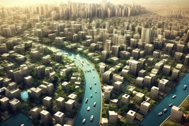
Geographic Information Systems (GIS) technology aids in mapping disaster-prone areas and assessing risks. By visualizing data, GIS supports strategic planning and resource allocation for effective disaster preparedness. For instance, GIS can help identify which neighborhoods are most vulnerable to flooding and allow city planners to implement preventive measures. This technology not only enhances our understanding of disaster risks but also empowers communities to take proactive steps toward safety.
Training simulations and virtual reality (VR) are providing immersive experiences that enhance disaster preparedness training. These technologies allow responders to practice their skills in realistic scenarios, preparing them for the chaos of real-life situations. Imagine firefighters training in a virtual burning building, learning how to navigate smoke and flames without the real danger. This kind of training not only builds confidence but also equips responders with the essential skills they need to save lives.
Wearable technology is enhancing the safety and efficiency of first responders. Devices that monitor health metrics and location allow for better coordination and response during emergencies. For example, wearables can track a firefighter's heart rate and body temperature, alerting command if they are in distress. This technology ensures that responders are not only effective but also safe while performing their duties.
Engaging communities through technology fosters resilience. Platforms that encourage collaboration and information sharing empower citizens to actively participate in disaster preparedness initiatives. Whether it’s through local apps that provide safety tips or community forums where residents can share experiences and strategies, technology is building a culture of preparedness. When citizens are informed and engaged, communities become stronger and more resilient in the face of disasters.
- How can I prepare my family for a disaster? Start by creating an emergency plan that includes communication strategies and a supply kit with essentials.
- What role does technology play in disaster response? Technology enhances communication, resource allocation, and situational awareness, improving overall response efforts.
- Are there apps specifically for disaster preparedness? Yes, many apps provide alerts, safety tips, and resources tailored to your location.
- How can communities use social media during disasters? Communities can share real-time updates, coordinate volunteer efforts, and provide support through social media platforms.

Smart Communication Systems
Effective communication is crucial during disasters. Imagine a scenario where a natural disaster strikes, and the first thing that goes haywire is the communication network. It’s like being in a dark room with no flashlight—utterly disorienting! are here to illuminate that darkness. These systems ensure that information flows seamlessly and rapidly, enabling communities to respond quickly and efficiently to emergencies.
One of the standout features of smart communication systems is their ability to provide real-time updates. Think of them as your personal alert system during a storm. They can send out notifications about impending hazards, evacuation routes, and safety measures directly to your smartphone or other devices. This instant access to information can mean the difference between safety and chaos.
Moreover, these systems often utilize a mix of traditional and modern technology. For instance, they can integrate social media platforms to broadcast urgent messages to a wider audience. During a disaster, people are often glued to their social media feeds, so why not harness that? By sharing updates through platforms like Twitter or Facebook, authorities can reach people where they are, ensuring that critical information is disseminated swiftly.
Furthermore, smart communication systems can also include features like two-way communication. This aspect allows residents to report their status, request help, or provide information about local conditions. Imagine being able to text your local emergency services with a quick message: "I need help, my neighborhood is flooded!" It’s a game-changer for community engagement and response.
To illustrate the impact of these systems, let’s take a look at a table that outlines some key functionalities:
| Functionality | Description |
|---|---|
| Real-time Alerts | Instant notifications about emergencies sent to users’ devices. |
| Social Media Integration | Utilizing social media for rapid information dissemination. |
| Two-way Communication | Allows citizens to report issues and request assistance. |
| Location Tracking | Helps emergency services locate individuals in need of help. |
In conclusion, smart communication systems are the backbone of disaster preparedness. They not only facilitate the flow of information but also empower communities to take action. With these systems in place, the chances of a community bouncing back from a disaster increase significantly. After all, when everyone is informed and connected, it’s like having a safety net that catches you when you fall.

Predictive Analytics
Imagine being able to predict the future, at least when it comes to natural disasters. is like having a crystal ball that uses data to foresee potential calamities before they strike. By analyzing vast amounts of data—think weather patterns, historical disaster occurrences, and even social media trends—this technology helps organizations prepare and allocate resources effectively. It’s not just about knowing a storm is coming; it's about understanding its potential impact and acting accordingly.
For instance, predictive analytics can identify areas that are more likely to be affected by floods or wildfires. By recognizing these patterns, local governments can implement measures like creating better drainage systems or conducting controlled burns to reduce the risk of wildfires. This proactive approach not only saves lives but also minimizes property damage and economic loss.
Furthermore, predictive analytics isn't just for governments. Businesses can also benefit from these insights. For example, a grocery store chain can use predictive models to manage inventory effectively, ensuring that essential supplies are available in the wake of a disaster. By anticipating community needs, businesses can play a crucial role in disaster response, reinforcing their ties with the community and enhancing their reputation.
To illustrate the impact of predictive analytics, consider the following table summarizing its key benefits:
| Benefit | Description |
|---|---|
| Resource Allocation | Helps in directing resources to the most vulnerable areas, ensuring efficient use of funds and materials. |
| Risk Assessment | Identifies high-risk areas, enabling targeted interventions and better preparedness. |
| Community Awareness | Informs the public about potential threats, fostering a culture of preparedness. |
| Response Planning | Facilitates the development of effective response plans tailored to specific scenarios. |
Moreover, the integration of predictive analytics with other technologies amplifies its effectiveness. For example, when combined with Geographic Information Systems (GIS), predictive models can visually represent risk areas on maps, making it easier for decision-makers to understand where to focus their efforts. This synergy creates a comprehensive approach to disaster preparedness that is both innovative and practical.
In conclusion, predictive analytics is a game-changer in the realm of disaster preparedness. It empowers communities and organizations to not only anticipate disasters but also to take actionable steps to mitigate their effects. As technology continues to evolve, we can expect predictive analytics to become an even more integral part of our disaster management strategies, ultimately leading to safer, more resilient communities.
- What is predictive analytics? - Predictive analytics is a technology that uses data analysis to forecast potential future events, particularly in disaster scenarios.
- How does predictive analytics help in disaster preparedness? - It helps organizations identify high-risk areas, allocate resources effectively, and develop tailored response plans.
- Can businesses use predictive analytics? - Yes, businesses can leverage predictive analytics to manage inventory and enhance community support during disasters.
- What technologies complement predictive analytics? - Technologies like Geographic Information Systems (GIS) and mobile applications enhance the effectiveness of predictive analytics.
Mobile Applications for Safety
In today's fast-paced world, the advent of mobile applications has transformed how we prepare for and respond to disasters. Imagine being in the midst of an emergency situation, and your smartphone becomes your lifeline. These applications are not just convenient; they are essential tools that provide real-time updates and alerts, empowering individuals to make informed decisions during critical times. From severe weather warnings to evacuation routes, mobile apps serve as a vital source of information that can mean the difference between safety and chaos.
One of the most significant advantages of mobile applications is their ability to deliver instant notifications. For instance, when a natural disaster strikes, such as a hurricane or earthquake, these apps can send alerts directly to users' devices, informing them of the situation and recommended actions. This immediate access to information allows individuals to react swiftly, whether that means seeking shelter, evacuating, or simply staying informed about the evolving situation. In a world where every second counts, having a mobile app that keeps you updated can be a game-changer.
Moreover, many of these applications are designed with user-friendly interfaces, making them accessible to a wide audience. They often include features such as
- Interactive maps that show safe zones and emergency shelters.
- Checklists for emergency preparedness, ensuring that users are ready before disaster strikes.
- Community forums where users can share information and resources.
Another remarkable aspect of mobile applications is their ability to foster community awareness. During a disaster, information is power, and sharing that information can save lives. Many apps allow users to report local conditions, such as flooding or road closures, which can be invaluable for others in the area. This communal approach not only keeps everyone informed but also strengthens community bonds as people come together to help each other during tough times.
Furthermore, mobile applications can also assist in post-disaster recovery. After a disaster has occurred, these tools can provide users with information on available resources, such as food banks, shelters, and medical assistance. They can also help individuals connect with local aid organizations, making the recovery process smoother and more efficient. In essence, mobile applications are not just about immediate safety; they play a crucial role in the long-term resilience of communities.
In conclusion, mobile applications for safety are a revolutionary step forward in disaster preparedness and response. They offer a blend of real-time information, community engagement, and recovery resources, making them indispensable tools in today's world. As technology continues to evolve, we can only expect these applications to become even more sophisticated, further enhancing our ability to navigate the challenges posed by natural disasters.
Q: How do I choose the right mobile application for disaster preparedness?
A: Look for apps that offer real-time alerts, user-friendly interfaces, and community features. Check reviews and recommendations to find the most reliable options.
Q: Are these mobile applications available for free?
A: Many disaster preparedness apps are free to download, but some may offer premium features for a fee. Always check the app details before downloading.
Q: Can I trust the information provided by these applications?
A: Most reputable apps source their information from official government agencies and weather services, ensuring that the alerts and updates are accurate and timely.

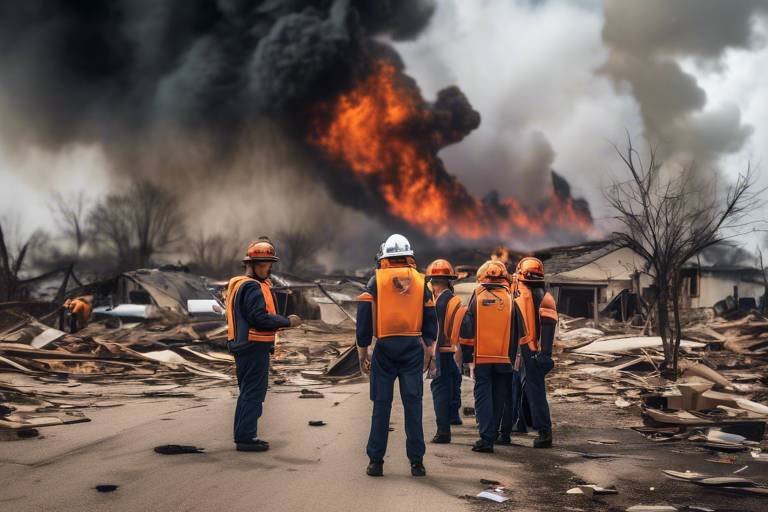
Drones in Disaster Management
Drones have emerged as a game-changer in the realm of disaster management, revolutionizing the way we respond to emergencies. Imagine a scenario where a natural disaster strikes, and traditional methods of assessing damage and delivering aid become challenging. This is where drones swoop in, quite literally! Equipped with advanced technology, these unmanned aerial vehicles (UAVs) can navigate through hazardous environments, providing critical support when it’s needed the most.
One of the primary advantages of using drones in disaster management is their ability to conduct aerial surveys quickly and efficiently. In the aftermath of a disaster, obtaining a comprehensive overview of the affected area is essential for effective response efforts. Drones can capture high-resolution images and videos, allowing emergency responders to assess damage and identify areas that require immediate attention. This rapid assessment can significantly reduce the time it takes to mobilize resources and aid, ultimately saving lives.
Furthermore, drones can access hard-to-reach areas that may be unsafe for ground personnel. For example, in the aftermath of an earthquake or a flood, some regions may be completely cut off due to debris or unstable structures. Drones can fly over these areas, providing crucial information without putting human lives at risk. This capability is particularly beneficial in remote locations where traditional communication and transportation methods may be compromised.
In addition to surveying, drones are also being utilized for delivery purposes. Imagine a community that has been isolated due to a natural disaster, with essential supplies running low. Drones can be equipped to transport medical supplies, food, and water directly to those in need, bypassing obstacles that would hinder ground vehicles. This not only speeds up the delivery process but also ensures that aid reaches the most vulnerable populations without delay.
Moreover, the integration of drones with other technologies, such as Geographic Information Systems (GIS), enhances their effectiveness. By overlaying drone imagery with GIS data, responders can create detailed maps that highlight the most affected areas, helping to prioritize resource allocation. This synergy between drones and GIS technology exemplifies how modern tools can work together to create a more efficient disaster response framework.
To highlight the impact of drones in disaster management, consider the following table that showcases their key benefits:
| Benefit | Description |
|---|---|
| Rapid Aerial Surveys | Quickly assess damage and gather data for effective response. |
| Access to Hazardous Areas | Reach locations unsafe for ground personnel. |
| Delivery of Supplies | Transport essential goods to isolated communities. |
| Integration with GIS | Create detailed maps for better resource allocation. |
As we look to the future, the potential for drones in disaster management is vast. With advancements in technology, we can expect even more innovative applications, such as autonomous drones that can operate without direct human control. This could further enhance response times and efficiency, allowing communities to bounce back from disasters more rapidly.
In conclusion, drones are not just a futuristic concept; they are a vital part of our current disaster management strategies. By leveraging their capabilities, we can improve our preparedness and response to natural disasters, ultimately fostering greater resilience in communities around the world.
- How do drones help in disaster management? Drones assist in rapid aerial surveys, deliver supplies, and provide critical data for assessing damage, all while accessing hard-to-reach areas.
- Are drones safe to use during disasters? Yes, drones are designed to operate in hazardous conditions, minimizing risk to human lives while gathering essential information.
- Can drones operate autonomously? Future advancements may allow drones to operate autonomously, enhancing their effectiveness in disaster response.
Social Media as a Tool
In today's fast-paced digital world, social media has emerged as a powerful tool during disasters. Imagine a scenario where a natural disaster strikes, and the traditional communication channels are down. What do people turn to? That's right—social media! Platforms like Twitter, Facebook, and Instagram become lifelines, allowing individuals to share information, seek help, and coordinate responses in real-time. The immediacy of social media can be a game-changer, making it a pivotal element in disaster preparedness and response.
One of the most significant advantages of using social media during disasters is its ability to facilitate information sharing. When an earthquake hits or a hurricane is approaching, people can quickly post updates about their safety, share alerts from authorities, and broadcast critical information about evacuation routes or shelter locations. This rapid dissemination of information can save lives and reduce panic. For instance, during Hurricane Harvey in 2017, social media played a crucial role in connecting people with rescue services and sharing vital updates on flooding conditions.
Moreover, social media platforms serve as a community engagement hub. They allow local organizations and government agencies to communicate directly with the public, providing updates, resources, and guidance. Through live streams, posts, and stories, authorities can keep communities informed and engaged, fostering a sense of solidarity and collective action. Think about it—when communities come together on social media, they can share experiences, provide support, and mobilize resources more effectively.
Another fascinating aspect of social media is its ability to create awareness and education. Before a disaster strikes, social media can be used to educate the public about preparedness measures. Campaigns can be launched to inform people about what to do before, during, and after a disaster, making them more resilient. For example, infographics shared on platforms can illustrate emergency kits' contents or outline evacuation plans, making the information easily digestible and shareable.
However, it's essential to acknowledge the challenges that come with using social media during disasters. Misinformation can spread like wildfire, leading to confusion and panic. Therefore, it is crucial for users to verify the information they encounter and for authorities to actively combat false narratives. This is where credibility comes into play. Official accounts should be the go-to sources for accurate information, and they must work diligently to maintain trust with the public.
In conclusion, social media is not just a platform for sharing cute cat videos or vacation photos; it is a vital tool in disaster preparedness and response. Its ability to disseminate information quickly, engage communities, and educate the public makes it an invaluable resource during emergencies. As we continue to navigate the complexities of disaster management, leveraging social media effectively can significantly enhance our collective resilience.
- How can I use social media during a disaster? Use social media to stay informed about the situation, share your safety status, and connect with local resources.
- What are the risks of using social media in emergencies? Misinformation can spread quickly, so it's crucial to verify information before sharing it.
- Can social media help in recovery after a disaster? Absolutely! Social media can facilitate community support, resource sharing, and coordination of recovery efforts.
Geographic Information Systems (GIS)
Geographic Information Systems, commonly known as GIS, are transforming the way we understand and prepare for disasters. Imagine having the power to visualize complex data and see how it relates to our physical environment. That’s exactly what GIS offers! By integrating various data sources, GIS allows us to create detailed maps that highlight disaster-prone areas, assess risks, and plan accordingly. It’s like having a crystal ball that helps communities anticipate challenges before they strike.
One of the most significant advantages of GIS is its ability to analyze spatial relationships. For instance, by overlaying population density maps with flood zone maps, emergency planners can identify which communities are most at risk during a flood event. This strategic insight enables local governments and organizations to allocate resources more effectively, ensuring that help reaches those who need it most. Furthermore, GIS technology can be used to simulate different disaster scenarios, providing invaluable training tools for emergency responders.
Moreover, GIS is not just about mapping; it’s about creating a comprehensive understanding of the environment. It can incorporate various data types, including:
- Topographical data
- Weather patterns
- Infrastructure layouts
- Historical disaster data
The implementation of GIS technology can be seen in various disaster management initiatives worldwide. Governments and organizations are increasingly investing in GIS tools to enhance their response capabilities. By leveraging this technology, they can create real-time maps that provide critical information during disasters, such as evacuation routes, shelter locations, and resource distribution points. These maps can be shared through mobile applications and websites, ensuring that residents have access to vital information when they need it the most.
In conclusion, GIS is a game-changer for disaster preparedness. By harnessing the power of spatial analysis and data visualization, communities can become more resilient against natural disasters. As technology continues to evolve, the potential for GIS to improve disaster response and recovery will only grow, making it an essential tool in our collective effort to safeguard lives and property.
- What is GIS? Geographic Information Systems (GIS) are tools that allow users to visualize, analyze, and interpret data related to geographical locations.
- How does GIS help in disaster preparedness? GIS helps identify disaster-prone areas, assess risks, and plan resource allocation effectively, enhancing community resilience.
- Can GIS be used in real-time during a disaster? Yes, GIS can provide real-time mapping and data analysis during disasters, assisting in decision-making and resource distribution.
- Is GIS technology expensive to implement? While there are costs associated with GIS technology, many free and open-source options exist, making it accessible for various organizations.
Training Simulations and Virtual Reality
In today's fast-paced world, the importance of effective training for disaster preparedness cannot be overstated. Traditional training methods, while valuable, often fall short in providing the immersive experience needed for real-life scenarios. This is where training simulations and virtual reality (VR) come into play. Imagine being able to step into a virtual environment that mimics a disaster situation—this technology allows first responders and community members to experience the chaos and urgency of a crisis without the real-world risks.
Training simulations create realistic scenarios that challenge participants to think critically and act decisively. For instance, a virtual simulation might replicate an earthquake scenario, complete with shaking buildings and emergency alerts. This not only helps in honing technical skills but also fosters teamwork and communication among responders. By practicing in these controlled environments, trainees can develop a muscle memory that is invaluable when they face actual emergencies.
Moreover, VR technology can be particularly beneficial for individuals who may not have the opportunity to engage in hands-on training. With just a headset and controllers, anyone can immerse themselves in a variety of disaster scenarios, from floods to wildfires. This accessibility democratizes training, ensuring that more people are equipped with the knowledge and skills necessary to respond effectively in a crisis. The ability to repeat simulations also allows for continuous learning and improvement, as users can refine their responses based on past experiences.
Consider the following benefits of using training simulations and VR in disaster preparedness:
- Realism: Participants can experience lifelike situations that prepare them for the unexpected.
- Flexibility: Training can be conducted anywhere, anytime, making it easier for individuals to participate.
- Feedback: Immediate feedback during simulations helps trainees understand their strengths and areas for improvement.
- Cost-Effectiveness: VR training can reduce the need for physical resources and personnel, saving time and money.
As technology continues to evolve, the potential for training simulations and VR in disaster preparedness is limitless. Organizations can tailor these experiences to meet specific community needs, whether it’s preparing for a hurricane evacuation or a mass casualty incident. The key takeaway here is that by integrating these advanced technologies into training programs, we can significantly enhance the readiness of individuals and teams.
In conclusion, the use of training simulations and virtual reality represents a revolutionary shift in how we prepare for disasters. By providing immersive, realistic experiences, these tools not only improve individual skills but also strengthen community resilience as a whole. As we look to the future, embracing these technologies will be crucial in building a safer, more prepared society.
Q1: How do training simulations differ from traditional training methods?
A1: Training simulations provide immersive, realistic experiences that allow participants to practice their skills in lifelike scenarios, while traditional methods often rely on lectures and book learning.
Q2: Can anyone use virtual reality for disaster training?
A2: Yes! Virtual reality is accessible to anyone with the right equipment, making it a valuable tool for broadening the reach of disaster preparedness training.
Q3: What types of disasters can be simulated using VR?
A3: VR can simulate a wide range of disasters, including earthquakes, floods, wildfires, and mass casualty incidents, allowing trainees to experience various emergency situations.
Q4: Are there any drawbacks to using VR for training?
A4: While VR offers many benefits, it can be expensive to implement and may require technical expertise to set up and maintain.

Wearable Technology for First Responders
In the fast-paced world of emergency response, the stakes are incredibly high. First responders often find themselves in life-or-death situations, making it essential that they have the best tools at their disposal. Enter wearable technology, a game-changer that is revolutionizing how these heroes operate in the field. Imagine a firefighter battling flames while wearing a device that continuously monitors their vital signs, providing real-time feedback to their team. This is no longer science fiction; it’s happening right now!
Wearable devices are designed to enhance the safety and efficiency of first responders, ensuring they can perform their duties effectively while minimizing risks. These gadgets can track a variety of health metrics, such as heart rate, body temperature, and even oxygen levels. By keeping tabs on these vital signs, supervisors can make informed decisions about their team's safety. For instance, if a firefighter's heart rate spikes dangerously, the team can be alerted immediately, potentially saving lives.
Moreover, wearable technology can improve location tracking. In chaotic environments, knowing where each team member is located can be the difference between life and death. Devices equipped with GPS capabilities allow incident commanders to monitor their team's movements in real-time, ensuring that help can be dispatched quickly if someone is in distress. This technology not only enhances individual safety but also improves overall team coordination.
Another exciting aspect of wearable technology is its ability to integrate with other systems. For example, when combined with smart helmets, these devices can provide augmented reality (AR) overlays, showing vital information directly in the responder's line of sight. Imagine a firefighter entering a burning building and seeing a digital map of the structure, highlighting escape routes and areas of high risk. This kind of information can be lifesaving!
However, implementing wearable technology isn't without its challenges. Training is crucial to ensure that first responders know how to use these devices effectively. A robust training program should include hands-on experience with the technology, making sure that responders feel comfortable relying on it during critical situations. Additionally, concerns about data security and privacy must be addressed. After all, the information collected by these devices can be sensitive, and it’s vital to protect it from unauthorized access.
As we look to the future, the potential for wearable technology in disaster response is enormous. With advancements in artificial intelligence and machine learning, we can expect even smarter devices that can predict health issues before they occur, further enhancing the safety of first responders. The integration of these technologies into emergency response protocols will not only save lives but also empower responders to perform their duties with greater confidence and efficiency.
In summary, wearable technology is transforming the landscape of first response. By providing real-time health monitoring, location tracking, and enhanced situational awareness, these devices are setting a new standard for safety and effectiveness in the field. As technology continues to evolve, we can only imagine the incredible advancements that await us in disaster preparedness and response.
- What types of wearable technology are used by first responders? Wearable technology includes health monitoring devices, smart helmets with AR capabilities, and GPS tracking systems.
- How does wearable technology improve safety for first responders? It allows for real-time monitoring of health metrics and location tracking, enhancing team coordination and individual safety.
- Are there any challenges associated with using wearable technology in emergency response? Yes, challenges include the need for proper training, data security concerns, and ensuring that responders are comfortable using the technology.
- What is the future of wearable technology in disaster response? Future advancements may include AI integration for predictive health monitoring and even smarter devices that can provide critical information in real-time.
Community Engagement through Technology
In today's fast-paced world, community engagement has taken on a new dimension, thanks to technology. Imagine a scenario where neighbors band together, not just in times of crisis, but in preparation for potential disasters. With the help of modern tools, communities can foster a culture of resilience, ensuring that when the unexpected strikes, they are ready to face it head-on. Technology has transformed the way we connect, share information, and mobilize resources, making it easier than ever for individuals to come together for a common cause.
One of the most significant advancements in this realm is the rise of community platforms designed specifically for disaster preparedness. These platforms allow citizens to exchange valuable information, share experiences, and coordinate efforts. For instance, applications like Nextdoor or local Facebook groups enable residents to discuss their concerns about potential hazards, share tips on emergency kits, and even organize community drills. This kind of proactive engagement can significantly enhance a community's readiness for disasters.
Moreover, social media plays a pivotal role in fostering community connections. During emergencies, platforms like Twitter, Facebook, and Instagram become lifelines for sharing real-time updates. Citizens can post alerts about local conditions, such as flooding or fires, and help disseminate critical information quickly. This rapid communication not only keeps people informed but also encourages them to check in on their neighbors, reinforcing the social fabric that is crucial during a crisis.
Additionally, technology facilitates the creation of educational resources that empower communities. Online webinars, interactive workshops, and instructional videos provide essential training on disaster preparedness. These resources can cover topics ranging from first aid to evacuation plans, ensuring that community members are not just passive recipients of information but active participants in their safety. By engaging in these learning opportunities, individuals can develop the skills needed to respond effectively in emergencies, thereby enhancing overall community resilience.
Furthermore, technology enables the collection and analysis of data that can inform community preparedness strategies. Geographic Information Systems (GIS), for example, can help visualize risk areas and identify vulnerable populations. This data-driven approach allows communities to prioritize resources and plan interventions more effectively. When residents understand the specific risks they face, they are more likely to engage in preparedness activities, creating a proactive rather than reactive mindset.
To illustrate the impact of technology on community engagement, consider the following table that outlines various technological tools and their contributions to disaster preparedness:
| Technology Tool | Contribution to Community Engagement |
|---|---|
| Community Platforms | Facilitate information sharing and coordination of local efforts. |
| Social Media | Enable rapid communication and updates during emergencies. |
| Educational Resources | Empower citizens with knowledge and skills for disaster preparedness. |
| GIS Technology | Visualize risks and inform strategic planning for resource allocation. |
In conclusion, technology is not just a tool; it is a catalyst for community engagement in disaster preparedness. By harnessing the power of modern communication, education, and data analysis, communities can cultivate a culture of resilience that empowers individuals to take charge of their safety. As we look to the future, the importance of technology in fostering strong, connected communities cannot be overstated. It is a reminder that together, we can weather any storm.
Q: How can I get involved in my community’s disaster preparedness efforts?
A: You can start by joining local community platforms or social media groups focused on disaster preparedness. Participate in discussions, attend workshops, and share your knowledge with others.
Q: What are some effective ways to educate my community about disaster preparedness?
A: Organizing community events, creating informative flyers, and leveraging social media to share resources are great ways to educate others. Consider hosting a local workshop or webinar to engage your neighbors.
Q: How can technology help during a disaster?
A: Technology can provide real-time updates, facilitate communication, and help coordinate response efforts. It also aids in mapping risks and planning resource allocation effectively.
Frequently Asked Questions
- How does technology improve communication during disasters?
Technology enhances communication through smart systems that provide real-time updates and alerts. These systems ensure that crucial information reaches individuals and communities quickly, allowing for an organized and swift response to emergencies.
- What role does predictive analytics play in disaster preparedness?
Predictive analytics utilizes big data to identify patterns and trends that can forecast potential disasters. By analyzing this data, organizations can effectively prepare and allocate resources, ultimately minimizing the impact of disasters on communities.
- Are there mobile applications designed for disaster safety?
Yes, there are numerous mobile applications that provide users with real-time updates and alerts during disasters. These apps empower individuals with vital information, enhancing personal safety and promoting community awareness during emergencies.
- How are drones utilized in disaster management?
Drones are invaluable in disaster management as they conduct aerial surveys and can deliver supplies to hard-to-reach areas. Their ability to navigate challenging environments significantly enhances response efforts during emergencies.
- Can social media be effective during disasters?
Absolutely! Social media serves as a powerful tool for communication during disasters. It facilitates information sharing and community engagement, helping coordinate responses and disseminate critical updates to the public.
- What is the significance of Geographic Information Systems (GIS) in disaster preparedness?
GIS technology is crucial for mapping disaster-prone areas and assessing risks. By visualizing data, it supports strategic planning and resource allocation, enabling effective disaster preparedness and response strategies.
- How do training simulations and virtual reality contribute to preparedness?
Training simulations and virtual reality offer immersive experiences that enhance disaster preparedness training. These technologies provide responders with essential skills and knowledge, making them better equipped for real-life situations.
- What benefits do wearable technologies offer first responders?
Wearable technology enhances the safety and efficiency of first responders by monitoring health metrics and location. This data allows for improved coordination and response during emergencies, ensuring that help reaches those in need quickly.
- How can technology promote community engagement in disaster preparedness?
Technology fosters community engagement by providing platforms that encourage collaboration and information sharing. These tools empower citizens to actively participate in disaster preparedness initiatives, building resilience within their communities.