Future Trends in Disaster Relief - The Role of Drones
In today's fast-paced world, the unexpected can strike at any moment, leaving communities devastated and in dire need of help. Enter drones, the unsung heroes of modern disaster relief. These flying machines are not just a tech novelty; they are transforming how we respond to crises. Imagine a scenario where a natural disaster has just unfolded—roads are blocked, communication lines are down, and traditional aid methods are hindered. Drones swoop in like a superhero, equipped with cutting-edge technology to deliver essential supplies, conduct aerial surveillance, and assist in search and rescue missions. It's not just about speed; it's about efficiency and precision in the face of chaos.
The use of drones in disaster relief is more than a trend; it’s a revolution. As we look ahead, we see a future where these devices will become even more integral to humanitarian efforts. With advancements in technology, drones are evolving to meet the challenges posed by various disasters. They are becoming smarter, more reliable, and better equipped to handle the complexities of emergency situations. From mapping affected areas to delivering life-saving supplies, the potential applications are vast and varied.
But why are drones so effective in these scenarios? One reason is their ability to reach remote or inaccessible locations quickly. Traditional vehicles may struggle to navigate through debris or rough terrain, but drones can fly over obstacles, providing a bird's-eye view of the situation. This capability not only speeds up the response time but also allows for better situational awareness for rescue teams on the ground. In essence, drones act as the eyes in the sky, offering real-time data that can be crucial for decision-making.
Moreover, the integration of thermal imaging technology into drones is a game-changer. This feature allows them to detect heat signatures, making it easier to locate individuals trapped under rubble or in hard-to-reach areas. Imagine a drone equipped with thermal sensors flying over a disaster zone, pinpointing the location of survivors who might otherwise go unnoticed. This capability can mean the difference between life and death.
However, the journey to fully realizing the potential of drones in disaster relief is not without its challenges. Regulatory hurdles, battery life limitations, and the need for skilled operators can impede their deployment. But as technology advances and policies evolve, we can expect to see drones playing an even larger role in future disaster response efforts. The future is bright, and the sky is the limit!
- How do drones improve disaster response times? Drones can quickly survey areas that are difficult to reach, providing real-time data to rescue teams, which accelerates decision-making and resource allocation.
- What types of supplies can drones deliver? Drones can carry medical supplies, food, water, and other essential items to remote or hard-hit areas, ensuring that aid reaches those in need as quickly as possible.
- Are there any risks associated with using drones in disaster relief? Yes, challenges such as regulatory issues, technical limitations, and the need for trained operators can pose risks, but ongoing advancements are addressing these concerns.
- How does thermal imaging work in search and rescue operations? Thermal imaging detects heat emitted by objects, allowing drones to identify people trapped under debris or in areas where visibility is poor.

The Evolution of Drone Technology
The journey of drones has been nothing short of astonishing, evolving from simple remote-controlled devices into sophisticated machines that are now revolutionizing disaster relief efforts. Initially, drones were primarily used for military applications, but over the years, their potential for humanitarian purposes has been recognized and harnessed. Today, drones are equipped with advanced technologies that enhance their functionality, making them invaluable in crisis situations.
One of the most significant advancements in drone technology has been the development of autonomous flight systems. These systems allow drones to navigate complex environments without constant human input, enabling them to perform tasks like mapping disaster zones or searching for survivors more efficiently. GPS technology has also played a crucial role in this evolution, providing drones with the ability to pinpoint locations accurately, thus facilitating better coordination during relief operations.
Moreover, the integration of high-resolution cameras and thermal imaging capabilities has dramatically improved the way drones can assess damage and locate individuals in need of assistance. For instance, thermal imaging allows drones to detect heat signatures, which is particularly useful in search and rescue missions where visibility may be compromised due to debris or smoke. This capability has transformed the way rescue teams approach their missions, enabling them to locate survivors more quickly and effectively.
As drone technology continues to evolve, we also see improvements in battery life and payload capacity. Modern drones can now carry heavier loads and operate for longer periods, which is essential when delivering supplies to remote or hard-to-reach areas. This is particularly important in disaster scenarios where traditional methods of transportation may be disrupted.
In summary, the evolution of drone technology has been marked by significant advancements that enhance their effectiveness in disaster relief. From autonomous navigation to advanced imaging systems, these innovations have transformed drones into powerful tools for humanitarian aid. As we look to the future, it’s exciting to imagine how further technological developments will continue to improve the efficiency and effectiveness of disaster response efforts.
| Year | Key Development | Impact on Disaster Relief |
|---|---|---|
| 2000 | Introduction of military drones | Initial recognition of drone capabilities |
| 2010 | Emergence of commercial drones | Expansion into humanitarian applications |
| 2015 | Integration of thermal imaging | Enhanced search and rescue operations |
| 2020 | Advanced autonomous flight systems | Improved operational efficiency |
- What types of drones are used in disaster relief? Drones used in disaster relief can include fixed-wing drones for long-distance flights and multirotor drones for short-range tasks, each suited for specific applications.
- How do drones improve response times during disasters? Drones can quickly survey large areas, providing real-time data and imagery that help responders assess the situation and allocate resources more effectively.
- Are there any limitations to using drones in disaster scenarios? Yes, challenges include regulatory issues, technical limitations like battery life, and the need for skilled operators to manage the drones effectively.

Applications of Drones in Disaster Relief
When disaster strikes, time is of the essence. Every second counts, and that's where drones come into play, transforming the landscape of disaster relief. These remarkable flying machines have evolved into indispensable tools, offering a plethora of applications that enhance response efforts. From aerial surveillance to logistics management, drones are reshaping how aid is delivered in crisis situations.
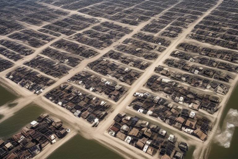
One of the most significant roles drones play is in aerial surveillance. Imagine a vast area devastated by a natural disaster, where traditional methods of assessing damage might take days. Drones can swiftly fly over affected regions, capturing high-resolution images and videos that provide real-time insights into the extent of the damage. This immediate data allows relief organizations to prioritize their efforts effectively, ensuring that help reaches those in dire need without delay.
Moreover, drones are excellent at mapping affected areas. Utilizing advanced software, they can create detailed 3D maps of disaster zones, which are crucial for planning rescue operations. These maps help identify the safest routes for ground teams, highlight areas where people might be trapped, and even pinpoint critical infrastructure that needs immediate attention. The ability to visualize the landscape from above provides a strategic advantage that would be nearly impossible to achieve using traditional methods.
In search and rescue missions, drones are nothing short of revolutionary. They can cover large areas quickly, providing real-time data and imagery that help rescuers locate survivors in challenging environments. Imagine a team of rescuers trying to navigate through a dense forest after a landslide; a drone can fly overhead, identifying heat signatures or movement that might indicate the presence of trapped individuals. This capability not only saves time but also increases the chances of successful rescues.
One of the standout features of many drones used in disaster relief is their thermal imaging technology. This technology allows drones to detect heat signatures, significantly enhancing their ability to find individuals trapped under debris or in difficult-to-reach areas. For instance, during a building collapse, thermal drones can identify the warmth of a human body beneath the rubble, guiding rescue teams to their exact location. This capability can be a game-changer in situations where every moment counts.
However, the effectiveness of drones in search and rescue operations hinges on effective communication between drone operators and ground teams. A well-coordinated effort ensures that the data collected by drones is utilized efficiently. For example, while a drone is surveying an area, ground teams can receive live feeds, allowing them to adjust their search strategies in real-time. This synergy between aerial and ground resources maximizes the chances of locating survivors swiftly.
Drones are also revolutionizing logistics in disaster relief by enabling rapid delivery of medical supplies, food, and other necessities to affected populations. In many disaster scenarios, traditional delivery methods can be hindered by damaged infrastructure, making it challenging to reach those in need. Drones can bypass these obstacles, flying directly to remote locations where help is urgently required.
For instance, consider a situation where a community is cut off from the outside world due to flooding. Drones can be deployed to deliver essential supplies such as medications, water, and food directly to those in need. This capability not only saves lives but also boosts the morale of affected communities, knowing that help is on the way.
| Application | Description | Benefits |
|---|---|---|
| Aerial Surveillance | Capturing real-time data and imagery of disaster zones. | Quick assessment of damage and prioritization of aid. |
| Mapping | Creating detailed 3D maps of affected areas. | Identifying safe routes and critical infrastructure. |
| Search and Rescue | Locating survivors using real-time data and thermal imaging. | Increased chances of successful rescues. |
| Logistics | Delivering medical supplies and food to remote locations. | Rapid response to urgent needs in inaccessible areas. |
In conclusion, the applications of drones in disaster relief are vast and varied. From enhancing search and rescue operations to revolutionizing logistics, these flying machines are proving to be invaluable assets in crisis situations. As technology continues to advance, we can only imagine the even greater roles drones will play in the future of disaster management.
- How do drones improve response times in disaster relief?
Drones can quickly assess damage and deliver supplies to remote areas, significantly reducing the time it takes to deliver aid. - What types of drones are used in disaster relief?
Various types of drones are used, including those equipped with thermal imaging, high-resolution cameras, and those specifically designed for logistics and supply delivery. - Are there any regulations governing the use of drones in disaster relief?
Yes, there are regulatory frameworks that vary by country, which can affect how and when drones can be deployed in disaster scenarios.

Search and Rescue Operations
When disaster strikes, the clock is ticking, and every second counts. Drones have emerged as a game-changing tool in search and rescue operations, transforming how rescue teams operate in challenging conditions. Imagine a scenario where a natural disaster has devastated a community, leaving countless individuals trapped beneath rubble or stranded in remote areas. In such dire situations, drones can swoop in like modern-day superheroes, providing critical support that can mean the difference between life and death.
Drones equipped with high-resolution cameras and advanced sensors can survey disaster zones from above, capturing real-time data that is invaluable for rescue teams. This aerial surveillance allows rescuers to identify hotspots where survivors might be located, enabling them to prioritize their efforts effectively. Moreover, the ability to cover large areas quickly means that drones can provide a comprehensive overview of the situation, giving teams the insights they need to strategize their rescue missions.
One of the standout features of drones in search and rescue operations is their thermal imaging capabilities. By detecting heat signatures, drones can pinpoint the location of individuals trapped under debris or those in distress, even in low visibility conditions. This technology acts like a guiding light in the dark, helping rescuers locate survivors who might otherwise go unnoticed. The integration of thermal imaging not only enhances the chances of finding survivors but also speeds up the overall rescue process.
However, the effectiveness of drones in these operations is not solely reliant on technology; it also hinges on the seamless coordination between drone operators and ground teams. Effective communication is essential for maximizing efficiency during rescue missions. When drone operators relay real-time data to ground teams, it enables them to make informed decisions quickly. For instance, if a drone identifies a group of survivors in need of immediate assistance, ground teams can be directed to that exact location, optimizing their response time.
In summary, drones are revolutionizing search and rescue operations by providing real-time data, enhancing situational awareness, and significantly improving the chances of locating survivors in disaster scenarios. As technology continues to evolve, we can only expect these aerial allies to become even more sophisticated, further enhancing their role in saving lives during crises.
- How do drones assist in search and rescue operations?
Drones provide aerial surveillance, thermal imaging, and real-time data, helping rescuers locate survivors quickly and efficiently. - What technology do drones use for thermal imaging?
Drones are equipped with specialized cameras that detect heat signatures, allowing them to identify individuals in distress even in challenging conditions. - Can drones operate in severe weather conditions?
While drones are designed for various environments, severe weather can impact their performance and flight capabilities. Operators must assess conditions before deployment. - How do ground teams communicate with drone operators?
Effective communication is facilitated through radios, mobile devices, or dedicated communication systems, ensuring that real-time information is shared promptly.

Thermal Imaging Capabilities
The integration of thermal imaging technology into drone operations has been nothing short of revolutionary, particularly in the realm of disaster relief. Imagine a scenario where a natural disaster has struck, leaving behind a landscape of chaos and destruction. Traditional search methods might take hours or even days to locate survivors, but with drones equipped with thermal imaging, the game changes dramatically. These drones can fly over affected areas, scanning for heat signatures that indicate the presence of people, even in the most challenging environments.
What makes thermal imaging so powerful? It allows drones to detect variations in temperature, which is crucial when searching for individuals trapped under debris or hidden in dense foliage. For instance, during a building collapse, the thermal camera can identify the heat emitted by a person’s body, even if they are buried several feet beneath rubble. This capability not only speeds up rescue operations but also significantly increases the chances of saving lives.
Moreover, the use of thermal imaging is not limited to just finding survivors. It can also be instrumental in assessing the extent of damage caused by disasters. Drones can capture thermal images of buildings and infrastructure, revealing areas that are structurally compromised or at risk of collapse. This information is invaluable for first responders and rescue teams, allowing them to prioritize their efforts effectively.
To further illustrate the impact of thermal imaging in disaster scenarios, let’s consider a few key advantages:
- Rapid Deployment: Drones can be deployed quickly and cover large areas in a fraction of the time it would take ground teams.
- Real-Time Data: The thermal imaging data is transmitted in real-time, enabling immediate analysis and decision-making.
- Reduced Risk: Utilizing drones reduces the need for personnel to enter potentially dangerous environments, thereby enhancing safety.
In conclusion, the thermal imaging capabilities of drones are transforming the landscape of disaster relief. They not only improve the efficiency of search and rescue operations but also provide critical data that can aid in the overall recovery process. As technology continues to advance, we can only anticipate even greater innovations that will enhance these capabilities further.

Coordination with Ground Teams
In the chaotic aftermath of a disaster, the ability to coordinate effectively with ground teams can be the difference between life and death. Drones, equipped with advanced technology, provide a unique aerial perspective that enhances situational awareness for ground responders. However, this advantage is only realized when drone operators and ground teams work in harmony, sharing critical information and resources in real-time.
Imagine a scenario where a natural disaster has struck a densely populated area. Traditional methods of communication may be compromised, and ground teams could be overwhelmed with the sheer volume of tasks at hand. Here, drones come into play, offering a bird's-eye view of the situation. They can quickly assess damage, identify blocked routes, and locate individuals in need of assistance. Yet, this information must be relayed efficiently to the ground teams who are executing the rescue operations.
To facilitate this coordination, establishing a clear communication protocol is essential. Drone operators need to be in constant contact with ground teams, providing updates on their findings and receiving instructions on areas that require immediate attention. For instance, if a drone identifies a cluster of survivors in a remote location, the ground team must be informed promptly to mobilize resources effectively. This dynamic exchange of information can be streamlined through the use of mobile applications and communication devices that allow for instant messaging and video feeds.
Moreover, training plays a crucial role in ensuring that both drone operators and ground teams understand each other's capabilities and limitations. Regular joint exercises can enhance familiarity, allowing teams to practice scenarios where drones are deployed for search and rescue missions. These exercises not only build trust between the teams but also refine their operational strategies, ensuring they are prepared for real-life situations.
In addition to training, leveraging technology to create a unified command center can significantly improve coordination. This center can serve as a hub for data collection, analysis, and dissemination, allowing both drone operators and ground teams to access crucial information at a moment's notice. For example, using a centralized mapping system, teams can visualize real-time data on affected areas, making it easier to allocate resources and plan rescue missions effectively.
In conclusion, effective coordination between drone operators and ground teams is vital for maximizing the impact of drones in disaster relief efforts. By fostering communication, training together, and utilizing technology, we can ensure that every life-saving opportunity is seized during the critical moments following a disaster.
- How do drones communicate with ground teams during a disaster?
Drones typically use radio frequencies or mobile networks to transmit data and communicate with ground teams, ensuring real-time updates and coordination. - What kind of training do drone operators receive for disaster relief?
Drone operators undergo specialized training that includes flying techniques, data analysis, and effective communication with ground teams to enhance operational efficiency. - Are there specific regulations governing drone use in disaster scenarios?
Yes, drone usage is subject to regulations that vary by region, and operators must navigate these rules to ensure compliance while providing assistance during disasters.

Logistics and Supply Delivery
The landscape of disaster relief is undergoing a radical transformation, and at the forefront of this change are drones. These remarkable flying machines are not just a novelty; they are becoming essential tools in the logistics and supply delivery process during emergencies. Imagine a scenario where traditional delivery methods are hampered by blocked roads or dangerous conditions. In such cases, drones swoop in like modern-day heroes, delivering vital supplies where they are needed most.
Drones excel in delivering a variety of goods, from medical supplies to food, ensuring that even the most remote locations can receive help quickly. One of the most striking advantages of using drones for logistics is their ability to bypass physical barriers that would typically delay ground transport. For instance, in the aftermath of a natural disaster, when roads may be washed out or inaccessible, drones can fly directly to affected areas, significantly reducing the time it takes to get aid to those in need.
Let's break down some of the key benefits of using drones for logistics and supply delivery:
- Speed: Drones can deliver supplies within minutes, as opposed to hours or days that traditional methods may require.
- Cost-Effectiveness: With lower operational costs compared to ground vehicles, drones can provide a more economical solution for delivering aid.
- Access to Remote Areas: Drones can reach locations that are otherwise difficult to access, ensuring that no one is left behind during a crisis.
- Real-Time Tracking: Drones equipped with GPS technology allow for real-time tracking of deliveries, providing transparency and efficiency in logistics operations.
To illustrate the impact of drones in logistics, consider a recent case study where drones were deployed in a flood-affected region. In this scenario, a fleet of drones successfully delivered over 1,000 medical kits within just 24 hours of the disaster striking. This rapid response not only saved lives but also showcased the potential of drone technology in logistics.
However, the implementation of drones in logistics is not without its challenges. Factors such as payload capacity and battery life can limit the amount of supplies that can be transported in a single flight. Additionally, adverse weather conditions can affect flight safety and delivery reliability. Navigating these challenges requires innovative solutions and ongoing advancements in drone technology.
As we look to the future, the role of drones in disaster relief logistics will likely expand. With continuous improvements in battery technology and payload capabilities, we may soon witness drones that can carry heavier loads over longer distances. Furthermore, the integration of artificial intelligence could enhance the efficiency of flight paths and delivery schedules, making drone logistics even more effective.
In conclusion, the use of drones in logistics and supply delivery is not just a trend; it is a revolution in how we respond to disasters. By leveraging this technology, we can ensure that help arrives faster and more efficiently, ultimately saving lives and alleviating suffering in the wake of disasters.
- How do drones navigate during supply deliveries? Drones typically use GPS technology and pre-programmed flight paths to navigate to their delivery destinations.
- What types of supplies can drones deliver? Drones can deliver a wide range of supplies, including medical kits, food, water, and emergency equipment.
- Are there any regulations governing drone use in disaster relief? Yes, drone operations are subject to regulations that vary by country, often requiring permits and adherence to safety guidelines.
- How do drones handle adverse weather conditions? Drones are equipped with sensors to monitor weather conditions, and many models are designed to operate in light rain and moderate winds, but severe weather can still pose challenges.

Challenges and Limitations
While drones are making waves in the disaster relief arena, it's essential to recognize that they are not a panacea. The associated with drone technology can impede its effectiveness in crisis situations. For instance, one of the most significant hurdles lies in navigating the complex regulatory landscape. Each country has its own set of rules governing drone usage, and these regulations can vary widely. In many cases, disaster relief organizations must seek special permissions to deploy drones, which can delay response times when every second counts.
Moreover, the technical limitations of drones are another barrier to their widespread adoption in disaster relief. Most drones have a limited flight time, typically ranging from 20 to 30 minutes, depending on the model and payload. This restriction means that they can only cover a limited area before needing to return for recharging or battery replacement. Additionally, drones often face challenges related to payload capacity. While some can carry essential supplies like medical kits or food, their ability to transport larger items is restricted. This limitation can hinder efforts to deliver substantial aid quickly.
Weather conditions also play a crucial role in the operational effectiveness of drones. High winds, rain, and snow can severely impact a drone's ability to fly safely and accurately. For example, a drone designed for clear skies may struggle to maintain stability in gusty winds, rendering it ineffective during crucial moments. This unpredictability can lead to missed opportunities for delivering aid or conducting search and rescue operations.
To give you a clearer picture, here's a quick overview of some of the main challenges faced by drones in disaster relief:
| Challenge | Description |
|---|---|
| Regulatory Issues | Complex laws and regulations can delay drone deployment. |
| Flight Time | Limited battery life restricts operational range. |
| Payload Capacity | Inability to carry larger supplies can hinder relief efforts. |
| Weather Conditions | Adverse weather can impede flight safety and accuracy. |
In addition to these technical challenges, there is also the need for skilled operators who can manage drone operations effectively. The technology behind drones is continually evolving, and it requires trained personnel who can navigate both the hardware and software aspects of these devices. Without proper training, the potential of drones in disaster relief can be significantly reduced, leading to inefficient operations and wasted resources.
In summary, while drones represent a promising innovation in disaster relief, various challenges must be addressed to maximize their potential. From regulatory hurdles to technical limitations, understanding these barriers is crucial for organizations looking to harness the power of drones in crisis situations.
- What are the main benefits of using drones in disaster relief? Drones can provide real-time data, enhance search and rescue operations, and deliver supplies quickly to remote areas.
- Are there regulations governing drone use in disaster scenarios? Yes, regulations vary by country, and organizations often need special permissions to deploy drones.
- What technical limitations do drones face? Drones are limited by battery life, payload capacity, and weather conditions, which can affect their operational effectiveness.
- How can organizations overcome these challenges? Advocacy for policy changes, investing in better technology, and training skilled operators can help address these challenges.

Regulatory Issues
The deployment of drones in disaster relief is not just about having the right technology; it’s also about navigating a complex web of that can significantly impact their effectiveness. As drone technology has advanced rapidly, so too have the regulations that govern their use. In many countries, these regulations are still catching up to the pace of innovation, leading to a situation where potential life-saving applications are stymied by red tape.
One of the primary regulatory hurdles is the need for airspace authorization. Drones must operate within designated airspace, and obtaining clearance can be a time-consuming process. During a disaster, every second counts, and delays in securing airspace can mean the difference between life and death. Moreover, many regions have strict no-fly zones, particularly near airports or military installations, which can further complicate matters.
Additionally, there are privacy concerns that come into play. Drones equipped with cameras can inadvertently capture sensitive information, leading to potential violations of privacy laws. This issue can create resistance from local communities, who may fear surveillance rather than see the benefits of drone deployment in disaster situations. Consequently, stakeholders must work diligently to establish trust and transparency with affected populations.
To illustrate the regulatory landscape, consider the following table that outlines key regulatory challenges faced by drone operators in disaster relief:
| Regulatory Challenge | Description |
|---|---|
| Airspace Authorization | Delays in obtaining necessary permissions to operate drones in emergency zones. |
| Privacy Concerns | Potential violations of privacy laws due to aerial surveillance capabilities. |
| Licensing Requirements | Need for drone operators to have specific licenses, which can limit the number of available operators. |
| Insurance and Liability | Challenges in securing adequate insurance coverage for drone operations in disaster scenarios. |
Advocacy for policy changes is crucial to address these regulatory barriers. Stakeholders, including drone manufacturers, humanitarian organizations, and government agencies, must collaborate to create frameworks that facilitate the use of drones in disaster relief. This could involve establishing temporary flight corridors during emergencies, creating streamlined processes for airspace authorization, and developing guidelines that address privacy concerns while maximizing the benefits of drone technology.
In conclusion, while the potential of drones in disaster relief is immense, realizing that potential depends heavily on overcoming regulatory challenges. By fostering dialogue between regulators and the drone community, we can pave the way for a future where drones are a standard part of our disaster response toolkit.
- What are the main regulatory challenges for drones in disaster relief?
The main challenges include airspace authorization, privacy concerns, licensing requirements, and insurance issues.
- How can advocacy help in overcoming these regulatory issues?
Advocacy can lead to policy changes that streamline processes, establish temporary flight corridors, and create guidelines that protect privacy while allowing for effective drone use.
- Are there specific regulations that apply to drone operators during disasters?
Yes, drone operators must adhere to local and national aviation regulations, which may include obtaining specific licenses and permissions to operate in emergency zones.

Technical Limitations
While drones are proving to be game-changers in disaster relief, they are not without their . Understanding these constraints is crucial for optimizing their deployment and ensuring that they can be used effectively when disaster strikes. One of the most significant challenges is flight time. Most drones are equipped with batteries that can only sustain flight for a limited duration, typically ranging from 20 to 30 minutes. This short operational window can be a major drawback when trying to cover vast areas or conduct prolonged missions.
Another limitation is payload capacity. Drones vary in their ability to carry weight, and many are restricted to delivering only small packages. In disaster scenarios where larger supplies, such as medical equipment or food rations, are needed, this can pose a serious challenge. For instance, a drone might be able to deliver a few essential items, but it cannot replace a full truckload of supplies that would be necessary to make a significant impact.
Weather conditions also play a pivotal role in the effectiveness of drone operations. High winds, rain, or snow can severely affect a drone's ability to fly safely and accurately. This unpredictability can lead to missed opportunities for aid delivery or search and rescue missions. For example, imagine a drone struggling to navigate through a storm while trying to deliver urgent medical supplies; the potential for failure increases drastically.
Moreover, the requirement for skilled operators cannot be overlooked. While technology has advanced, the need for trained personnel to manage drone operations remains critical. In chaotic disaster situations, having a knowledgeable operator who can swiftly make decisions based on real-time data is essential. Without this expertise, the potential of drones to save lives and deliver aid can be compromised.
To summarize, the technical limitations of drones in disaster relief include:
- Flight Time: Limited to 20-30 minutes, restricting coverage area.
- Payload Capacity: Often unable to carry large supplies needed in emergencies.
- Weather Dependency: Adverse conditions can impede functionality.
- Operator Skill Requirement: Necessity for trained personnel to ensure effective operations.
Addressing these limitations through ongoing research and development will be essential for enhancing the role of drones in future disaster relief efforts. As technology continues to evolve, we can anticipate improvements that will allow drones to operate more efficiently, carry larger loads, and withstand challenging weather conditions. The future of disaster relief may very well depend on overcoming these technical hurdles.
Q1: How long can a typical drone fly during a disaster relief mission?
A1: Most drones can fly for about 20 to 30 minutes on a single battery charge, which can limit their operational effectiveness.
Q2: Can drones carry heavy supplies?
A2: Drones generally have a limited payload capacity, which means they are best suited for delivering small packages rather than large supplies.
Q3: What weather conditions can affect drone operations?
A3: High winds, rain, and snow can all impede a drone's ability to fly safely and accurately, potentially affecting mission success.
Q4: Do drones require specialized operators?
A4: Yes, skilled operators are necessary to manage drone operations effectively, especially in complex and chaotic disaster scenarios.
Frequently Asked Questions
- How do drones enhance disaster relief efforts?
Drones significantly improve disaster relief by providing real-time aerial surveillance, mapping affected areas, and delivering essential supplies quickly. Their ability to cover large areas in a short time allows responders to assess damage and plan their actions more effectively.
- What are the key applications of drones in disaster scenarios?
Drones are used for various applications, including search and rescue operations, logistics for supply delivery, and aerial mapping. They help locate survivors through thermal imaging and can transport medical supplies or food to remote areas cut off from traditional aid routes.
- What challenges do drones face in disaster relief?
Despite their advantages, drones encounter challenges like regulatory hurdles, limited battery life, and payload capacity. Weather conditions can also affect their performance, making it crucial to have skilled operators who can navigate these obstacles effectively.
- How does thermal imaging improve search and rescue missions?
Thermal imaging technology allows drones to detect heat signatures, which is invaluable in locating individuals trapped under debris or in hard-to-reach areas. This capability can significantly speed up rescue operations, potentially saving lives.
- What is the importance of coordination between drone operators and ground teams?
Effective communication between drone operators and ground teams is essential for maximizing the efficiency of disaster response. Coordinated efforts ensure that the data collected by drones is utilized effectively, allowing for timely and informed decision-making.
- Are there specific regulations governing drone usage in disaster relief?
Yes, the use of drones in disaster relief is subject to various regulations that can vary by region. These regulations often involve airspace restrictions and require operators to obtain specific permissions. Advocacy for policy changes is necessary to facilitate the broader use of drones in emergencies.
- How can drones improve logistics in disaster situations?
Drones revolutionize logistics by enabling rapid delivery of supplies such as food, water, and medical aid to affected populations. Their ability to bypass traditional infrastructure challenges means that aid can reach those in need much faster, which is critical during emergencies.