The Future of Remote Sensing Technologies in Science
Remote sensing technologies are changing the way we understand and interact with our world. Imagine being able to observe the Earth from space, gathering data that can help us tackle pressing issues like climate change, natural disasters, and even urban planning. These technologies are not just tools; they are gateways to a more informed future, enabling scientists and researchers to make decisions based on real-time data instead of guesswork. As we stand on the brink of a technological revolution, let's explore how these advancements are shaping the future of science.
Recent innovations in remote sensing technologies have significantly enhanced data collection capabilities, leading to more accurate environmental monitoring and analysis. From the development of high-resolution satellite imagery to the deployment of drones equipped with advanced sensors, the landscape of remote sensing is evolving at a breathtaking pace. These advancements are not just about collecting data; they are about making sense of it. For instance, artificial intelligence (AI) is being increasingly integrated into remote sensing systems, allowing for the analysis of vast datasets in a fraction of the time it would take a human analyst. This means that scientists can focus on interpreting the data rather than merely gathering it, leading to more actionable insights.
Remote sensing technologies play a vital role in environmental science, aiding in climate change studies, habitat monitoring, and disaster management. These tools are revolutionizing our understanding of the environment by providing a bird's-eye view of ecological changes. For example, satellite data can track deforestation rates in real-time, helping conservationists respond swiftly to threats. Similarly, remote sensing can monitor the health of coral reefs, providing crucial data for marine biologists. The implications are vast, and the applications are as varied as the challenges they aim to address.
The ability to track changes in land cover, temperature, and atmospheric conditions through remote sensing is crucial for climate change research. Technologies such as satellite imagery and aerial surveys are at the forefront of this monitoring effort. They allow researchers to visualize and quantify changes over time, offering invaluable insights into how climate change affects our planet.
Satellite imagery provides comprehensive data on global climate patterns. By analyzing satellite data, scientists can identify trends in temperature changes, ice melt, and even shifts in vegetation patterns. This information is critical for informing policy decisions and shaping climate action strategies. For instance, organizations like NASA and the European Space Agency utilize satellite data to create models that predict future climate scenarios, helping governments and communities prepare for potential impacts.
Aerial surveys complement satellite data by offering high-resolution images of specific areas. These surveys are particularly useful for localized climate studies and environmental assessments. For example, drones can be deployed to capture detailed images of coastal erosion, providing data that is essential for effective coastal management strategies. The combination of aerial and satellite data creates a more comprehensive understanding of environmental changes.
Remote sensing aids in disaster response by providing real-time data for effective management. During natural disasters such as hurricanes, floods, or wildfires, timely information is crucial for emergency responders. Remote sensing technologies can assess damage, identify affected areas, and even predict the path of a disaster. This capability enhances preparedness and recovery efforts, ultimately saving lives and resources.
Despite their benefits, remote sensing technologies face challenges such as data accuracy, accessibility, and integration. These obstacles must be addressed for future advancements to be realized. For instance, ensuring the accuracy of remote sensing data is paramount for reliable analysis. Researchers must employ rigorous methods for data calibration and validation to maintain the integrity of their findings.
Ensuring the accuracy of remote sensing data is paramount for reliable analysis. Various methods and technologies are employed for data calibration and validation, including cross-referencing satellite data with ground measurements. This process helps to minimize errors and ensures that the data used in scientific studies is as precise as possible.
The high cost of advanced remote sensing technologies can limit their accessibility. Many researchers and organizations may struggle to acquire the necessary tools and data. However, initiatives aimed at reducing costs and increasing access are in progress. Open-source platforms and collaborative projects are emerging, allowing more researchers to leverage remote sensing data without breaking the bank.
The future of remote sensing technologies is promising, with trends pointing towards increased automation, improved data analytics, and enhanced user interfaces. As machine learning and AI continue to evolve, we can expect even greater accuracy and efficiency in data analysis. Additionally, user-friendly interfaces will make these technologies more accessible to non-experts, broadening the scope of who can utilize remote sensing data for research and decision-making.
- What is remote sensing? Remote sensing is the process of collecting data about an object or area from a distance, typically using satellite or aerial imagery.
- How does remote sensing help in climate change research? Remote sensing provides crucial data on changes in land cover, temperature, and atmospheric conditions, enabling scientists to track and analyze climate change impacts.
- What are the main challenges facing remote sensing technologies? Key challenges include data accuracy, accessibility, and the integration of various data sources.
- What is the future of remote sensing technologies? The future includes increased automation, improved data analytics, and more accessible user interfaces, making these technologies easier to use for a wider audience.

Advancements in Remote Sensing Technologies
Recent innovations in remote sensing technologies have significantly enhanced our ability to collect and analyze data about the Earth’s surface and atmosphere. These advancements are not just incremental; they represent a leap forward in how scientists and researchers can observe and understand our planet. Imagine having the power to monitor environmental changes from space, capturing the intricate details of ecosystems, urban development, and even the effects of climate change with unprecedented clarity. This is the reality we are stepping into, thanks to cutting-edge technologies that are reshaping the landscape of scientific inquiry.
One of the most exciting developments is the integration of machine learning and artificial intelligence into remote sensing. These technologies enable the rapid processing of vast amounts of data, allowing researchers to identify patterns and anomalies that would have been impossible to detect manually. For instance, AI algorithms can analyze satellite images to predict deforestation trends or track the movement of glaciers, providing insights that are crucial for environmental management and policy-making.
Moreover, the advent of small satellites and drone technology has revolutionized data collection. Unlike traditional satellites that can be costly and time-consuming to deploy, small satellites are more affordable and can be launched in constellations to provide near real-time data. Drones, on the other hand, can capture high-resolution images of specific areas, making them invaluable for localized studies. These technologies are particularly useful in agriculture, where they help farmers monitor crop health, assess soil conditions, and optimize resource use.
To illustrate these advancements, consider the following table that highlights some key technologies and their applications:
| Technology | Application |
|---|---|
| Satellite Imagery | Global climate monitoring and land use analysis |
| Drones | Precision agriculture and localized environmental assessments |
| LiDAR (Light Detection and Ranging) | Mapping forest canopies and topography |
| Hyperspectral Imaging | Identifying mineral compositions and assessing plant health |
These innovations are not just enhancing data collection; they are also improving the accuracy of environmental monitoring. By utilizing a combination of different remote sensing technologies, researchers can cross-validate data, ensuring that their findings are reliable and actionable. For instance, integrating satellite data with ground-based measurements provides a more comprehensive view of ecological changes, enabling scientists to make informed decisions about conservation efforts.
In summary, the advancements in remote sensing technologies are paving the way for more precise and efficient data collection methods. As we continue to push the boundaries of what's possible, the implications for various scientific fields are profound. From climate change research to disaster management, these technologies are not just tools; they are catalysts for change, helping us to better understand and protect our planet.

Applications in Environmental Science
Remote sensing technologies are not just a buzzword; they are a game changer in the field of environmental science. Imagine having the ability to monitor our planet from space, tracking changes in ecosystems, weather patterns, and even human impact on the environment—all in real-time! These technologies allow scientists to gather data that was once impossible to obtain, providing insights that are crucial for understanding and addressing pressing environmental issues.
One of the most significant applications of remote sensing is in the study of climate change. By utilizing satellite imagery and aerial surveys, researchers can observe shifts in land cover, temperature fluctuations, and atmospheric conditions over time. This data is vital for developing models that predict future climate scenarios and for informing policy decisions aimed at mitigating the effects of climate change. For instance, satellite data can reveal the extent of ice melt in polar regions, while aerial surveys can provide detailed information on how local habitats are changing.
Moreover, remote sensing technologies play a pivotal role in habitat monitoring. They enable scientists to assess the health of various ecosystems, from forests to wetlands, by analyzing vegetation cover, water quality, and biodiversity. This information is essential for conservation efforts, as it helps identify areas that are under threat and require immediate action. For example, remote sensing can detect illegal logging activities in protected areas, allowing authorities to respond swiftly and effectively.
In addition to monitoring climate and habitats, remote sensing is indispensable in disaster management. When natural disasters strike—be it hurricanes, wildfires, or floods—real-time data from remote sensing technologies can significantly enhance response efforts. Emergency services can utilize this data to assess damage, plan evacuations, and allocate resources efficiently. For instance, during a flood, satellite imagery can provide an overview of affected areas, helping responders to determine where help is needed most urgently.
Furthermore, the integration of remote sensing with Geographic Information Systems (GIS) allows for sophisticated data analysis and visualization. This synergy enables researchers and policymakers to create detailed maps that illustrate environmental changes and trends. Such visual tools are not only informative but also serve as powerful communication aids, helping to raise awareness about environmental issues among the public and decision-makers alike.
In summary, the applications of remote sensing in environmental science are vast and varied. From monitoring climate change and assessing habitat health to managing natural disasters, these technologies are revolutionizing our understanding of the environment. As we continue to innovate and improve these tools, the potential for positive impact on environmental conservation and sustainable development is immense.
- What is remote sensing? Remote sensing is the process of collecting data about an object or area from a distance, typically using satellite or aerial imagery.
- How does remote sensing help in climate change research? It provides critical data on changes in land cover, temperature, and atmospheric conditions, allowing for better modeling and understanding of climate impacts.
- Can remote sensing technologies be used for disaster management? Yes, they offer real-time data that aids in assessing damage and planning effective response strategies during natural disasters.
- What are some challenges associated with remote sensing? Challenges include data accuracy, accessibility, and the high costs of advanced technologies.

Climate Change Monitoring
Climate change monitoring is more important than ever as our planet faces unprecedented environmental challenges. The ability to track changes in land cover, temperature, and atmospheric conditions through remote sensing is crucial for climate change research. Imagine having a bird's-eye view of the Earth, capturing data that reveals how our planet is evolving. This is where remote sensing technologies come into play, acting like a superhero for scientists who are on a mission to understand and combat climate change.
One of the standout technologies in this field is satellite imagery. Satellites orbiting our planet provide comprehensive data on global climate patterns. They capture vast amounts of information, from temperature fluctuations to shifts in vegetation cover. For instance, the MODIS (Moderate Resolution Imaging Spectroradiometer) satellite can monitor changes in land surface temperature and vegetation health, which are critical indicators of climate change. By analyzing this data, researchers can identify trends and make informed decisions that influence policy and conservation efforts.
Moreover, aerial surveys complement satellite data by offering high-resolution images of specific areas. While satellites provide a broad overview, aerial surveys zoom in on localized climate studies and environmental assessments. Think of it as having both a panoramic view and a close-up shot of the same scene. Drones and aircraft equipped with advanced imaging technologies can capture detailed information about urban heat islands, deforestation, and even the health of agricultural lands. These insights are vital for developing targeted strategies to mitigate the impacts of climate change.
Remote sensing technologies also enable scientists to monitor other critical aspects of climate change, such as sea level rise and glacier retreat. By utilizing a combination of satellite data and ground-based observations, researchers can create detailed models that predict future climate scenarios. For example, the CryoSat-2 satellite is specifically designed to measure ice thickness, providing crucial data on how melting ice contributes to rising sea levels. This information is not just academic; it has real-world implications for coastal communities and ecosystems.
As we look to the future, the integration of artificial intelligence and machine learning with remote sensing technologies promises to revolutionize climate change monitoring even further. These advancements will enable faster data processing and more accurate predictions, allowing scientists to respond more effectively to the ongoing climate crisis. In essence, remote sensing is transforming the way we understand our environment, providing the tools necessary to make informed decisions that could shape the future of our planet.
- What is remote sensing? Remote sensing is the acquisition of information about an object or phenomenon without making physical contact, typically using satellite or aerial imagery.
- How does remote sensing help in climate change monitoring? It provides crucial data on temperature, land cover, and atmospheric conditions, enabling researchers to track and analyze climate change impacts.
- What technologies are used in remote sensing? Technologies include satellite imagery, aerial surveys, and advanced sensors that capture various environmental data.
- What are the benefits of using aerial surveys? Aerial surveys offer high-resolution images that complement satellite data, allowing for detailed analysis of localized environmental changes.
- How can I access remote sensing data? Many organizations provide access to remote sensing data, including NASA, ESA, and various academic institutions.
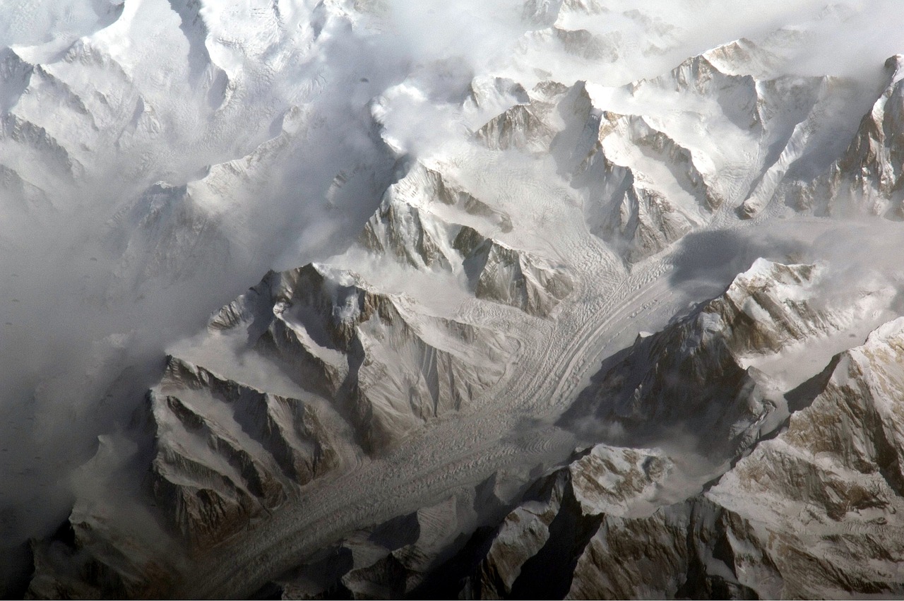
Satellite Imagery
has revolutionized our understanding of the Earth's climate and environmental changes. It provides a bird's-eye view of vast areas, allowing scientists to gather data that was once unimaginable. Imagine having the ability to monitor large-scale phenomena like deforestation, urban sprawl, and even natural disasters from space! This capability not only enhances our awareness but also equips us with the tools to make informed decisions regarding environmental policies and disaster preparedness.
The data collected from satellites can be incredibly detailed, offering insights into various aspects of the Earth's surface. For instance, satellite images can reveal changes in land cover over time, such as the conversion of forests into agricultural land or the expansion of cities. These changes are crucial for understanding the impacts of climate change and human activities on our planet. In fact, a recent study indicated that satellite imagery has helped identify over 50% of the world's deforestation hotspots.
Moreover, satellite imagery is not just about capturing images; it’s about analyzing them. Advanced algorithms and machine learning techniques are now being employed to process this data. This means that researchers can quickly identify trends and anomalies, leading to faster responses to environmental issues. For example, when a natural disaster strikes, satellite images can provide real-time data on affected areas, helping emergency responders assess damage and allocate resources effectively.
To give you a clearer picture of how satellite imagery is utilized, here are some key applications:
- Climate Monitoring: Satellites track temperature changes, greenhouse gas concentrations, and ice melt, providing critical data for climate models.
- Urban Planning: City planners use satellite data to analyze land use patterns and make decisions about infrastructure development.
- Agricultural Management: Farmers can monitor crop health and soil moisture levels, optimizing their yields and resource use.
In addition to these applications, satellite imagery is vital for international collaboration on environmental issues. Countries can share data and insights, enabling a unified approach to tackle global challenges like climate change. The combination of high-resolution images and advanced analytics allows for a comprehensive understanding of our planet, making satellite imagery an indispensable tool in the field of environmental science.
As we look to the future, the potential of satellite imagery continues to expand. With advancements in technology, we can expect even higher resolution images, more frequent data collection, and improved analytical capabilities. This evolution will undoubtedly enhance our ability to monitor the Earth’s changes and respond to environmental challenges.
Q: What is satellite imagery?
A: Satellite imagery refers to images of the Earth taken from satellites orbiting the planet. These images provide valuable data for various applications, including environmental monitoring, urban planning, and disaster management.
Q: How does satellite imagery help in climate change research?
A: Satellite imagery allows scientists to observe changes in land cover, temperature, and atmospheric conditions over time, providing essential data for understanding climate change impacts.
Q: Can satellite imagery be used in real-time?
A: Yes, many satellites are equipped to capture and transmit images in real-time, which is crucial for disaster response and management.
Q: What are the limitations of satellite imagery?
A: While satellite imagery is powerful, it can be limited by factors such as weather conditions, the resolution of images, and the need for ground validation to ensure data accuracy.

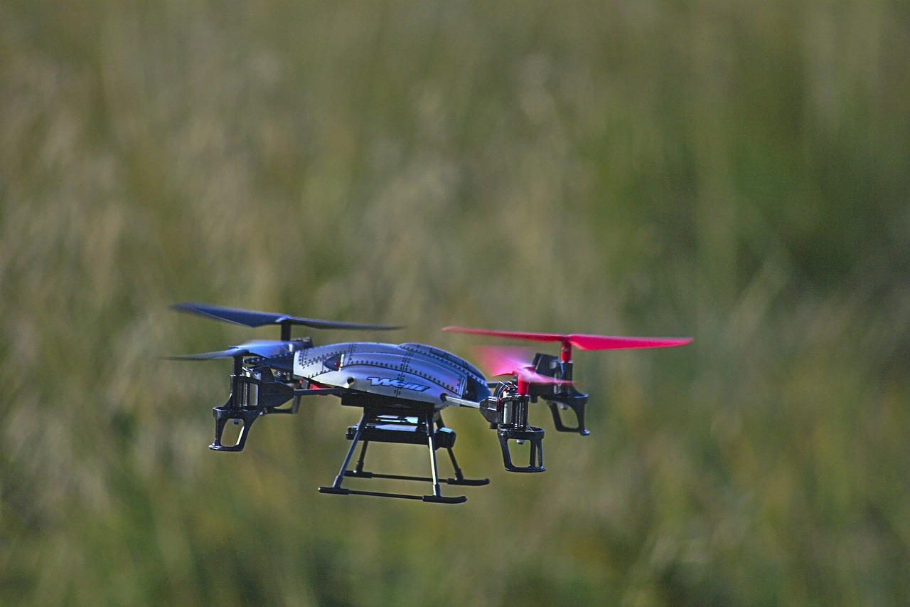
Aerial Surveys
Aerial surveys have emerged as a crucial complement to satellite data, providing high-resolution images that can capture intricate details of specific areas. Imagine being able to zoom in on a landscape, revealing features that would otherwise be lost in the vastness of satellite imagery. This ability is particularly important for localized climate studies, urban planning, and environmental assessments. With advancements in drone technology and imaging sensors, aerial surveys are not just about capturing pretty pictures; they are about gathering actionable insights that can drive decision-making.
One of the most significant advantages of aerial surveys is their flexibility. Drones can be deployed rapidly to assess areas affected by natural disasters, monitor wildlife habitats, or even conduct agricultural assessments. For instance, during a wildfire, drones can provide real-time data on the extent of the fire, helping emergency services make informed decisions. This capability is vital in today’s fast-paced world where time is of the essence.
Furthermore, aerial surveys can be tailored to meet the specific needs of various scientific fields. Researchers can select the type of sensors they want to use, whether it’s thermal imaging to monitor heat patterns or multispectral sensors to assess vegetation health. This versatility allows for a wide range of applications, including:
- Habitat Monitoring: Tracking changes in ecosystems and wildlife populations.
- Urban Development: Assessing land use and planning infrastructure.
- Agricultural Management: Evaluating crop health and optimizing yields.
However, it’s important to note that aerial surveys are not without their challenges. Factors such as weather conditions, regulatory restrictions, and the need for skilled operators can complicate their deployment. Despite these hurdles, the potential benefits far outweigh the drawbacks, making aerial surveys an indispensable tool in the arsenal of remote sensing technologies.
As we look to the future, the integration of artificial intelligence with aerial survey data promises to revolutionize how we interpret and utilize this information. Imagine algorithms that can automatically analyze aerial images to detect changes in land use or identify potential environmental hazards. The possibilities are endless, and the impact on science and society could be profound.

Disaster Response and Management
When disaster strikes, every second counts. The ability to respond swiftly and effectively can mean the difference between life and death. This is where remote sensing technologies come into play, revolutionizing the way we manage and respond to natural disasters. Imagine being able to monitor a hurricane's path in real-time or assess the damage caused by an earthquake from miles away. Remote sensing provides us with the tools to do just that, offering invaluable data that enhances our preparedness and recovery efforts.
One of the most significant advantages of remote sensing in disaster management is its capability to provide real-time data. For instance, satellites equipped with advanced sensors can capture images and data on weather patterns, allowing meteorologists to predict severe weather events with greater accuracy. This predictive capability is crucial for issuing timely warnings and evacuating areas at risk. Additionally, aerial surveys can be deployed immediately after a disaster to assess damage, enabling first responders to prioritize their efforts based on the most affected areas.
Moreover, remote sensing technologies facilitate the integration of data from various sources, creating a comprehensive overview of the disaster situation. This integration can include information from ground-based sensors, aerial drones, and satellite imagery, all of which can be processed and analyzed to inform decision-makers. For example, during a flood event, data on rainfall, river levels, and land use can be combined to model flood scenarios and predict potential impacts on communities. This holistic approach enhances situational awareness and allows for more effective resource allocation.
However, it's essential to recognize that while remote sensing technologies offer tremendous benefits, they are not without challenges. Data interpretation requires skilled personnel who can analyze complex datasets and translate them into actionable insights. Additionally, the reliability of remote sensing data can be affected by factors such as cloud cover or sensor calibration issues. Therefore, ongoing training and investment in technology are crucial to maximize the potential of these tools in disaster response.
In conclusion, the integration of remote sensing technologies into disaster response and management is transforming how we approach natural disasters. By providing real-time data, enhancing situational awareness, and improving resource allocation, these technologies are paving the way for more effective disaster management strategies. As we continue to innovate and refine these tools, we can look forward to a future where our ability to respond to disasters is not just reactive but proactive, ultimately saving lives and minimizing damage.
- What is remote sensing? Remote sensing is the process of collecting data about an object or area from a distance, typically using satellites or aircraft.
- How does remote sensing help in disaster management? It provides real-time data and imagery that help in assessing damage, predicting disasters, and planning response strategies.
- What are some examples of remote sensing technologies? Examples include satellite imagery, aerial drones, and ground-based sensors.
- Are there challenges associated with remote sensing? Yes, challenges include data accuracy, the need for skilled personnel, and issues related to data accessibility and cost.

Challenges Facing Remote Sensing Technologies
As with any cutting-edge technology, remote sensing technologies come with their own set of challenges that can hinder their full potential. While the advancements in this field have been revolutionary, they also present significant hurdles that need to be addressed. One of the most pressing issues is data accuracy. Inaccurate data can lead to misguided decisions, especially in critical areas like environmental monitoring and disaster management. Researchers and scientists rely heavily on precise data to draw conclusions, and any discrepancies can skew results.
To combat this, various methods and technologies are employed for data calibration and validation. These processes are essential to ensure that the information gathered from remote sensing devices reflects the real-world conditions accurately. For example, ground-truthing, which involves collecting data from the field to verify remote sensing data, is a common practice. However, it can be resource-intensive and time-consuming, creating a bottleneck in the workflow.
Another significant challenge is accessibility. The high cost of advanced remote sensing technologies can be a barrier for many researchers, particularly those in developing regions. While satellite data is becoming more available, the sophisticated sensors and analysis tools often come with hefty price tags. This can lead to a disparity in the availability of data and tools, hindering research efforts in less affluent areas. To address this, various initiatives are being undertaken to lower costs and increase access, ensuring that a broader range of researchers can benefit from these technologies.
Additionally, the integration of data from multiple sources poses another challenge. As remote sensing technologies evolve, they generate vast amounts of data from different platforms, including satellites, drones, and ground-based sensors. The ability to combine and analyze this data effectively is crucial for comprehensive environmental assessments. However, the lack of standardized protocols and varying data formats can complicate integration efforts. Researchers often find themselves spending more time on data management than on actual analysis, which can be frustrating.
In summary, while remote sensing technologies offer incredible opportunities for scientific advancement, they are not without their challenges. Addressing issues related to data accuracy, accessibility, and integration will be crucial for unlocking the full potential of these tools. As technology continues to evolve, it is imperative that the scientific community works collaboratively to overcome these obstacles, paving the way for a future where remote sensing can be utilized to its fullest extent.
- What are remote sensing technologies?
Remote sensing technologies involve the collection and analysis of data from a distance, typically using satellites or drones, to monitor and assess environmental conditions.
- How is data accuracy ensured in remote sensing?
Data accuracy is ensured through methods like ground-truthing, calibration, and validation processes that compare remote sensing data with real-world observations.
- Why is accessibility a concern in remote sensing?
The high cost of advanced remote sensing technologies can limit access for researchers, particularly in developing regions, creating disparities in research capabilities.
- What is data integration, and why is it challenging?
Data integration refers to the process of combining data from various sources. It is challenging due to the lack of standardized protocols and varying data formats, which can complicate analysis.

Data Accuracy and Calibration
When it comes to remote sensing, data accuracy is not just a luxury; it’s a necessity. Imagine trying to navigate through a dense fog without a compass—this is what scientists face when they deal with inaccurate data. The reliability of remote sensing data directly impacts research outcomes, policy-making, and environmental management strategies. Therefore, ensuring that the data collected from satellites and aerial surveys is precise and trustworthy is paramount.
Calibration is the process that helps maintain this accuracy. It involves comparing the measurements obtained from remote sensing instruments with known standards to identify any discrepancies. This is akin to tuning a musical instrument; without proper calibration, the data can become off-key, leading to flawed interpretations. Various methods are employed to ensure that data remains reliable:
- Ground Truthing: This technique involves collecting data from the field to validate the remote sensing results. By comparing satellite data with actual measurements taken on-site, researchers can adjust their models for greater accuracy.
- Cross-Calibration: Different sensors can yield varying results. Cross-calibration helps in harmonizing data from multiple sources, ensuring that they are comparable.
- Algorithm Refinement: Continuous improvements in algorithms used for data processing can enhance accuracy. Researchers are constantly developing new methods to better interpret the data collected.
Moreover, technological advancements play a crucial role in improving data accuracy. For instance, modern sensors are equipped with advanced features such as multi-spectral and hyper-spectral imaging, which allow for more detailed observations. This means that scientists can detect subtle changes in the environment that were previously undetectable. The integration of artificial intelligence and machine learning algorithms is also revolutionizing how data is analyzed, providing deeper insights and reducing human error.
However, challenges remain. Factors such as atmospheric conditions, sensor degradation over time, and variations in geographical features can affect data accuracy. For example, clouds can obscure satellite images, leading to incomplete data for analysis. To mitigate these issues, researchers are exploring innovative solutions, such as the use of drones for localized data collection, which can operate below cloud cover and provide high-resolution images.
In conclusion, the journey towards achieving high data accuracy in remote sensing is ongoing. It requires a combination of robust calibration techniques, technological innovation, and continuous validation against ground truth. As we push the boundaries of what remote sensing can achieve, maintaining data accuracy will remain a cornerstone of effective scientific research and environmental stewardship.
- What is remote sensing? Remote sensing is the acquisition of information about an object or phenomenon without making physical contact, typically through satellite or aerial imagery.
- Why is data accuracy important in remote sensing? Accurate data is essential for making informed decisions in environmental management, climate studies, and disaster response.
- How is data calibrated in remote sensing? Calibration involves comparing remote sensing data with ground truth data to ensure reliability, using methods like ground truthing and cross-calibration.
- What technologies are improving data accuracy? Advancements in sensor technology, machine learning algorithms, and data processing techniques are enhancing the accuracy of remote sensing data.

Accessibility and Cost Issues
The rapid evolution of remote sensing technologies has undoubtedly opened up a realm of possibilities for researchers and scientists. However, one of the most pressing challenges that remains is the accessibility of these advanced tools, particularly due to their high costs. For many organizations, especially smaller institutions or those in developing countries, the financial barrier can be a significant obstacle to harnessing the full potential of remote sensing.
Imagine wanting to explore the vastness of the universe but being unable to afford a telescope. That's the reality for many researchers who wish to utilize cutting-edge remote sensing technologies. The cost of acquiring high-resolution satellite imagery, drone equipment, and sophisticated data processing software can be prohibitive. This situation is further exacerbated by the need for specialized training to operate these technologies effectively. As a result, a gap emerges between those who can afford these tools and those who cannot, leading to inequities in research capabilities.
To address these accessibility issues, several initiatives have emerged. For example, collaborative projects and partnerships between universities, governments, and private companies aim to pool resources and share data. Additionally, open-source software and platforms are becoming more prevalent, allowing researchers to analyze remote sensing data without incurring hefty licensing fees. Here are some approaches being taken to enhance accessibility:
- Open Data Initiatives: Governments and organizations are increasingly making remote sensing data available for free, enabling researchers to access valuable information without financial constraints.
- Cost-sharing Collaborations: By forming partnerships, institutions can share the costs associated with acquiring remote sensing technologies, making it more feasible for all parties involved.
- Training Programs: Many organizations are offering training programs to help researchers learn how to use remote sensing tools effectively, thus maximizing their investment.
Despite these efforts, the challenge of cost remains significant. Many advanced remote sensing technologies require substantial initial investments, which can deter potential users. This situation raises an important question: how can we balance the need for cutting-edge technology with the reality of budget constraints? The answer lies in innovation and collaboration. By developing more affordable alternatives and encouraging partnerships, we can work towards making remote sensing accessible to all.
In conclusion, while the future of remote sensing technologies is bright, addressing accessibility and cost issues is crucial for ensuring that these advancements benefit the scientific community as a whole. As we move forward, fostering an inclusive environment where researchers from all backgrounds can contribute to our understanding of the world will be essential for long-term success.
- What are remote sensing technologies? Remote sensing technologies involve collecting data about the Earth's surface using satellites, aircraft, and drones to monitor environmental changes and gather information for various scientific applications.
- Why are remote sensing technologies important? These technologies provide critical data for understanding climate change, managing natural resources, and responding to disasters, ultimately aiding in better decision-making.
- How can I access remote sensing data? Many organizations offer open data initiatives, allowing researchers and the public to access remote sensing data for free. Additionally, partnerships and collaborations can help share resources and costs.
- What are the main challenges facing remote sensing technologies? Key challenges include data accuracy, high costs, accessibility issues, and the need for specialized training to effectively utilize these technologies.
Future Trends in Remote Sensing
The future of remote sensing technologies is not just bright; it's positively dazzling! As we stand on the brink of a new era in scientific exploration, several exciting trends are emerging that promise to revolutionize the way we collect and analyze data. Imagine a world where data collection is so seamless that it feels like magic—this is the reality that remote sensing is heading towards. With advancements in automation, data analytics, and user interfaces, the landscape of remote sensing is set to undergo a significant transformation.
One of the most notable trends is the rise of automated data collection. Gone are the days when scientists had to painstakingly gather data manually. With the development of advanced algorithms and machine learning techniques, remote sensing systems can now autonomously collect and process vast amounts of data. This not only speeds up research but also enhances the accuracy of the information gathered. Imagine drones equipped with sensors flying over forests, collecting data on tree health without any human intervention. This is not just a dream; it is becoming a reality!
Furthermore, the integration of artificial intelligence (AI) in remote sensing is paving the way for improved data analytics. AI can analyze complex datasets faster and more accurately than traditional methods. By applying machine learning techniques, researchers can identify patterns and trends that may have gone unnoticed. For instance, AI can help predict environmental changes by analyzing historical data alongside current remote sensing observations. This synergy between AI and remote sensing is like having a superpower in environmental monitoring!
In addition to automation and AI, we can expect to see significant enhancements in user interfaces. As remote sensing technologies become more sophisticated, the need for intuitive and user-friendly interfaces becomes paramount. Scientists, researchers, and even policy-makers will benefit from platforms that allow them to visualize and interact with data in real-time. Imagine being able to manipulate satellite imagery with just a few clicks, zooming in on specific areas of interest, or overlaying different datasets to gain deeper insights. This level of accessibility will empower a broader audience to engage with remote sensing data, fostering collaboration across various scientific disciplines.
Moreover, the trend towards open data initiatives is gaining momentum. As more organizations recognize the value of sharing data, remote sensing technologies will become increasingly accessible to researchers and the public alike. This democratization of data is crucial for addressing global challenges such as climate change, biodiversity loss, and disaster management. By making remote sensing data available to a wider audience, we can harness collective intelligence and drive innovative solutions.
To summarize, the future trends in remote sensing technologies are characterized by:
- Automated data collection through drones and advanced algorithms.
- Artificial intelligence enhancing data analytics and pattern recognition.
- User-friendly interfaces for real-time data visualization and interaction.
- Open data initiatives promoting accessibility and collaboration.
As we look ahead, it’s clear that these advancements will not only improve our understanding of the environment but will also empower scientists and researchers to make informed decisions that impact our planet. The integration of these trends will usher in a new age of remote sensing that is more efficient, accurate, and accessible than ever before.
Q: What are remote sensing technologies?
Remote sensing technologies involve collecting data about the Earth's surface from a distance, typically using satellites, drones, or aircraft equipped with sensors.
Q: How do remote sensing technologies help in climate change research?
These technologies provide critical data on land use changes, temperature variations, and atmospheric conditions, which are essential for understanding and mitigating climate change impacts.
Q: What role does artificial intelligence play in remote sensing?
AI enhances data analysis by identifying patterns and trends in large datasets, enabling faster and more accurate insights into environmental changes.
Q: Are remote sensing technologies accessible to everyone?
While some advanced technologies can be costly, there is a growing trend towards open data initiatives that aim to make remote sensing data available to researchers and the public.
Frequently Asked Questions
- What are remote sensing technologies?
Remote sensing technologies involve collecting data about the Earth's surface from a distance, typically using satellites or aircraft. These technologies allow scientists to gather information on various environmental factors without being physically present in the location being studied.
- How do remote sensing technologies benefit environmental science?
These technologies play a crucial role in environmental science by providing vital data for climate change studies, habitat monitoring, and disaster management. They enable researchers to analyze large areas quickly and accurately, leading to better understanding and decision-making regarding environmental issues.
- What types of remote sensing technologies are commonly used?
Common remote sensing technologies include satellite imagery, aerial surveys, and ground-based sensors. Each of these methods has its strengths, with satellites offering broad coverage and aerial surveys providing high-resolution images of specific areas.
- How is satellite imagery used in climate change monitoring?
Satellite imagery is essential for tracking changes in land cover, temperature, and atmospheric conditions. By analyzing this data, scientists can identify trends related to climate change and inform policy decisions aimed at mitigating its impacts.
- What challenges do remote sensing technologies face?
Despite their advantages, remote sensing technologies encounter challenges such as data accuracy, accessibility, and high costs. Ensuring the reliability of the data collected and making these technologies available to a wider audience are key issues that need to be addressed.
- What is being done to improve data accuracy in remote sensing?
Efforts to enhance data accuracy include developing improved calibration methods and validation techniques. Researchers are constantly refining these processes to ensure that the data collected from remote sensing technologies is as reliable as possible.
- Are there initiatives to make remote sensing technologies more accessible?
Yes! Various initiatives aim to reduce the costs associated with advanced remote sensing technologies and increase access for researchers and organizations. This includes open-source data platforms and collaborations between institutions to share resources.
- What future trends can we expect in remote sensing technologies?
The future of remote sensing technologies looks bright, with trends pointing towards increased automation, enhanced data analytics, and user-friendly interfaces. These advancements will likely lead to more efficient data collection and analysis, making it easier for scientists to tackle complex environmental challenges.