How to Use Remote Sensing in Environmental Studies
Remote sensing is revolutionizing the way we understand and manage our environment. Imagine being able to observe vast swathes of land from the comfort of your home, gathering critical data that can inform environmental policies, conservation efforts, and resource management strategies. This technology, which involves collecting data from a distance—primarily through satellites or aircraft—offers a unique lens through which to view our planet. By leveraging remote sensing, researchers and environmentalists can monitor changes over time, assess the health of ecosystems, and respond to environmental challenges more effectively.
But what exactly does remote sensing entail? At its core, it involves the use of sensors to gather information about the Earth's surface without making physical contact. These sensors can be passive, capturing natural energy reflected from surfaces, or active, emitting their own energy to measure the reflected signals. The data collected can be transformed into images and maps, providing a wealth of information about land cover, vegetation health, and even urban development. This technological marvel not only enhances our understanding of environmental dynamics but also empowers us to make informed decisions that promote sustainability.
To fully appreciate the impact of remote sensing in environmental studies, it's essential to grasp its fundamental concepts. The technology primarily relies on two types of sensors: optical sensors and radar sensors. Optical sensors capture images based on sunlight reflection, making them ideal for observing vegetation and land use patterns. On the other hand, radar sensors use microwave signals, allowing them to penetrate clouds and work effectively in various weather conditions.
Data acquisition methods vary, but they generally involve the following steps:
- Data Collection: Satellites or aerial platforms gather data, which is then transmitted to ground stations.
- Data Processing: Raw data is processed to create usable images and maps.
- Data Analysis: Researchers analyze the processed data to extract meaningful information.
These steps form the backbone of remote sensing applications, enabling scientists to monitor environmental changes and make data-driven decisions. As we delve deeper into the applications of remote sensing, it becomes clear that its significance in environmental studies cannot be overstated.
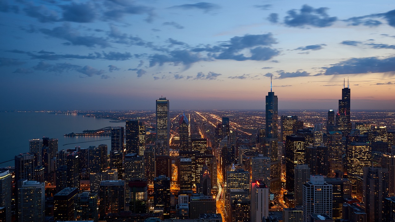
One of the most critical applications of remote sensing is in land use monitoring. The ability to track changes in land cover over time is invaluable for understanding urban development, agricultural expansion, and deforestation trends. For instance, satellite imagery can reveal how cities are expanding into surrounding areas, providing insights into urban sprawl and its implications for local ecosystems.
Urban growth analysis through remote sensing allows researchers to assess the impact of urbanization on the environment. By comparing historical satellite images, scientists can identify patterns of urban expansion, such as the conversion of green spaces into residential or commercial areas. This information is crucial for urban planners and policymakers who aim to create sustainable cities.
Several cities around the world have utilized remote sensing to understand their growth patterns. For example, a study of Los Angeles revealed how the city has expanded over the last few decades, leading to significant habitat loss and increased air pollution. Similarly, Beijing has seen rapid urbanization, prompting researchers to use remote sensing to analyze the effects on local climate and ecology. These case studies not only demonstrate the practical implications of remote sensing but also highlight the urgent need for sustainable urban development.
Despite its numerous advantages, monitoring urban growth through remote sensing is not without challenges. Issues such as data accuracy and resolution limitations can hinder effective analysis. Moreover, the need for advanced analytical techniques to interpret complex data sets adds another layer of difficulty. Researchers must continuously innovate and adapt their methods to overcome these hurdles, ensuring that remote sensing remains a reliable tool for environmental studies.
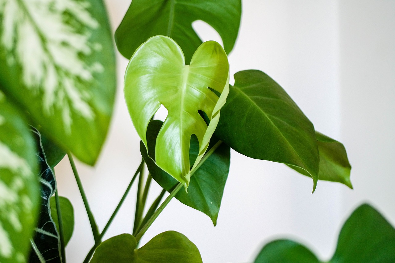
Remote sensing is equally instrumental in the field of agriculture, particularly in precision agriculture. By assessing crop health, predicting yields, and managing resources efficiently, farmers can make informed decisions that enhance productivity while minimizing environmental impact. For instance, satellite data can help identify areas of a field that require more water or fertilizer, optimizing resource use and reducing waste.
Beyond land use monitoring, remote sensing plays a pivotal role in detecting environmental changes caused by both natural and human factors. Techniques employed in this area allow scientists to monitor climate change impacts, natural disasters, and habitat alterations with remarkable precision. The ability to visualize these changes over time provides invaluable insights into the health of our planet.
Remote sensing is a powerful tool for tracking climate-related changes. For example, it can provide data on temperature fluctuations, sea-level rise, and glacial retreat. By analyzing this data, researchers can better understand the implications of climate change on ecosystems and human societies. The visual representation of these changes serves as a stark reminder of the urgency of addressing climate issues.
In the realm of disaster management, remote sensing proves invaluable by providing timely information crucial for effective response efforts. Satellite imagery can be used to assess damage after natural disasters such as hurricanes or earthquakes, enabling authorities to plan recovery strategies swiftly. Additionally, remote sensing aids in enhancing resilience against future disasters by identifying vulnerable areas and monitoring environmental conditions.
Q: What is remote sensing?
A: Remote sensing is the process of collecting data about the Earth's surface from a distance, often using satellites or aerial platforms.
Q: How does remote sensing benefit environmental studies?
A: It allows for efficient monitoring of land use changes, climate impacts, and disaster management, providing critical data for informed decision-making.
Q: What types of sensors are used in remote sensing?
A: There are two main types: optical sensors, which capture sunlight reflection, and radar sensors, which use microwave signals to gather data.
Q: Can remote sensing help in disaster management?
A: Yes, it provides timely information for assessing damage and planning response efforts during natural disasters.

Understanding Remote Sensing
Remote sensing is a fascinating field that involves the collection of data from a distance, which can be achieved using various technologies, primarily satellites and aircraft. Imagine being able to observe our planet from above, gathering crucial information about its surface without ever having to step foot on it. This capability is what makes remote sensing an invaluable tool in environmental studies. At its core, remote sensing allows researchers to monitor, analyze, and manage natural resources more effectively than ever before.
The fundamental concepts behind remote sensing revolve around the use of sensors that capture electromagnetic radiation emitted or reflected from the Earth's surface. These sensors can be broadly categorized into two types: passive sensors and active sensors. Passive sensors detect natural energy (like sunlight) reflected off objects, while active sensors emit their own energy to illuminate the target before measuring the reflected energy. This distinction is crucial, as it influences the type of data collected and the applications for which it can be used.
Data acquisition methods in remote sensing can vary significantly, but they typically involve two primary approaches: satellite-based and airborne systems. Satellite-based remote sensing provides a global perspective, allowing for the monitoring of vast areas over time. On the other hand, airborne systems, such as drones or manned aircraft, offer higher resolution data for smaller areas, making them ideal for detailed studies. The choice between these methods often depends on the specific objectives of the research and the scale of the area being studied.
One of the most exciting aspects of remote sensing is its ability to provide data across different spectral bands. This means that researchers can analyze not just visible light, but also infrared and other wavelengths, revealing information that is not immediately visible to the naked eye. For instance, in agriculture, infrared data can help assess crop health by identifying stressed plants that may not be evident in standard optical images. This multi-spectral capability enhances the understanding of various environmental parameters, leading to more informed decision-making.
In summary, remote sensing is a powerful and versatile tool that plays a pivotal role in environmental studies. By understanding its fundamental concepts, technologies, and methodologies, researchers can harness its full potential to monitor changes in our environment effectively. As we continue to face challenges such as climate change and urbanization, the importance of remote sensing in managing our natural resources cannot be overstated.
Applications in Land Use Monitoring
Remote sensing plays a crucial role in tracking land use changes, providing a bird's-eye view of our planet that traditional methods simply can't match. Imagine being able to see how a forest gradually turns into a bustling city, or how agricultural fields expand to meet the demands of a growing population—all without stepping foot outside your office. This technology harnesses the power of satellites and aerial imagery to collect data that helps researchers and policymakers understand how land is being used and how it changes over time.
One of the most significant applications of remote sensing in land use monitoring is its ability to analyze urban development. Urban areas are constantly evolving, and with the rapid pace of growth, it becomes essential to monitor these changes effectively. By employing sophisticated algorithms and high-resolution satellite imagery, researchers can assess urban sprawl and its impact on the environment. For instance, remote sensing can help identify areas of impervious surfaces, such as roads and buildings, which contribute to increased runoff and potential flooding. This data is vital for urban planners who need to make informed decisions about infrastructure and resource allocation.
Furthermore, remote sensing technology is invaluable in monitoring agricultural expansion. As the world’s population continues to rise, the demand for food increases, leading to the conversion of forests and natural habitats into farmland. Satellite imagery allows us to visualize these transformations, providing insights into crop health and yield predictions. For example, by analyzing vegetation indices derived from remote sensing data, farmers can optimize irrigation and fertilization, ensuring that resources are used efficiently and sustainably.
In addition to urban and agricultural monitoring, remote sensing is also instrumental in tracking deforestation trends. Forests play a critical role in carbon sequestration and biodiversity conservation, making their monitoring essential for environmental management. By utilizing multi-temporal satellite images, researchers can detect changes in forest cover over time, helping to identify areas at risk of degradation. This information is crucial for implementing conservation strategies and ensuring sustainable land use practices.
However, while the advantages of remote sensing in land use monitoring are clear, it’s important to acknowledge the challenges that come with it. For instance, data accuracy can be influenced by factors such as atmospheric conditions and sensor calibration. Additionally, the resolution of satellite images can sometimes limit the ability to capture small-scale changes. To overcome these challenges, advanced analytical techniques and multi-source data integration are essential. This ensures that the insights gained from remote sensing are reliable and actionable.
In summary, remote sensing is revolutionizing the way we monitor land use changes. With its ability to provide comprehensive, real-time data, it empowers researchers, urban planners, and environmentalists to make informed decisions that shape the future of our landscapes. As technology continues to evolve, the potential applications of remote sensing in land use monitoring will only expand, paving the way for more sustainable management of our natural resources.
- What is remote sensing? Remote sensing is the process of collecting data about an object or area from a distance, often using satellites or aircraft.
- How does remote sensing help in land use monitoring? It provides detailed imagery and data that allow for the analysis of changes in land use over time, such as urban development or agricultural expansion.
- What are the challenges associated with remote sensing? Challenges include data accuracy, resolution limitations, and the need for advanced analytical techniques to interpret the data effectively.
- Can remote sensing be used for disaster management? Yes, remote sensing is a valuable tool for assessing damage and planning response efforts during natural disasters.
Urban Growth Analysis
Urban growth is a phenomenon that has been accelerating at an unprecedented rate, especially in the last few decades. The rapid expansion of cities can have profound implications for the environment, economy, and social structures. By leveraging remote sensing technology, researchers can gain valuable insights into how urban areas are evolving. This technology allows for the analysis of vast areas over time, providing a comprehensive view of urban sprawl and its impacts.
One of the primary methods used in urban growth analysis is the evaluation of satellite imagery. These images can illustrate changes in land cover, enabling researchers to identify patterns of development. For instance, by comparing satellite images from different years, it becomes possible to quantify the extent of urban expansion. This approach not only highlights the areas that have been developed but also sheds light on the loss of green spaces and agricultural lands, which are often sacrificed for urbanization.
To better understand the impact of urbanization on the environment, researchers utilize various analytical techniques, including:
- Change Detection: This involves comparing images from different time periods to identify changes in land use.
- Spatial Analysis: Techniques such as Geographic Information Systems (GIS) help in mapping and analyzing spatial patterns of growth.
- Modeling: Predictive models can forecast future urban growth based on current trends and factors influencing development.
Moreover, remote sensing can be instrumental in assessing the environmental consequences of urban growth. For example, researchers can monitor air quality changes, heat island effects, and water resource management issues that arise from expanding urban areas. By understanding these dynamics, city planners and policymakers can implement strategies to mitigate negative impacts on the environment.
Numerous case studies worldwide illustrate the effectiveness of remote sensing in urban growth analysis. For instance, cities like Los Angeles, Beijing, and Mumbai have utilized satellite data to track urban sprawl and its effects on local ecosystems. In Los Angeles, researchers have documented significant increases in impervious surfaces, which has led to heightened runoff and flooding risks. Meanwhile, in Beijing, satellite imagery has revealed rapid urbanization that is encroaching on agricultural land, raising concerns about food security.
Despite the advantages of remote sensing, several challenges persist in urban monitoring. Issues such as data accuracy and resolution limitations can hinder effective analysis. For instance, lower-resolution images may fail to capture fine details necessary for understanding urban dynamics. Furthermore, the need for advanced analytical techniques is crucial to interpret the vast amounts of data generated by remote sensing technologies. As urban areas continue to evolve, it becomes increasingly important to address these challenges to enhance the effectiveness of urban growth monitoring.
In conclusion, remote sensing provides a powerful tool for urban growth analysis, enabling researchers to track changes over time and understand their implications. By employing various methodologies and addressing the challenges associated with data accuracy and resolution, we can better manage urban expansion and its effects on the environment.
Case Studies of Urban Areas
When it comes to understanding urban growth patterns, remote sensing technology has proven to be a game changer. Let's dive into some fascinating case studies that highlight how cities around the globe have utilized this innovative approach to monitor their development and its impacts on the environment.
One notable example is the city of Los Angeles, California. Researchers employed satellite imagery to examine the sprawling urban landscape over several decades. The analysis revealed significant increases in impervious surfaces, which are crucial for understanding urban heat islands and stormwater management. By comparing historical images, scientists could track how the city expanded into surrounding natural areas, leading to habitat fragmentation and increased pollution levels.
Another compelling case study comes from São Paulo, Brazil. Here, remote sensing was used to evaluate land use changes in response to rapid population growth. The data collected indicated that agricultural lands were being converted into residential areas at an alarming rate. This transition not only affects local biodiversity but also poses challenges for food security. The findings prompted local authorities to rethink urban planning strategies, emphasizing sustainable development and the preservation of green spaces.
In Europe, the city of Amsterdam has leveraged remote sensing to monitor its unique canal system and associated urban ecosystems. By analyzing satellite data, researchers assessed the health of aquatic habitats and the impact of urbanization on water quality. The results highlighted the need for better management practices to mitigate pollution and promote biodiversity within the urban environment. These insights are invaluable for city planners aiming to balance growth with ecological sustainability.
Moreover, remote sensing has been instrumental in tracking urban sprawl in Beijing, China. The city has witnessed explosive growth over the past few decades, and the use of high-resolution satellite imagery has allowed researchers to quantify land cover changes with remarkable precision. The data revealed that urban expansion was often occurring at the expense of agricultural land, leading to significant environmental consequences. This information has guided policymakers in implementing zoning regulations and promoting more sustainable land use practices.
To summarize, these case studies illustrate the profound impact that remote sensing can have on urban studies. By providing detailed insights into land use changes, these technologies empower cities to make informed decisions that balance development with environmental stewardship. As urban areas continue to grow, the importance of integrating remote sensing into urban planning cannot be overstated.
- What is remote sensing? Remote sensing is the process of collecting data about an object or area from a distance, typically using satellites or aircraft.
- How does remote sensing help in urban studies? It allows researchers to monitor land use changes, assess environmental impacts, and inform urban planning through detailed imagery and data analysis.
- What are some challenges of using remote sensing? Challenges include data accuracy, resolution limitations, and the need for advanced analytical techniques to interpret the data effectively.
- Can remote sensing be used for disaster management? Yes, remote sensing provides timely information for assessing damage and planning response efforts during natural disasters.
Challenges in Urban Monitoring
Monitoring urban growth through remote sensing is not without its challenges. While the technology offers a wealth of data and insights, several factors can complicate the process. For instance, the accuracy of satellite imagery can be influenced by atmospheric conditions, which may obscure the view of the Earth's surface. This can lead to discrepancies in data interpretation, making it difficult for researchers to draw reliable conclusions about urban expansion.
Additionally, the resolution of satellite images is a critical factor. High-resolution images provide detailed views of urban areas, but they are often limited in availability and can be costly to obtain. In contrast, lower-resolution images may cover larger areas but lack the detail necessary to analyze specific urban features effectively. This trade-off can hinder efforts to monitor urban sprawl accurately, as researchers must balance the need for detail with the practicality of data acquisition.
Another significant challenge is the rapid pace of urbanization itself. Cities can change dramatically in a short time frame, making it difficult for remote sensing data to keep up. For example, new developments, infrastructure changes, and shifts in land use can occur between satellite passes, leading to potential gaps in data that complicate trend analysis. This is especially true in developing regions, where urban growth can be particularly explosive and unpredictable.
Moreover, the integration of remote sensing data with other data sources presents its own set of challenges. Urban monitoring often requires the combination of various datasets, such as demographic information and socio-economic indicators, to gain a comprehensive understanding of urban dynamics. However, inconsistencies in data formats, scales, and collection methods can create hurdles in data integration efforts.
To address these challenges, researchers and urban planners are increasingly adopting advanced analytical techniques, such as machine learning and artificial intelligence, to enhance data interpretation and improve accuracy. These technologies can help automate the processing of large datasets, identify patterns, and predict future urban growth scenarios. Nevertheless, the effectiveness of these methods relies heavily on the quality and resolution of the input data, underscoring the importance of continuous advancements in remote sensing technology.
In summary, while remote sensing offers invaluable tools for urban monitoring, it is essential to recognize and address the challenges it presents. By understanding these obstacles, researchers can develop more effective strategies for tracking urban growth and its impacts on the environment.
- What is remote sensing? Remote sensing is the process of collecting data about the Earth's surface from a distance, typically through satellites or aircraft.
- How does remote sensing help in urban monitoring? It provides valuable insights into land use changes, urban sprawl, and environmental impacts through satellite imagery and data analysis.
- What are the limitations of remote sensing? Limitations include data accuracy, resolution constraints, and challenges in integrating multiple data sources.
- Can remote sensing be used for disaster management? Yes, it plays a crucial role in assessing damage and planning response efforts during natural disasters.
Agricultural Monitoring Techniques
Agricultural monitoring techniques have evolved dramatically over the years, thanks to the advancements in remote sensing technology. Imagine being able to assess the health of crops from thousands of miles away, all while sipping your morning coffee. This is not science fiction; it's the reality of precision agriculture today. Remote sensing allows farmers and researchers to gather crucial data that can lead to more informed decisions, optimizing both yield and resource management.
One of the primary uses of remote sensing in agriculture is the assessment of crop health. Through the use of satellite imagery and aerial photography, farmers can monitor their fields for signs of stress, disease, or nutrient deficiencies. For instance, Normalized Difference Vegetation Index (NDVI) is a popular technique that utilizes the difference in reflectance between near-infrared and visible light to determine plant health. Healthy vegetation reflects more near-infrared light and absorbs visible light, making NDVI a powerful tool for monitoring crop vitality.
Moreover, remote sensing can help in predicting crop yields. By analyzing historical data and current crop conditions, farmers can forecast how much produce they can expect at harvest time. This predictive capability is invaluable for planning purposes, allowing for better resource allocation and market strategy. For example, if a farmer knows that a particular crop is underperforming due to drought conditions detected via satellite, they can make timely decisions to conserve water or adjust their planting strategies.
Resource management is another critical aspect where remote sensing shines. Farmers can utilize satellite data to optimize irrigation practices. With the ability to identify areas of a field that are over or under-watered, they can apply irrigation more efficiently, saving both water and money. This not only enhances productivity but also contributes to sustainable farming practices, which is increasingly important in our changing climate.
In addition to these techniques, remote sensing can also be employed for soil moisture monitoring. By utilizing sensors that measure the electromagnetic radiation emitted by the soil, farmers can gain insights into moisture levels across their fields. This information is crucial for irrigation management, especially in regions prone to drought. When combined with other data sources, such as weather forecasts, farmers can make more precise irrigation decisions, ensuring that crops receive the right amount of water at the right time.
To summarize, the integration of remote sensing in agricultural monitoring is revolutionizing the way farming is conducted. The benefits are substantial, and the techniques employed are continually evolving. By leveraging data collected from satellites and drones, farmers can not only enhance their productivity but also contribute to the sustainability of our planet. It's a win-win situation that exemplifies the power of technology in agriculture.
- What is remote sensing in agriculture? Remote sensing involves collecting data from satellites or aircraft to monitor various agricultural aspects, including crop health, yield prediction, and resource management.
- How does NDVI work? NDVI calculates the difference in reflectance between near-infrared and visible light to assess plant health, with higher values indicating healthier vegetation.
- Can remote sensing help with irrigation management? Yes, remote sensing can identify areas of a field that require more or less water, enabling more efficient irrigation practices.
- What are the benefits of using remote sensing in agriculture? Benefits include improved crop monitoring, better yield predictions, optimized resource management, and enhanced sustainability practices.
Environmental Change Detection
In today's rapidly changing world, detecting environmental changes has never been more critical. Remote sensing technology provides a powerful toolset for monitoring alterations in our environment, whether they arise from natural phenomena or human activities. This technology allows researchers and policymakers to gather data from vast areas without the need for ground-level surveys, making it an efficient and effective method for understanding our planet's dynamics.
One of the primary applications of remote sensing in environmental change detection is its ability to monitor climate change impacts. For instance, satellite imagery can track temperature fluctuations across different regions, revealing patterns that may indicate broader climatic shifts. Additionally, remote sensing is instrumental in observing glacial retreat, which is a significant indicator of climate change. By analyzing historical satellite images, scientists can quantify the extent of glacial melting over time, providing crucial data for climate models.
Moreover, remote sensing plays a pivotal role in assessing natural disasters. When a disaster strikes, such as a hurricane or earthquake, timely information is essential for effective response strategies. Satellite imagery can quickly assess damage to infrastructure, track the movement of floodwaters, and identify areas in need of immediate assistance. This data not only aids in disaster response but also helps in planning for future resilience against similar events.
To illustrate the impact of remote sensing on environmental change detection, consider the following table that summarizes key applications and their benefits:
| Application | Description | Benefits |
|---|---|---|
| Climate Change Monitoring | Tracking temperature changes, sea-level rise, and glacial retreat | Provides data for climate models and policy-making |
| Natural Disaster Assessment | Evaluating damage and monitoring disaster response | Enhances emergency response and recovery efforts |
| Habitat Alteration Detection | Observing changes in ecosystems and biodiversity | Helps in conservation efforts and habitat restoration |
Furthermore, remote sensing technology enables scientists to detect habitat alterations that may arise from both natural and anthropogenic activities. For example, deforestation can be monitored through satellite images, allowing researchers to quantify the loss of forest cover over time. This information is vital for conservation efforts and can guide policies aimed at preserving biodiversity. By providing a bird's-eye view of environmental changes, remote sensing allows us to understand the bigger picture and make informed decisions.
In conclusion, the significance of remote sensing in environmental change detection cannot be overstated. It equips us with the tools to monitor our planet's health, respond to disasters, and plan for a sustainable future. As technology continues to advance, the potential for remote sensing to contribute to environmental studies will only grow, providing us with deeper insights into the challenges we face and the actions we need to take.
- What is remote sensing? Remote sensing is the process of collecting data about an object or area from a distance, typically using satellites or aircraft.
- How does remote sensing help in environmental studies? It provides critical data for monitoring changes in land use, climate, and ecosystems without the need for extensive ground surveys.
- What are some challenges of using remote sensing? Challenges include data accuracy, resolution limitations, and the need for advanced analytical techniques to interpret the data.
- Can remote sensing be used for disaster management? Yes, remote sensing is invaluable for assessing damage, planning response efforts, and enhancing resilience against natural disasters.
Climate Change Monitoring
Climate change is one of the most pressing challenges facing our planet today, and monitoring its effects is crucial for understanding and mitigating its impact. Remote sensing technology plays a pivotal role in this endeavor, allowing scientists to gather data from afar and analyze changes over time. Imagine being able to observe the Earth from space, capturing the subtle shifts in climate that occur over months and years. That’s the power of remote sensing!
Remote sensing provides a wealth of information that can help us track climate-related changes, such as temperature fluctuations, sea-level rise, and glacial retreat. By utilizing various types of sensors, satellites can collect data on different wavelengths of light, which can be analyzed to reveal changes in land cover, vegetation health, and surface temperatures. This data is essential for researchers who are trying to piece together the complex puzzle of climate dynamics.
One of the most significant applications of remote sensing in climate change monitoring is the ability to detect changes in surface temperatures. For instance, satellite-based thermal infrared sensors can measure the heat emitted from the Earth's surface, allowing scientists to identify warming trends over large areas. This data is crucial for understanding how urban areas contribute to the urban heat island effect, where cities become significantly warmer than their rural surroundings.
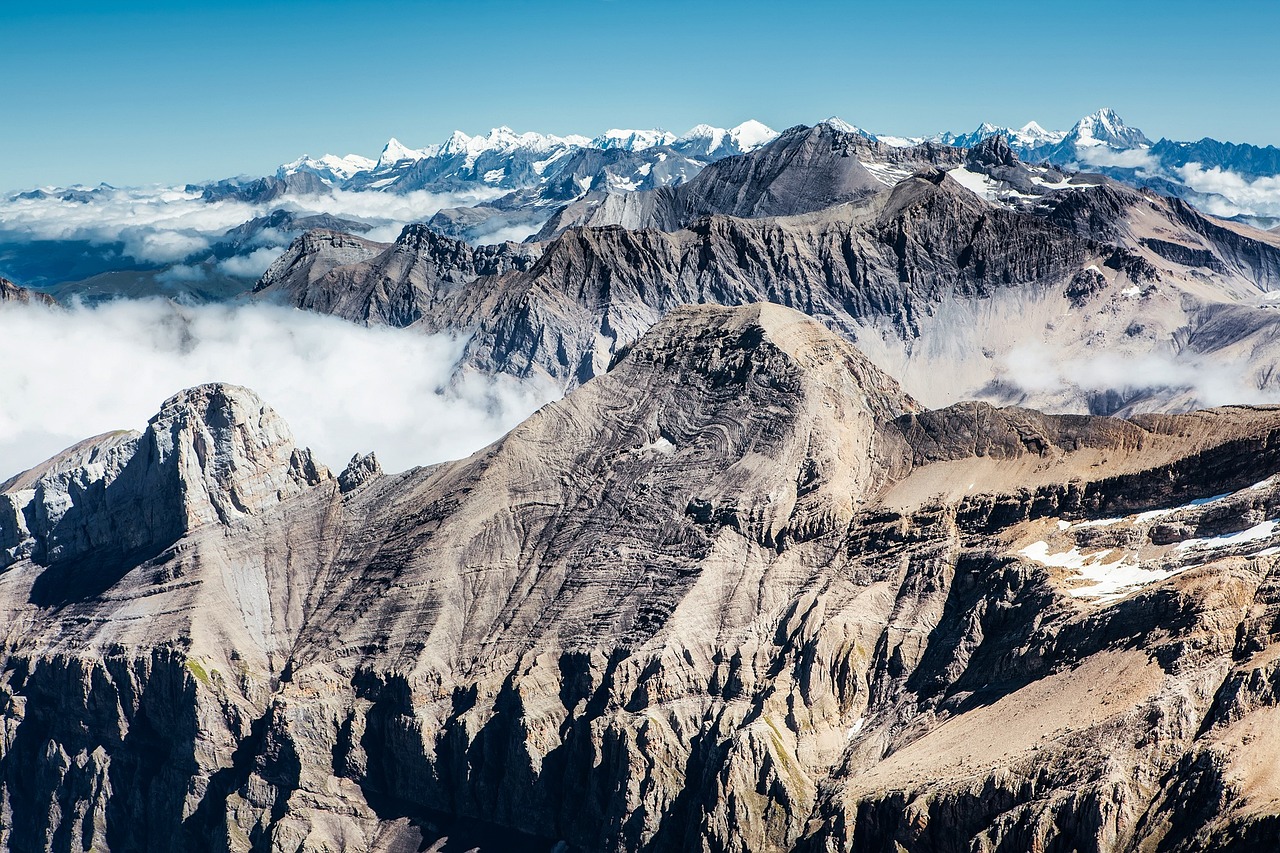
Another critical aspect is the monitoring of glacial retreat. Glaciers are sensitive indicators of climate change, and their melting can have profound impacts on sea levels and freshwater availability. Remote sensing technology, such as synthetic aperture radar (SAR), allows researchers to track changes in glacier thickness and extent over time. This information is vital for predicting future sea-level rise and assessing the potential impacts on coastal communities.
Moreover, remote sensing is instrumental in monitoring changes in land cover and vegetation, which are essential for understanding carbon sequestration and greenhouse gas emissions. By analyzing satellite imagery, scientists can assess the health of forests, grasslands, and wetlands, which play a significant role in absorbing carbon dioxide from the atmosphere. This data can help inform conservation efforts and land management practices aimed at mitigating climate change.
To summarize, remote sensing is an invaluable tool in climate change monitoring. It enables scientists to:
- Track temperature changes over time.
- Monitor glacial retreat and its implications for sea-level rise.
- Assess land cover changes and their impact on carbon sequestration.
As we continue to face the challenges posed by climate change, leveraging remote sensing technology will be crucial in our efforts to understand and combat its effects. With ongoing advancements in satellite technology and data analysis techniques, the future of climate monitoring looks promising. We can gather more precise data, allowing us to make informed decisions and take effective action to protect our planet.
Q1: How does remote sensing help in climate change monitoring?
A1: Remote sensing helps by providing data on temperature changes, land cover alterations, and glacial retreat, which are essential for understanding climate dynamics.
Q2: What types of sensors are used in remote sensing for climate studies?
A2: Various sensors, including thermal infrared sensors and synthetic aperture radar (SAR), are used to collect data on different aspects of the Earth's surface.
Q3: Why is monitoring glacial retreat important?
A3: Monitoring glacial retreat is important because it provides insights into sea-level rise and the availability of freshwater resources, which can significantly impact coastal communities.
Q4: Can remote sensing data inform conservation efforts?
A4: Yes, remote sensing data can help assess the health of ecosystems, guiding conservation efforts and land management practices aimed at mitigating climate change.

Disaster Management Strategies
When it comes to disaster management, remote sensing technology is like having a superhero in your toolkit. Imagine being able to see the world from above, capturing real-time data that can save lives and resources. Remote sensing provides crucial information that helps in assessing damage, planning effective response strategies, and ultimately enhancing resilience against natural disasters. With the ability to monitor changes in the environment quickly, this technology plays a pivotal role in disaster preparedness and response.
One of the most significant advantages of using remote sensing in disaster management is its ability to provide timely and accurate information. For instance, during a natural disaster such as a hurricane or flood, satellite imagery can be analyzed to assess the extent of the damage. This data can be invaluable for emergency responders and government agencies as they coordinate their efforts to assist affected communities. The speed at which data can be gathered and analyzed means that decisions can be made faster, potentially saving lives.
Moreover, remote sensing can help in the pre-disaster phase by identifying areas at risk. By analyzing historical data and current environmental conditions, authorities can pinpoint regions that are more susceptible to disasters like landslides, wildfires, or flooding. This proactive approach allows for better resource allocation and preparedness strategies. For example, if a region is identified as being prone to flooding, authorities can implement measures such as building levees or creating drainage systems to mitigate the impact.
In the aftermath of a disaster, remote sensing continues to play a vital role. The data collected can be used to create detailed maps that show the extent of damage, which is essential for recovery efforts. This information can guide funding and resource distribution, ensuring that aid reaches those who need it most. For example, after a wildfire, satellite imagery can help assess which areas have been affected, allowing for targeted reforestation efforts and habitat restoration.
To illustrate the effectiveness of remote sensing in disaster management, consider the following table that summarizes key applications:
| Application | Description |
|---|---|
| Damage Assessment | Using satellite imagery to evaluate the extent of destruction post-disaster. |
| Risk Mapping | Identifying vulnerable areas to prioritize disaster preparedness efforts. |
| Resource Allocation | Guiding the distribution of aid and resources based on damage assessments. |
| Monitoring Recovery | Tracking the progress of recovery and reconstruction efforts over time. |
Additionally, remote sensing can facilitate communication and coordination among various agencies involved in disaster response. By providing a common platform for data sharing, different organizations can work together more effectively. This collaboration is critical during large-scale disasters where multiple entities are involved in the response efforts.
Ultimately, the integration of remote sensing into disaster management strategies represents a significant advancement in our ability to prepare for and respond to natural disasters. As technology continues to evolve, we can expect even more sophisticated applications that will enhance our resilience and ability to protect communities. So, the next time you think about disaster management, remember that remote sensing is not just a tool; it’s a game changer.
- What is remote sensing? Remote sensing is the process of collecting data about an object or area from a distance, typically using satellites or aircraft.
- How does remote sensing help in disaster management? It provides timely data for damage assessment, risk mapping, and resource allocation, which are essential for effective disaster response.
- Can remote sensing predict natural disasters? While it cannot predict disasters with absolute certainty, it can identify areas at risk and monitor conditions that may lead to disasters.
- What types of data can be collected through remote sensing? Remote sensing can gather various types of data, including imagery, temperature readings, and vegetation health indicators.
Frequently Asked Questions
- What is remote sensing?
Remote sensing is a technology that involves collecting data about the Earth's surface from a distance, typically using satellites or aircraft. It allows researchers to gather information without being in direct contact with the area being studied, making it incredibly useful for monitoring environmental changes.
- How is remote sensing used in environmental studies?
Remote sensing is used in environmental studies to monitor and manage natural resources effectively. It helps in tracking land use changes, assessing crop health, detecting climate change impacts, and managing disaster response efforts. By providing timely and accurate data, it supports informed decision-making for sustainable resource management.
- What are the benefits of using remote sensing for land use monitoring?
The benefits of using remote sensing for land use monitoring include the ability to cover large areas quickly, provide historical data for trend analysis, and detect changes over time. It allows researchers to analyze urban development, agricultural expansion, and deforestation, helping to identify patterns and make predictions about future land use.
- What challenges are associated with urban monitoring through remote sensing?
While remote sensing offers many advantages, there are challenges such as data accuracy, resolution limitations, and the complexity of analyzing large datasets. These factors can affect the reliability of the information gathered, making it essential for researchers to use advanced analytical techniques to overcome these challenges.
- Can remote sensing help in climate change monitoring?
Absolutely! Remote sensing is crucial for tracking climate-related changes. It provides valuable data on temperature fluctuations, sea-level rise, and glacial retreat, which are essential for understanding the impacts of climate change and informing climate studies.
- How does remote sensing aid in disaster management?
Remote sensing aids disaster management by offering timely information that can be used to assess damage, plan response efforts, and enhance resilience against natural disasters. Satellite imagery plays a vital role in monitoring the aftermath of events like hurricanes, floods, and wildfires, ensuring effective and efficient emergency responses.