How Technology is Redefining Climate Science
In today's rapidly changing world, technology is not just a tool; it's a game-changer in the field of climate science. Gone are the days when scientists relied solely on traditional methods to gather data and analyze climate patterns. Instead, we are witnessing a revolution fueled by innovative technologies that enhance our understanding of the climate crisis. Imagine being able to monitor the Earth's atmosphere in real-time or analyze vast datasets at lightning speed—this is not science fiction; it's the reality we live in today. The integration of cutting-edge technologies is reshaping how we approach climate change, making our responses more informed and effective. From sophisticated data collection techniques to advanced modeling and public engagement, technology is paving the way for a more sustainable future.
Advancements in technology have revolutionized data collection methods, allowing scientists to gather more accurate and comprehensive information about climate patterns and changes. This shift is significant because it leads to better-informed decisions and strategies. For instance, traditional weather stations have limitations, but with new technologies, we can deploy sensors in diverse environments, from urban areas to remote forests. These sensors collect data on temperature, humidity, and atmospheric pressure, providing a wealth of information that was previously unreachable.
Moreover, the use of mobile applications and citizen science initiatives has empowered individuals to contribute to data collection. Imagine thousands of volunteers using their smartphones to report local weather conditions or document wildlife sightings. This grassroots approach not only enriches the data pool but also fosters a sense of community involvement in climate science.
Remote sensing technology and satellites play a crucial role in monitoring climate variables. They provide real-time data on atmospheric conditions, land use changes, and environmental impacts, which are essential for effective climate research. For example, satellites can track deforestation rates across the Amazon rainforest or monitor ice melt in the Arctic, offering insights that are vital for understanding global climate trends.
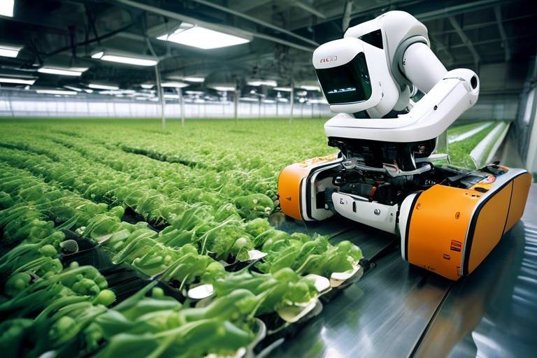
Drones are increasingly utilized in climate studies, offering a cost-effective means to collect high-resolution data in hard-to-reach areas. These flying machines are like modern-day explorers, capturing images and data that enhance our understanding of ecosystems and their responses to climate change. Whether it’s surveying a forest canopy or assessing damage after a natural disaster, drones provide a unique vantage point that traditional methods simply cannot match.
Drones are particularly effective in monitoring forest health. They can assess deforestation rates and track carbon storage, providing vital information for conservation efforts and climate mitigation strategies. For instance, by analyzing drone imagery, scientists can identify areas of illegal logging and take necessary action to protect these vital ecosystems.
In coastal and marine environments, drones help researchers monitor changes in water quality, habitat loss, and marine biodiversity. This technology contributes to a more comprehensive understanding of climate impacts on these ecosystems. By gathering data on coral reef health or tracking sea level rise, drones play a pivotal role in informing conservation efforts.
Technological innovations in computational power and algorithms have significantly improved climate modeling. Scientists can now simulate future climate scenarios with greater accuracy and detail, which is crucial for informing policy and adaptation strategies. With the ability to analyze complex interactions between various climate factors, these models provide a clearer picture of potential outcomes and help decision-makers plan accordingly.
The integration of big data analytics in climate science allows researchers to analyze vast datasets, uncovering trends and correlations that enhance our understanding of climate dynamics. This capability is akin to finding a needle in a haystack, where the needle represents critical insights that can guide our response to climate change. By employing sophisticated algorithms, scientists can identify patterns that may not be immediately obvious, leading to more effective strategies for mitigation and adaptation.
Machine learning techniques are being employed to predict climate patterns and assess risks, providing valuable insights that can guide mitigation and adaptation efforts in the face of climate change. These algorithms can analyze historical data and forecast future climate scenarios, helping us prepare for the unexpected.
Advanced data visualization tools facilitate the effective communication of complex climate data. By transforming raw data into engaging graphics and interactive maps, these tools make it accessible to policymakers and the public. This accessibility fosters greater awareness and engagement in climate action initiatives, empowering individuals and communities to take part in the fight against climate change.
Technology plays a pivotal role in increasing public awareness and engagement in climate science. Utilizing social media, mobile applications, and interactive platforms, information is disseminated widely, encouraging community involvement in climate initiatives. Imagine scrolling through your social media feed and coming across a campaign urging you to reduce your carbon footprint—this is the power of technology in action.
Citizen science projects leverage technology to involve the public in data collection and monitoring. This not only empowers individuals to contribute to climate research but also fosters a sense of responsibility towards environmental stewardship. When people see their efforts making a difference, it ignites a passion for protecting our planet.
Educational technologies are enhancing climate literacy by providing interactive learning experiences. These tools enable individuals to understand climate science concepts and the importance of sustainable practices in addressing climate change. With engaging content and gamified learning experiences, technology is making climate education more accessible and enjoyable.
- How is technology helping in climate data collection?
Technology allows for real-time data collection through sensors, satellites, and drones, providing more accurate and comprehensive information about climate patterns. - What role do drones play in climate research?
Drones collect high-resolution data in hard-to-reach areas, enhancing our understanding of ecosystems and their responses to climate change. - How does big data analytics contribute to climate science?
Big data analytics helps researchers uncover trends and correlations in vast datasets, leading to better-informed climate strategies.

Innovative Data Collection Techniques
Advancements in technology have revolutionized the way scientists collect data, bringing a wave of innovation that enhances our understanding of climate change. Imagine a world where data is collected not just from the ground but also from the skies, oceans, and even the depths of the forests. This is no longer a dream but a reality. Innovative data collection techniques are enabling researchers to gather more accurate and comprehensive information about climate patterns, leading to better-informed decisions and strategies.
One of the most exciting developments in this arena is the use of automated sensors. These devices can be deployed in various environments, from remote mountain ranges to bustling urban areas, continuously collecting data on temperature, humidity, and atmospheric pressure. This constant flow of information allows scientists to build a more detailed picture of how climate variables interact over time. For instance, sensors placed in forests can provide real-time data on tree health, which is crucial for understanding how these vital ecosystems respond to climate stressors.
Furthermore, the incorporation of mobile technology has made data collection more accessible than ever. Researchers can now use smartphones and tablets to gather data in the field, utilizing apps designed for specific climate studies. This not only speeds up the process but also allows for greater participation from citizen scientists who can contribute valuable observations from their local environments. The integration of Geographic Information Systems (GIS) has also transformed data collection, enabling scientists to visualize complex data sets in a spatial context, revealing patterns and trends that might go unnoticed in traditional analysis.
To illustrate the impact of these innovative techniques, consider the following table that summarizes various data collection methods and their applications:
| Data Collection Method | Application | Benefits |
|---|---|---|
| Automated Sensors | Monitoring atmospheric conditions | Real-time data collection |
| Drones | Forest and ecosystem monitoring | Access to hard-to-reach areas |
| Mobile Apps | Citizen science data collection | Increased public engagement |
| GIS Technology | Spatial analysis of climate data | Enhanced visualization of trends |
These innovative data collection techniques not only enhance the quality of research but also foster collaboration between scientists and the public. By leveraging technology, we can create a more robust understanding of climate dynamics, equipping policymakers and communities with the necessary tools to tackle climate change effectively. As we move forward, the integration of these advanced methods will be crucial in shaping our response to one of the greatest challenges of our time.

Remote Sensing and Satellite Technology
Remote sensing technology and satellites have fundamentally transformed the way we monitor and understand our planet's climate. Imagine having a bird's-eye view of the Earth, capturing data from thousands of miles above. This is what satellites do—they provide a comprehensive perspective that ground-based observations simply can't match. With the aid of advanced sensors, these technological marvels collect vast amounts of data about atmospheric conditions, land use changes, and environmental impacts. This real-time data is crucial for effective climate research, as it allows scientists to track changes over time, identify trends, and make informed decisions.
One of the most significant advantages of satellite technology is its ability to cover large areas quickly and efficiently. For instance, satellites can monitor deforestation in the Amazon rainforest or track melting ice caps in the Arctic with remarkable precision. This capability not only enhances our understanding of climate change but also aids in the development of strategies to combat its effects. The data collected through remote sensing is invaluable for creating models that predict future climate scenarios, which can help policymakers formulate effective environmental regulations.
Moreover, the integration of satellite data with ground-based observations creates a powerful synergy that enhances the accuracy of climate models. By combining these two sources of information, researchers can calibrate their models more effectively, leading to improved predictions. For example, NASA's Earth Observing System Data and Information System (EOSDIS) provides a wealth of satellite data that is freely accessible to researchers and the public alike. This open-access approach fosters collaboration and innovation in climate science, enabling a broader range of stakeholders to contribute to our understanding of climate dynamics.
To illustrate the impact of remote sensing and satellite technology, consider the following table that highlights some key applications:
| Application | Description | Benefits |
|---|---|---|
| Atmospheric Monitoring | Tracking greenhouse gas concentrations and air quality | Informs policy decisions and public health initiatives |
| Land Use Change Detection | Monitoring urban expansion and agricultural practices | Helps in sustainable land management |
| Disaster Response | Assessing damage from natural disasters like hurricanes and floods | Facilitates timely humanitarian aid and recovery efforts |
In conclusion, remote sensing and satellite technology are not just tools for scientists; they are essential instruments in the fight against climate change. By providing real-time data and insights, these technologies empower researchers, policymakers, and the public to take meaningful action. As we continue to innovate and refine these technologies, the potential for understanding and addressing climate change becomes even greater, paving the way for a more sustainable future.
- What is remote sensing? Remote sensing refers to the acquisition of information about an object or area from a distance, typically using satellites or aircraft.
- How do satellites help in climate research? Satellites provide real-time data on various climate variables, such as temperature, humidity, and vegetation cover, which is essential for monitoring climate change.
- Can anyone access satellite data? Yes, many satellite data sources are publicly available, allowing researchers and the public to utilize this information for various applications.

Impact of Drones in Climate Research
In recent years, the advent of drones has brought a seismic shift in how scientists approach climate research. These unmanned aerial vehicles (UAVs) are not just toys for tech enthusiasts; they are becoming indispensable tools for researchers who need to gather data from hard-to-reach areas. Imagine trying to study a remote forest or a coastal ecosystem—traditional methods often involve cumbersome equipment and extensive manpower. Drones, however, can swoop in, capturing high-resolution images and data with remarkable ease.
One of the most exciting aspects of using drones in climate research is their ability to collect data over large areas quickly. For instance, a drone can cover several square kilometers in a fraction of the time it would take a team of researchers on foot. This efficiency translates into more comprehensive data collection, allowing scientists to monitor changes in ecosystems and climate variables with unprecedented precision.
Moreover, drones can be equipped with various sensors and cameras that enable them to gather diverse types of data. These include:
- Thermal Imaging - Helps in assessing heat variations in different environments.
- Multispectral Cameras - Useful for analyzing vegetation health and land use changes.
- Lidar Technology - Enables detailed topographical mapping and forest structure analysis.
This versatility makes drones particularly effective in several key areas of climate research. For example, in forest monitoring, drones can assess tree health and track deforestation rates, providing vital information for conservation efforts. Imagine a drone flying over a forest, capturing images that reveal not just the number of trees but their health and growth patterns. This data is crucial for understanding how forests contribute to carbon storage and climate mitigation strategies.
In addition to terrestrial studies, drones are also making waves in coastal and marine research. They can monitor water quality, track changes in habitat, and assess marine biodiversity. Picture a drone gliding over a coastal area, collecting data on water temperature and salinity, which are essential for understanding the impacts of climate change on marine ecosystems. This real-time data can inform conservation strategies and help protect vulnerable marine species.
As we continue to grapple with the challenges posed by climate change, the role of drones in climate research will undoubtedly expand. They offer a cost-effective, efficient, and innovative way to gather data that can lead to better-informed decisions and strategies. By harnessing the power of drones, scientists can gain deeper insights into our planet's changing climate, paving the way for more effective responses to environmental challenges.
Q: How do drones collect data for climate research?
A: Drones are equipped with various sensors and cameras that can capture high-resolution images, thermal data, and other environmental metrics. This data is then analyzed to monitor changes in ecosystems and climate variables.
Q: Are drones safe to use in remote areas?
A: Yes, drones are generally safe to use, and their ability to operate in hard-to-reach areas minimizes risks to researchers. They can gather data without disturbing wildlife or the natural environment.
Q: What types of data can drones provide?
A: Drones can provide a wide range of data, including thermal images, multispectral data for vegetation analysis, and detailed topographical maps using Lidar technology.
Q: How do drones contribute to conservation efforts?
A: By providing accurate and timely data on ecosystems, drones help scientists track changes in biodiversity, monitor deforestation, and assess the health of natural habitats, all of which are crucial for effective conservation strategies.

Applications in Forest Monitoring
When it comes to understanding our planet's forests, technology has truly become a game changer. Drones, equipped with advanced sensors and cameras, are now at the forefront of forest monitoring, providing researchers with capabilities that were once thought to be science fiction. Imagine soaring above dense canopies, capturing high-resolution images that reveal the health of trees, the extent of deforestation, and even the intricate web of biodiversity that thrives beneath the leaves. This innovative approach not only enhances data collection but also transforms how we perceive and interact with forest ecosystems.
One of the most significant advantages of using drones in forest monitoring is their ability to access hard-to-reach areas. Traditional methods often involve labor-intensive ground surveys, which can be costly and time-consuming. Drones, on the other hand, can quickly cover large areas, providing a comprehensive overview of forest conditions in a fraction of the time. This efficiency allows scientists to monitor changes in forest health, track carbon storage, and assess the impacts of climate change more effectively.
Furthermore, drones can be equipped with various sensors, such as LiDAR (Light Detection and Ranging), which can penetrate the forest canopy to gather data on tree height, biomass, and structure. This information is crucial for understanding the role forests play in carbon sequestration and their overall contribution to mitigating climate change. By continuously monitoring these variables, researchers can identify trends and make informed decisions regarding conservation efforts.
To illustrate the impact of drone technology in forest monitoring, consider the following applications:
- Deforestation Tracking: Drones can provide real-time data on deforestation rates, enabling timely interventions and policy-making.
- Wildlife Habitat Assessment: By observing wildlife movements and habitat conditions, drones help in understanding the ecological balance within forests.
- Forest Fire Detection: Equipped with thermal imaging, drones can quickly identify hotspots, allowing for faster response times to forest fires.
In conclusion, the integration of drone technology in forest monitoring is not just a trend; it represents a significant leap forward in our ability to protect and manage our vital forest resources. As we continue to face the challenges posed by climate change, these technological advancements provide us with the tools necessary to safeguard the future of our forests. By harnessing the power of drones, we can enhance our understanding of forest ecosystems and ensure their resilience for generations to come.
1. How do drones improve forest monitoring compared to traditional methods?
Drones can cover larger areas quickly and provide high-resolution images and data, making them more efficient than ground surveys.
2. What types of sensors can be used on drones for forest monitoring?
Drones can be equipped with various sensors, including LiDAR, thermal imaging, and multispectral cameras, to gather different types of data.
3. How does drone technology contribute to carbon tracking in forests?
By measuring tree height and biomass, drones help estimate the carbon storage capacity of forests, which is crucial for climate change mitigation.
4. Are there any limitations to using drones in forest monitoring?
Yes, limitations include regulatory restrictions, battery life, and the need for skilled operators to analyze the data collected.

Coastal and Marine Studies
In the realm of climate research, have emerged as critical areas of focus, particularly as the impacts of climate change become more pronounced in these vulnerable ecosystems. With the help of drones and advanced monitoring technologies, researchers are now able to gather invaluable data that was previously difficult to obtain. Imagine being able to fly over a coral reef or a coastal marshland, capturing high-resolution images and data in real-time. This capability not only enhances our understanding of these environments but also allows scientists to detect changes that may indicate broader shifts in the climate.
The use of drones in marine studies provides several advantages:
- Accessibility: Drones can reach remote or difficult-to-access areas, allowing for comprehensive surveys of coastlines and marine habitats.
- Cost-effectiveness: Compared to traditional methods such as manned aircraft or boats, drones significantly reduce costs while still providing high-quality data.
- Real-time monitoring: The ability to gather and analyze data on the spot enables rapid responses to emerging environmental issues.
For instance, researchers can utilize drones to monitor changes in water quality, which is vital for understanding the health of marine ecosystems. Parameters such as temperature, salinity, and pollutant levels can be assessed quickly and efficiently. This immediate feedback loop is essential for tracking the impacts of climate change on marine biodiversity, including shifts in species distribution and the health of coral reefs.
Furthermore, the integration of drone technology in coastal studies allows scientists to observe habitat loss and restoration efforts over time. By capturing aerial footage and data, researchers can create detailed maps that reveal how coastal areas are evolving in response to rising sea levels and increased storm activity. This information is crucial for developing effective conservation strategies and informing policy decisions aimed at protecting these vital ecosystems.
Ultimately, the insights gained from coastal and marine studies not only enhance our scientific understanding but also engage local communities and policymakers. By sharing this data through interactive platforms and visualizations, we can foster a greater appreciation for the importance of these ecosystems and the urgent need for climate action. As technology continues to evolve, so too will our ability to monitor and protect our coastlines and marine environments in the face of climate change.
- What role do drones play in climate research?
Drones provide a cost-effective method for collecting high-resolution data in remote areas, enhancing our understanding of ecosystems affected by climate change. - How does technology improve data collection in coastal studies?
Technology allows for real-time monitoring and analysis of water quality, habitat changes, and biodiversity, leading to better-informed conservation strategies. - Why are coastal and marine studies important?
These studies help us understand the impacts of climate change on vulnerable ecosystems, which is crucial for developing effective policies and conservation efforts.

Advancements in Climate Modeling
In recent years, the field of climate modeling has experienced a remarkable transformation, thanks to the rapid advancements in technology. These innovations have not only improved the accuracy of climate predictions but also enhanced our understanding of complex climate systems. Imagine trying to predict the weather without a reliable map—this is akin to climate scientists working with outdated models. Fortunately, the latest computational power and sophisticated algorithms have provided them with the tools they need to create detailed and dynamic climate models.
One of the most significant breakthroughs in climate modeling is the development of high-resolution models. These models utilize vast amounts of data from various sources, including satellite observations and ground-based measurements, to simulate climate conditions on a much finer scale. This allows researchers to analyze localized climate phenomena, such as urban heat islands or the effects of deforestation on regional climates, which were previously difficult to assess.
Moreover, advancements in machine learning have revolutionized the way scientists approach climate data. By employing algorithms that can learn from and make predictions based on historical data, researchers can identify patterns and trends that were once hidden in the noise. For example, machine learning can help predict extreme weather events, such as hurricanes or heatwaves, by analyzing past occurrences and their associated climatic conditions.
Another exciting development is the integration of ensemble modeling. This approach involves running multiple simulations with slightly varied initial conditions to capture a range of possible future scenarios. By aggregating the results, scientists can provide a more comprehensive outlook on potential climate outcomes. This method is akin to tossing a coin several times to understand the likelihood of heads versus tails; it gives a clearer picture of uncertainty and risk associated with climate change.
To illustrate the impact of these advancements, consider the following table that highlights key improvements in climate modeling:
| Advancement | Description | Impact on Climate Science |
|---|---|---|
| High-Resolution Models | Models that simulate climate at a finer scale | Better understanding of localized climate phenomena |
| Machine Learning | Algorithms that predict trends based on historical data | Enhanced ability to forecast extreme weather events |
| Ensemble Modeling | Multiple simulations to account for variability | Improved risk assessment and uncertainty quantification |
These advancements not only enhance the scientific community's ability to predict climate change impacts but also play a crucial role in informing policymakers and stakeholders. With more accurate models, decision-makers can devise effective strategies to mitigate climate risks and adapt to changing conditions. It's like having a detailed road map when navigating through a stormy sea—knowing where to steer can significantly reduce the chances of capsizing.
As we continue to refine our climate models, it becomes increasingly clear that technology is a powerful ally in the fight against climate change. The combination of improved data collection, advanced computational techniques, and innovative modeling strategies is paving the way for a deeper understanding of our planet's climate system. This knowledge is essential for developing effective responses to the pressing challenges posed by climate change.
- What are climate models? Climate models are mathematical representations of the Earth's climate system that simulate interactions between the atmosphere, oceans, land surface, and ice.
- How do advancements in technology improve climate modeling? Technology enhances climate modeling by providing more data, increasing computational power, and enabling sophisticated algorithms that can analyze complex interactions.
- Why is machine learning important in climate science? Machine learning helps identify patterns in large datasets, improving the accuracy of climate predictions and enabling better risk assessments.
- What is ensemble modeling? Ensemble modeling involves running multiple simulations to capture a range of possible climate scenarios, which helps quantify uncertainty in predictions.

Big Data and Climate Analytics
The integration of big data analytics into climate science is nothing short of revolutionary. Imagine having access to an ocean of data that flows in from various sources—satellites, ground sensors, weather stations, and even social media. This wealth of information enables researchers to dive deep into the complexities of our climate systems, uncovering trends that were previously hidden beneath the surface. With the ability to analyze vast datasets, scientists can now identify correlations between human activities and climate phenomena, leading to more informed decisions regarding climate action.
One of the most significant advantages of big data in climate analytics is its ability to enhance predictive capabilities. For instance, by analyzing historical climate data alongside current variables, researchers can create sophisticated models that forecast future climate scenarios. This predictive power is crucial for policymakers who need to develop strategies that mitigate the impacts of climate change. It's like having a crystal ball that provides insights into potential futures, allowing us to prepare and adapt accordingly.
Moreover, big data analytics empowers scientists to focus on specific areas of concern. For example, they can analyze data related to extreme weather events, such as hurricanes and droughts, to understand their frequency and intensity. By doing so, they can help communities better prepare for these events, saving lives and reducing economic losses. The ability to visualize these data trends is equally important. Advanced data visualization tools allow researchers to present complex information in a more digestible format, making it easier for stakeholders to grasp the urgency of climate issues.
To illustrate the impact of big data on climate analytics, consider the following table that outlines key applications:
| Application | Description | Benefits |
|---|---|---|
| Weather Prediction | Utilizes historical data to forecast weather patterns. | Improved accuracy in predicting extreme weather events. |
| Carbon Emission Tracking | Analyzes emissions data from various sectors. | Informs policy decisions and reduction strategies. |
| Climate Impact Assessments | Evaluates the effects of climate change on ecosystems. | Guides conservation efforts and resource management. |
In addition to these applications, the role of machine learning in climate analytics cannot be overstated. By employing machine learning algorithms, researchers can sift through mountains of data to detect patterns and anomalies that traditional methods might overlook. This technology acts as a powerful ally in the fight against climate change, enabling scientists to develop more effective mitigation and adaptation strategies.
Ultimately, big data is not just a tool; it is a catalyst for change. It empowers scientists, policymakers, and the general public to understand the intricate web of climate dynamics. As we harness the potential of big data analytics, we move closer to a future where informed decisions can lead to meaningful climate action, ensuring a sustainable planet for generations to come.
- What is big data in climate science? Big data refers to the vast amounts of information collected from various sources related to climate, which can be analyzed to uncover trends and inform decision-making.
- How does big data improve climate predictions? By analyzing historical and current data, scientists can create models that forecast future climate scenarios with greater accuracy.
- What role does machine learning play in climate analytics? Machine learning helps identify patterns in large datasets, enhancing the ability to predict climate changes and assess risks.

Machine Learning Applications
In the realm of climate science, machine learning has emerged as a groundbreaking tool, transforming how researchers analyze complex datasets and predict climate patterns. Imagine having the ability to sift through mountains of data in mere seconds, identifying trends and anomalies that would take humans years to uncover. This is precisely what machine learning offers—an unprecedented capacity to process and analyze information at lightning speed.
One of the most significant applications of machine learning in climate science is its role in predictive modeling. By utilizing algorithms that learn from historical climate data, scientists can forecast future climate scenarios with remarkable accuracy. For instance, machine learning models can predict temperature fluctuations, precipitation patterns, and even extreme weather events, providing critical insights that help policymakers prepare and respond effectively.
Moreover, machine learning is instrumental in assessing climate-related risks. By analyzing various factors—such as geographical data, socio-economic conditions, and historical climate events—these models can evaluate the vulnerability of different regions to climate impacts. This information is vital for developing targeted adaptation strategies, ensuring that resources are allocated efficiently to mitigate risks.
Another fascinating application lies in the realm of carbon footprint analysis. Machine learning algorithms can analyze data from various sectors, including transportation, energy consumption, and industrial activities, to estimate carbon emissions. This allows governments and organizations to identify high-emission areas and implement strategies to reduce their carbon footprint, ultimately contributing to climate change mitigation efforts.
In addition to predictive modeling and risk assessment, machine learning also enhances our understanding of ecosystem dynamics. By analyzing data from satellite imagery and ground sensors, researchers can monitor changes in ecosystems in real-time. This capability is crucial for tracking biodiversity loss, deforestation rates, and habitat degradation, enabling timely interventions to protect vulnerable ecosystems.
To illustrate the impact of machine learning in climate science, consider the following table that summarizes key applications:
| Application | Description | Impact |
|---|---|---|
| Predictive Modeling | Forecasting future climate scenarios based on historical data. | Informs policy and preparedness for climate events. |
| Risk Assessment | Evaluating vulnerability of regions to climate impacts. | Guides targeted adaptation strategies. |
| Carbon Footprint Analysis | Estimating emissions from various sectors. | Identifies reduction opportunities for sustainability. |
| Ecosystem Monitoring | Tracking changes in ecosystems via satellite and sensor data. | Facilitates timely conservation efforts. |
In conclusion, the integration of machine learning in climate science is not just a trend; it is a revolution that empowers researchers to make data-driven decisions. As technology continues to evolve, the potential for machine learning applications in addressing climate change will only expand, paving the way for innovative solutions and more resilient ecosystems.
- What is machine learning? Machine learning is a subset of artificial intelligence that enables systems to learn from data and improve their performance over time without being explicitly programmed.
- How does machine learning help in climate science? It helps by analyzing large datasets to identify patterns, predict future climate scenarios, assess risks, and monitor ecosystem changes.
- Can machine learning predict extreme weather events? Yes, machine learning models can analyze historical data to forecast extreme weather events, aiding in preparedness and response efforts.
- What are the limitations of machine learning in climate science? While powerful, machine learning models can be limited by the quality and quantity of data available, and they may not always capture the complexity of climate systems.

Data Visualization Tools
In the realm of climate science, have emerged as a game-changer, turning complex datasets into understandable and actionable insights. Imagine trying to decipher a massive spreadsheet filled with numbers; it can be overwhelming, right? Now, picture that same data transformed into vibrant graphs, interactive maps, and engaging infographics. This transformation is crucial, as it allows scientists, policymakers, and the public to grasp the implications of climate data at a glance.
One of the most significant advantages of these tools is their ability to convey trends and patterns that might otherwise go unnoticed. For instance, a simple line graph can illustrate rising global temperatures over decades, while a heat map can reveal areas most affected by climate change. By using these visual aids, we can not only see the data but also understand the story it tells. This clarity is essential for driving informed discussions and decisions regarding climate action.
Moreover, many of these visualization tools come equipped with interactive features that allow users to manipulate the data themselves. For example, platforms like NOAA's Climate.gov provide users with the ability to explore climate data across various parameters, such as time frames and geographical regions. This interactivity fosters a deeper engagement with the material and encourages users to ask questions and seek answers.
Furthermore, the integration of storytelling with data visualization has proven effective in communicating the urgency of climate issues. By weaving narratives around the data, scientists can make their findings more relatable and compelling. For instance, a visualization that tracks the decline of polar bear populations alongside melting ice caps not only presents the data but also evokes an emotional response that can motivate action.
To illustrate the impact of these tools, consider the following table that highlights some popular data visualization platforms used in climate science:
| Tool Name | Description | Key Features |
|---|---|---|
| Tableau | A powerful data visualization software that allows users to create interactive and shareable dashboards. | Drag-and-drop interface, real-time data updates, and extensive sharing options. |
| ArcGIS | A geographic information system that enables users to analyze spatial data and create maps. | Spatial analysis tools, 3D visualization, and integration with various datasets. |
| Google Earth Engine | A cloud-based platform for planetary-scale environmental data analysis. | Access to a vast archive of satellite imagery and geospatial data, with powerful analysis capabilities. |
| R and ggplot2 | A programming language and package for statistical computing and graphics. | Customizable visualizations and extensive data manipulation capabilities. |
As we continue to confront the challenges posed by climate change, the role of data visualization tools cannot be overstated. They not only enhance our understanding but also empower us to communicate effectively with various stakeholders. In a world where every action counts, these tools are essential in rallying support and driving meaningful change.
- What are data visualization tools? Data visualization tools are software applications that help users create visual representations of data, making complex information easier to understand.
- Why are data visualization tools important in climate science? They help convey complex climate data in an accessible manner, facilitating better understanding and informed decision-making.
- Can I use data visualization tools without technical skills? Many modern tools are designed to be user-friendly, allowing individuals without technical skills to create effective visualizations.

Public Engagement Through Technology
In today's digital age, technology is not just reshaping how we gather and analyze climate data; it's also transforming the way we engage the public in climate science. Gone are the days when climate change was a topic reserved for scientists and policymakers. Now, with the power of the internet and mobile technology, everyone has a role to play in understanding and combating climate change. This shift has led to a surge in public awareness and involvement, making it essential for communities to embrace innovative tools that facilitate this engagement.
Social media platforms have become vital channels for disseminating information about climate issues. With a simple tweet or a Facebook post, organizations can reach millions, sharing important updates, research findings, and calls to action. These platforms not only spread awareness but also foster discussions, allowing individuals to share their thoughts and experiences related to climate change. For instance, hashtags like #ClimateAction and #FridaysForFuture have mobilized people worldwide, demonstrating the collective power of the public when equipped with the right tools.
Mobile applications have also emerged as powerful allies in the fight against climate change. From tracking personal carbon footprints to providing real-time updates on local environmental initiatives, these apps empower users to make informed decisions and take action in their daily lives. For example, apps like Oroeco help individuals understand how their lifestyle choices impact the environment, encouraging more sustainable habits. This kind of engagement is crucial as it turns awareness into action, allowing users to feel a direct connection to the climate issues at hand.
Moreover, interactive platforms are revolutionizing the way communities participate in climate initiatives. Websites and applications that facilitate citizen science projects empower individuals to contribute to climate research. By collecting data on local wildlife, weather patterns, or pollution levels, everyday citizens can play a significant role in advancing scientific understanding. This not only enhances the data available to researchers but also fosters a sense of ownership and responsibility among participants. Citizen science is a perfect example of how technology can bridge the gap between experts and the public, creating an inclusive approach to climate action.
To further illustrate the impact of technology on public engagement, consider the following table that highlights various tools and their contributions:
| Technology Tool | Contribution to Climate Engagement |
|---|---|
| Social Media | Spreads awareness and fosters discussions on climate issues. |
| Mobile Applications | Tracks personal impact and encourages sustainable practices. |
| Interactive Platforms | Facilitates citizen science and community involvement in research. |
In addition to these tools, educational technologies are playing a crucial role in enhancing climate literacy. Online courses, webinars, and interactive simulations allow individuals to dive deeper into climate science concepts. These resources are not just for students; they are accessible to anyone eager to learn. By breaking down complex topics into digestible formats, educational technologies make it easier for the public to grasp the urgency of climate action and the significance of their contributions.
As we move forward, the challenge lies in ensuring that these technological advancements reach all corners of society. Bridging the digital divide is essential to guarantee that everyone, regardless of their background or access to resources, can participate in climate discussions and initiatives. By creating inclusive platforms that cater to diverse audiences, we can cultivate a more informed and engaged public ready to tackle the pressing challenges of climate change.
- How can I get involved in citizen science projects? Many organizations offer platforms where you can sign up to collect data on local environmental issues. Websites like iNaturalist and Zooniverse are great places to start.
- What are some effective mobile apps for tracking my carbon footprint? Apps like Oroeco and JouleBug can help you monitor your lifestyle choices and suggest ways to reduce your carbon footprint.
- How does social media influence climate action? Social media raises awareness, connects like-minded individuals, and mobilizes communities for climate initiatives through campaigns and discussions.

Citizen Science Initiatives
Citizen science initiatives represent a remarkable fusion of technology and community engagement, empowering individuals to actively participate in the scientific process. By harnessing the collective power of the public, these initiatives not only enhance data collection but also foster a deeper connection between people and the environment. Imagine a world where anyone, regardless of their background, can contribute to groundbreaking research simply by observing their surroundings and sharing their findings. This is the essence of citizen science.
One of the most exciting aspects of citizen science is its ability to democratize research. With the advent of smartphones and mobile applications, ordinary citizens can now gather valuable data on various environmental factors. For instance, apps that track local weather patterns, plant growth, or wildlife sightings enable individuals to contribute to vast databases that scientists can analyze. This data is crucial for understanding climate change, as it provides localized insights that might be overlooked in traditional research methods.
Moreover, citizen science initiatives often focus on specific environmental issues, allowing participants to engage in projects that resonate with their personal experiences. For example, initiatives aimed at monitoring air quality or tracking the migration of certain species can inspire community members to take action in their own lives. By participating in these projects, individuals not only contribute to scientific knowledge but also become advocates for their environment, promoting sustainable practices within their communities.
To illustrate the impact of citizen science, consider the following examples:
- iNaturalist: A platform that allows users to document and share their observations of plants and animals, contributing to biodiversity research.
- Globe at Night: An initiative that encourages individuals to measure and report light pollution in their areas, helping scientists understand its effects on ecosystems.
- eBird: A citizen science project that collects bird sighting data from around the world, aiding in the study of avian populations and migration patterns.
These initiatives not only provide invaluable data but also create a sense of community among participants. People often find joy in sharing their observations and learning from one another, fostering a culture of environmental stewardship. As individuals become more knowledgeable about their surroundings, they also become more invested in the health of their ecosystems.
In conclusion, citizen science initiatives are revolutionizing the way we approach climate research. By leveraging technology and community involvement, these projects not only enhance data collection but also inspire individuals to take an active role in protecting our planet. As more people engage in citizen science, we can look forward to a future where collective action drives meaningful change in the fight against climate change.
Q: What is citizen science?
A: Citizen science involves the public in scientific research, allowing individuals to contribute data and observations to various projects, often related to environmental monitoring.
Q: How can I get involved in citizen science?
A: You can participate in citizen science by joining online platforms or mobile apps that focus on environmental data collection. Look for projects that interest you and start contributing!
Q: What are the benefits of citizen science?
A: Citizen science enhances data collection, raises public awareness about environmental issues, and fosters a sense of community among participants, all while contributing to valuable scientific research.

Educational Technologies and Climate Literacy
In today's fast-paced world, educational technologies are becoming the backbone of climate literacy initiatives. They are transforming the way we learn about climate science, making it not just accessible but also engaging. Imagine a classroom where students can explore the effects of climate change through interactive simulations, or where they can visualize data from real-time climate monitoring. This is the new frontier of education, and it’s essential for nurturing informed citizens who can tackle the challenges posed by climate change.
One of the most exciting advancements in educational technology is the use of virtual reality (VR) and augmented reality (AR). These tools allow learners to immerse themselves in environments affected by climate change. For instance, students can virtually visit melting glaciers or deforested areas, providing a visceral understanding of these issues. This not only enhances engagement but also fosters empathy and a sense of urgency about environmental stewardship.
Furthermore, online platforms and mobile applications are breaking geographical barriers, enabling learners from all over the globe to access quality climate education. These platforms often include interactive modules that cover various topics, from the science of climate change to sustainable practices individuals can adopt. For example, platforms like Coursera and edX offer courses developed by leading universities, making it easier for anyone to gain knowledge at their own pace.
In addition to formal education, social media plays a significant role in promoting climate literacy. Organizations and individuals share valuable information, infographics, and articles that raise awareness about climate issues. This democratization of information empowers people to engage in discussions, share their thoughts, and even participate in activism. The challenge, however, lies in ensuring that the information shared is accurate and constructive, which is where critical thinking skills come into play.
Moreover, educational technologies are also being used to facilitate citizen science projects, where individuals contribute to data collection and analysis. This hands-on approach not only enriches the learning experience but also instills a sense of responsibility towards the environment. For example, apps that allow users to report local wildlife sightings or track air quality levels turn ordinary citizens into active participants in climate research.
To sum it up, educational technologies are revolutionizing climate literacy. They provide a platform for interactive learning, promote global access to information, and encourage community involvement. As we continue to face the realities of climate change, equipping individuals with the knowledge and tools to understand and address these challenges is more crucial than ever. The future of our planet depends on informed citizens, and educational technologies are paving the way for a more sustainable world.
- What is climate literacy? Climate literacy refers to understanding the fundamental principles of Earth’s climate system, the impact of human activities on climate, and the ability to make informed decisions regarding climate change.
- How can technology improve climate education? Technology enhances climate education by providing interactive learning experiences, facilitating access to information, and encouraging public engagement through platforms and applications.
- What role does citizen science play in climate literacy? Citizen science involves the public in data collection and research, fostering a sense of responsibility and empowering individuals to contribute to climate science.
Frequently Asked Questions
- How has technology changed data collection in climate science?
Technology has revolutionized data collection in climate science by introducing innovative methods such as remote sensing, satellite imagery, and drones. These advancements allow scientists to gather more accurate and comprehensive data on climate patterns and changes, leading to better-informed decisions and strategies for addressing climate change.
- What role do drones play in climate research?
Drones are becoming increasingly important in climate research as they provide a cost-effective way to collect high-resolution data in hard-to-reach areas. They are particularly useful for monitoring forest health, assessing deforestation rates, and tracking carbon storage, which are vital for conservation efforts and climate mitigation strategies.
- How has climate modeling improved with technology?
Advancements in computational power and algorithms have significantly enhanced climate modeling. Scientists can now simulate future climate scenarios with greater accuracy and detail, which is crucial for informing policy decisions and adaptation strategies in response to climate change.
- What is the significance of big data in climate analytics?
The integration of big data analytics allows researchers to analyze vast datasets, uncovering trends and correlations that improve our understanding of climate dynamics. This data-driven approach is essential for making informed decisions and developing effective climate action plans.
- How does machine learning contribute to climate science?
Machine learning techniques are being used to predict climate patterns and assess risks, offering valuable insights that guide mitigation and adaptation efforts. By analyzing complex datasets, machine learning helps scientists identify patterns that might be missed through traditional analytical methods.
- What tools are available for data visualization in climate science?
Advanced data visualization tools help communicate complex climate data effectively, making it more accessible to policymakers and the public. These tools foster greater awareness and engagement in climate action initiatives by presenting data in an understandable and engaging manner.
- How does technology enhance public engagement in climate science?
Technology plays a crucial role in increasing public awareness and engagement in climate science through social media, mobile applications, and interactive platforms. These tools disseminate information and encourage community involvement in climate initiatives, making it easier for individuals to participate in the conversation about climate change.
- What are citizen science initiatives and how do they work?
Citizen science initiatives leverage technology to involve the public in data collection and monitoring. These projects empower individuals to contribute to climate research, fostering a sense of responsibility towards environmental stewardship and encouraging collective action against climate change.
- How are educational technologies improving climate literacy?
Educational technologies enhance climate literacy by providing interactive learning experiences that help individuals understand climate science concepts. These tools emphasize the importance of sustainable practices, making it easier for people to engage with and address the challenges posed by climate change.